Weinberge im Okanangan Valley, BC, Canada - PIP
Konferenz der Murmeltiere
Der Zaun am Emerald Lake, Yoho National Park, Cana…
Canada Place
Totem in Victoria
SS Sicamouse in Penticton
Die Bank und der Zaun in Port Alberni
Und täglich ein Möhrchen ...
Seeadler über Sechelt
Canada Place und Convention Centre
Eden Project - PIP: in den Kuppeln
Lizard Point, Cornwall
Mauerblümchen
Der Zaun und die Treppen zu Tintagel Castle
Coverack Hafen
Cadgwith, Cornwall
Dartmoor, Rundbogenbrücke gegenüber der Clapper Br…
Dartmoor alte Brücke
Dartmoor
Die Bank unter der Brücke im Trebah Garden
Einsames Gehöft?
Bucht von Calvi
Da kommt Sonne ins Haus
Bow River/Sea im Banff National Park
Sea Otter in Vancouver Aquarium
Der Zaun in Vancouver Downtown
Lake Louise
Johnson Street Bridge, Victoria
Trebah Garden, Cornwall
Riesenrhabarber in Trebah Gardens, Cornwall
Der beste Cappucino der Welt in Penticton
Der Zaun im Stanley Park, Vancouver
Alles Ebbe
Lands End, Cornwall
Der Zaun im Nirgendwo - eine Strasse durch den N…
Postbridge, Dartmoor
Vancouver Convention Centre,
English Bay, Vancouver
Science world, Vancouver
Emerald Lake, Yoho NP, Canada
Der Zaun in Capilano Suspension Bridge
Gallagher Lake, Okanagan Valley
Der Wächter
Canadian Pacific 374 - PIP
Lake Louise mit Fairmont Hotel
1/500 • f/4.1 • 9.6 mm • ISO 100 •
Panasonic DMC-TZ61
Location
See also...
See more...Keywords
Authorizations, license
-
Visible by: Everyone -
All rights reserved
-
366 visits
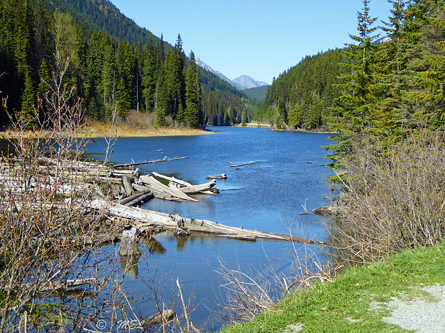
Lillooet Lake


Lillooet Lake ist ein See in der kanadischen Provinz British Columbia.
Der See liegt in den südlichen Coast Mountains, etwa 120 km nordnordöstlich von Vancouver. Er wird vom Lillooet River in südlicher Richtung durchflossen. Ein weiterer Zufluss an seinem nördlichen Ende ist der Birkenhead River. 12 km nördlich des Sees befindet sich der Ort Pemberton. Der See hat eine Länge von 25 km und eine Wasserfläche von 33,5 km². Wenige Kilometer südlich des Sees befindet sich der Little Lillooet Lake, der ebenfalls vom Lillooet River durchflossen wird.
Lillooet Lake is a lake in British Columbia, Canada about 25 km in length and about 33.5 square kilometres (22 mi²) in area. It is about 95 km downstream from the source of the Lillooet River, which resumes its course after leaving Little Lillooet Lake, aka Tenas Lake (tenass in the Chinook Jargon means little). Immediately adjacent to the mouth of the upper Lillooet River is the mouth of the Birkenhead River and just upstream along the Lillooet is the confluence of the Green River, which begins at Green Lake in the resort area of Whistler.
The community of Pemberton is about 12 km upstream from the head of Lillooet Lake, while the eastern edge of the Mount Currie Indian Reserve of the Lil'wat branch of the St'at'imc people is the lakeshore itself. The eastern ramparts of the mountain ranges of Garibaldi Provincial Park overlook Lillooet Lake from the west, while to the east are the northern reaches of the Lillooet Ranges which lie between the Lillooet-Harrison drainage and the Fraser River.
Lillooet Lake was part of the "Lakes Route" or Douglas Road, once if only briefly the principal route between the Coast and the Interior during the days of the Fraser Canyon Gold Rush. Several steamers and innumerable smaller watercraft served the busy freight and passenger traffic in those days. The best-known and largest of these was the SS Prince of Wales, whose wreckage was visible on the shores of the lake near Mount Currie for many years.
Boarischa Krautmo, Sami Serola (inactive), Ulrich John, Erhard Bernstein have particularly liked this photo
- Keyboard shortcuts:
Jump to top
RSS feed- Latest comments - Subscribe to the comment feeds of this photo
- ipernity © 2007-2024
- Help & Contact
|
Club news
|
About ipernity
|
History |
ipernity Club & Prices |
Guide of good conduct
Donate | Group guidelines | Privacy policy | Terms of use | Statutes | In memoria -
Facebook
Twitter

Danke, Ulrich und dito
Sign-in to write a comment.