IMG 4633
IMG 4634
IMG 4635
Indian Creek in flood, II
IMG 4641
Indian Creek--in flood!
IMG 2307 adj
IMG 4725 rot
Black Butte Reservoir
IMG 4727
IMG 4731
IMG 4733
IMG 4662
IMG 4665
IMG 4671
Feather River, North Fork
Thank you Captain Obvious--
IMG 4692
IMG 4695
Oroville Reservoir
IMG 4705
Sutter Buttes
IMG 4715 rot
Flooded, III
IMG 4538
Flooded, II
IMG 3426
20170213 162948 001
20170213 162854 001
IMG 3680
Flooded!
IMG 3675
Flooded!
The Once and Future Lake, part II
20170311 170206
Not an issue today--
20170311 164519 001
20170311 164201 001
20170311 164157 001
20170311 164144 001
20170311 164140 001
20170311 163910 001
20170311 163832 001
20170311 163714 001
20170311 163208 001
Location
See also...
Keywords
Authorizations, license
-
Visible by: Everyone -
All rights reserved
-
512 visits
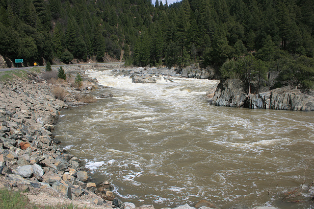
Indian Creek in flood, III


This is maybe a mile downstream from the previous pictures
www.ipernity.com/doc/289859/44673778
www.ipernity.com/doc/289859/44673774
and is just upstream of the confluence with Spanish Creek, said confluence marking the start of the East Branch of the North Fork of the Feather River (yes, that _is_ the official name! Really.) The leftmost insert shows the flow in Dec 2010, at a more normal level; the middle insert shows the flow during the drought, in Jan 2015, and the rightmost insert is a close-up of the spectacular rapid thru the rocks. The bedrock here is a hard, vertically foliated metamorphic rock that is almost at right angles to the current. The highway on the left is California State Route 89.
Don Barrett (aka DBs travels), , Pam J have particularly liked this photo
- Keyboard shortcuts:
Jump to top
RSS feed- Latest comments - Subscribe to the comment feeds of this photo
- ipernity © 2007-2024
- Help & Contact
|
Club news
|
About ipernity
|
History |
ipernity Club & Prices |
Guide of good conduct
Donate | Group guidelines | Privacy policy | Terms of use | Statutes | In memoria -
Facebook
Twitter

Admired in ~ I ♥ Nature
slgwv club has replied to Pam J clubslgwv club has replied to Don Barrett (aka DBs… clubSign-in to write a comment.