IMG 4705
Sutter Buttes
IMG 4715 rot
IMG 4716
The Sacramento at Sunset
IMG 4719
IMG 4966
IMG 4968
IMG 4970
IMG 4974
IMG 4977
IMG 4940 rot adj
IMG 4941
IMG 4942
IMG 4943 rot adj
IMG 4945
IMG 4946 rot
IMG 4947 rot
IMG 4948 rot
IMG 4949
IMG 4950
IMG 4951
IMG 4952
IMG 4695
IMG 4692
Thank you Captain Obvious--
Feather River, North Fork
IMG 4671
IMG 4665
IMG 4662
IMG 4733
IMG 4731
IMG 4727
Black Butte Reservoir
IMG 4725 rot
IMG 2307 adj
Indian Creek--in flood!
IMG 4641
Indian Creek in flood, II
IMG 4635
IMG 4634
IMG 4633
Indian Creek in flood, III
Flooded, III
IMG 4538
Location
See also...
See more...Keywords
Authorizations, license
-
Visible by: Everyone -
All rights reserved
-
630 visits
Oroville Reservoir


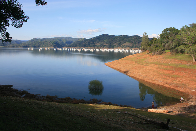
Formed by Oroville Dam on the Feather River, California, near (yes!) the town of Oroville. (Great gold rush name, too--"oro" = "gold" in Spanish. ;) The reservoir had been extremely hard hit by the drought, and there were lots of earnest prognostications that it would take _years_ to recover, if ever.
Well, it took one season. In mid-February >100,000 cubic feet per second of water (something over 2800 m^3/sec, if I've done the arithmetic right) was pouring down the Feather, and not only did the reservoir fill, it spilled over the concrete bypass spillway to the point that heavy damage ensued. The middle section (all concrete!) was completely eroded out. Fortunately, the hard metamorphic bedrock resisted further erosion, once the loose surface material was washed away, and the overflow established itself in a bedrock channel--looked kinda cool, actually, like a natural slot canyon.
The dam and its clobbered spillway made national news in the US. Dunno about overseas, but there are gobs of videos all over the net; here's one of a series done by the same aerial photographer:
www.youtube.com/watch?v=_2aD53JIDzo
He also has one of reopening the spillway a couple of weeks ago, to the tune of 35K cfs:
www.youtube.com/watch?v=65TMuhsKuVM&t=155s
This is being done to lower the reservoir to make room for the spring runoff! The video also gives a good view of the eroded-out middle of the spillway.
So, what we're looking at in this pic is the newly lowered level, from its all-time high. The driftwood on the shore below consists largely of trees eroded out from the shore by wave action at the high water level. Even now, the water level is _still_ higher than it's been in years; note the flooded tree. Note also that in the satellite view this inlet is completely dry!
And there's still lots of snow waiting to melt in the Sierra--
Gudrun, Pam J, Smiley Derleth have particularly liked this photo
- Keyboard shortcuts:
Jump to top
RSS feed- Latest comments - Subscribe to the comment feeds of this photo
- ipernity © 2007-2024
- Help & Contact
|
Club news
|
About ipernity
|
History |
ipernity Club & Prices |
Guide of good conduct
Donate | Group guidelines | Privacy policy | Terms of use | Statutes | In memoria -
Facebook
Twitter

slgwv club has replied to Smiley Derleth clubThe snow pack this year is more than the total of the past 4 years.'=
Btw... the second vid is "not available"
slgwv club has replied to Pam J clubslgwv club has replied to Pam J clubslgwv club has replied to Gudrun clubDon Barrett (aka DBs… club has replied to slgwv clubSign-in to write a comment.