Snowy street of Lhamo
Women of Lhamo
Granma & kid
Villagers
Villagers
Just walkin'
Bön ritual
Cola Magic
Try walking in my shoes...
Stripes and circles
Pray Pray Love
Labrang complex
Circle of Life
Weak riders on back
Plain, not in Spain
All got work to do
Flowers
Key issue
Street life
My trekking shoe in repair
Road somewhere in-between
Plateau
Bon Bön
Night Party in a Yurt
There is China 'round the Corner
Catch the Motor Guy
Best paratha in Ladakh
Simplicity is the Genius
Ladakh-Himachal Highway
My Friend, the Moon
Castle or Monastery?
Let's go Party, Budda
Trinity
A consumer?
Beauty does not lie in the eye
Such view, never will be boring
Auuuuuum, for every soul in the valley
Leaving Markha
Crazily nice here, I know why I prefer mountains t…
We deserve the rest, indeed we do...
I embrace it all
Me, my hills and ice
You cannot beat these mountains, even if you pay g…
Dusty path
Sun-lit day
Location
See also...
Keywords
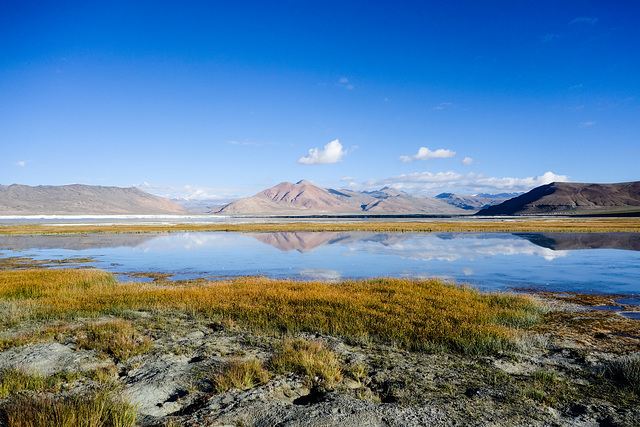
Salt Lake of Ladakh


The Tso Kar, known for its size and depth, is a fluctuating salt lake situated in the Rupshu Plateau and valley in the southern part of Ladakh (formerly part of Indian state of Jammu and Kashmir). The lake is connected by an inlet stream at its south-west end to a small lake, Startsapuk Tso, and together they form the 9 km2.
More plains pool, which is dominated by the peaks of two mountains, Thugje (6050 m) and Gursan (6370 m). From the geology of the More Plains, it can be concluded that the Tso Kar in historical times ranged up to this high valley. Until a few years ago the lake was an important source of salt, which the Changpa nomads used to export to Tibet. The nomadic settlement of Thugje is located 3 km in the north. There is a tented camp on the west bank of the lake which provides accommodation for tourists. Due to the high altitude, the climate is extreme in the winter; temperatures below -40 °C are not uncommon. In the summer the temperature rises above 30 °C, with extreme fluctuations during the day. Precipitation in the form of either rain or snow is extremely rare.
Factbox:
Coordinates: 33°18′N 77°59′E
Type: oligotrophic lake
Primary inflows: Pholokongka Chu
Primary outflows: none
Max. length: 7.5 km
Max. width: 2.3 km
Surface area: 22 km2
Surface elevation: 4,530 m
en.wikipedia.org/wiki/Tso_Kar
Christa1004, Günter Diel, Liliane LR, Gabriella Siglinde and 37 other people have particularly liked this photo
- Keyboard shortcuts:
Jump to top
RSS feed- Latest comments - Subscribe to the comment feeds of this photo
- ipernity © 2007-2024
- Help & Contact
|
Club news
|
About ipernity
|
History |
ipernity Club & Prices |
Guide of good conduct
Donate | Group guidelines | Privacy policy | Terms of use | Statutes | In memoria -
Facebook
Twitter

It will be taken into the frontpage collection, if you give your OK directly underneath the processed picture, please: www.ipernity.com/doc/team/50819980
Sign-in to write a comment.