m̌ ḫ's photos
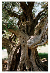
1500 y.o.olive tree in Kaštel Štafilić, Croatia
| |
|
|
|
Olive tree is a symbol of Dalmatia, it’s hard working people and the land which only the toughest people can cultivate and live from the fruits of their hard work. You can say that olive cultivation and oil production are a big part of rich heritage of this area.
The Olive tree in Kastel Stafilić was planted during Roman times inside the villa rusticae, and today stands as a real testimony of those times. Since ancient times, the technology used for olive cultivation in this area – planting, harvesting and refining – had hardly changed and was used until quite recently. The older residents of Kastela still remember the technique for crushing the olive fruits when the olives were ground manually, by pushing a wooden beam around a stone mill.
This 1,500 year old olive tree was declared a natural heritage monument in 1990, so you can be sure it will still be there when you come to enjoy in it’s ancient beauty.
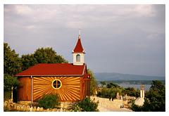
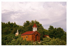
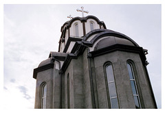
A church built by two brothers
| |
|
|
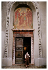
There were two brothers. One was an architect and a builde, so he built a church in his neighbourhood. The other was an artist, and he crafted the interior, made the sculptures and painted the holy pictures. An inspirative example how individuals can shape their environment, and thence change the world.
54390033
| |
|
|
South Velebit - view from Posedarje
| |
|
Velebit - view from Stap (860m)
| |
|
STAP is a large grassy valley with a flat base, surrounded by scenic limestone rock and forests. The most beautiful view of the whole Stap valley can be seen from the rocky Čučavac and from Debeli kuk. Hiking shelter Tatekova koliba on Stap is a nice cottage at the edge of the Stap valley, on the Velebit hiking trail (VPP route) - an ideal starting point for a number of interesting shorter ascents in near surroundings, but also an important overnight shelter on the longitudinal route from Baške Oštarije to Struge. The name Tatekova koliba (Daddy's cottage) comes from the nickname of Slavko Tomerlin, who built and furnished the hut. Water is supplied from narrow cavern, about 30 m from shelter.
Velebit [panorama]
| |
|
Velebit (Italian: Alpi Bebie) is the largest, though not the highest, mountain range in Croatia. Its highest peak is the Vaganski vrh at 1,757 m. The important characteristic of Velebit is its simple, solid form, stiff cliffs, and the nakedness of seaward side and the wood-covered slopes of the Lika side. The basic geological characteristic of the mountains is karst; flora and fauna are abundant. The whole mountain range is protected as nature park.
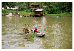
On a river
| |
|
|
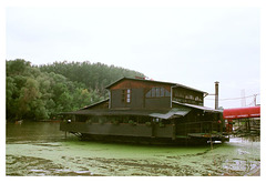
Pančevo (Serbian Cyrillic: Панчево; German: Pantschowa; Hungarian: Pancsova; Romanian: Panciova; Slovak: Pánčevo) is a city and the administrative center of the South Banat District in the autonomous province of Vojvodina. It is located on the shores of rivers Tamiš and Danube, in the southern part of Banat region. Since the 2011 census 123,414 people have been living in the Pančevo administrative area. Pančevo is the 4th largest city in Vojvodina and the 9th largest in Serbia by population.
The southern city quarters are located on the bank of the Danube, the western quarters to the bank of Tamiš. The Danube river islands Forkontumac and Čakljanac are southernmost part of urban area.
Let's drink on a river
| |
|
|
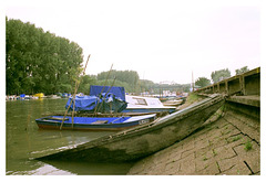
Parking of a boat
| |
|
Were the god comes to work
| |
|
|
|
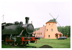
Coal and wind power... and a combustion engine
| |
|
|
|
Low profile
| |
|
|
Buy me a moped! Buy me a lolly!
| |
|
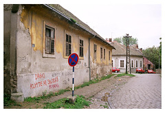
Crkva
| |
|
|
Loch Ness
| |
|
|
|
Did you know that Loch Ness contains more water than all the lakes of England and Wales combined, making it the most voluminous lake in the UK? This corner of the Highlands is world-famous for its dramatic scenery, great adventure sports and nearby castles and solitary lighthouses dotting the landscape.
Loch Ness is one of those rare destinations that engages everyone, from children enchanted with Nessie, to adults interested in photography, hiking and more. It combines Jacobite history, stunning scenery and the possibility of a monster sighting...
www.visitscotland.com/destinations-maps/loch-ness
High Rama Pano Land
| |
|
|
|
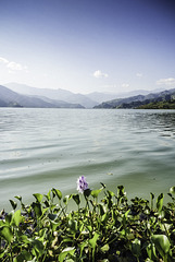
Phewa Tal
| |
|
|
|
Phewa Lake (Tal) is a freshwater lake in Nepal formerly called Baidam Tal located in the south of the Pokhara Valley. The lake is stream-fed but a dam regulates the water reserves, therefore, the lake is classified as semi-natural freshwater lake. It is the second largest lake in Nepal; the largest in Gandaki Pradesh after the Rara lake in the comparison to Nepal's water bodies. It is the most popular and most visited lake of Nepal. It is the only lake in Nepal to have a temple (Tal Barahi Temple) at the central part of lake. Phewa lake is located at an altitude of 742 m and covers an area of about 4.43 km2. It has an average depth of about 8.6 m and a maximum depth of 24 m. The Annapurna range on the north is only about 28 km (linear distance) away from the lake. The lake is also famous for the reflection of mount Machhapuchhre and other mountain peaks of the Annapurna and Dhaulagiri ranges on its surface.
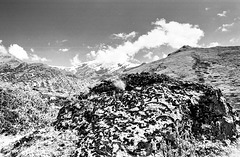
Swirls of high elevated plains
| |
|
|
You may not find many photos of this part of a circuit between Manang and Yak Kharka, as people have great views on the sharp peaks around and are focused on clicking selfies, yaks or panoramas. But this is a meditating part of a journey. These are a dry, high-elevated pastures where those who would not feel it, see it on a steeping price of water. But who'd remember the economics while overwhelmed by magic?

