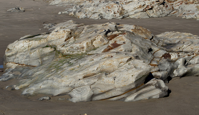
Jalama Beach (1232)
Jalama Beach (1233)
Jalama Beach (1234)
Jalama Beach (1235)
Jalama Beach road (1237)
Jalama Beach road (1241)
Gaviota (1243)
Morongo Canyon Preserve (4776)
Morongo Canyon Preserve (4778)
Morongo Canyon Preserve (4780)
Arches National Park (1732)
Arches National Park (1734)
Arches National Park (1739)
Arches National Park (1751)
Arches National Park (1753)
Arches National Park (1756)
Arches National Park (1759)
Arches National Park (1764)
Hovenweep National Monument (1697)
Hovenweep National Monument (1707)
Hovenweep National Monument (1714)
Hovenweep National Monument (1716)
Hovenweep National Monument (1717)
Jalama Beach (1230)
Jalama Beach (1229)
Jalama Beach (1227)
Guadalupe dunes - 10 Commandments? (1211)
Guadalupe dunes (1214)
Guadalupe cemetery (1225)
Guadalupe cemetery (1224)
Guadalupe Amtrak (1221)
Guadalupe Amtrak (1220)
Guadalupe Amtrak (1219)
Guadalupe oil (1209)
Lompoc (1207)
Lompoc (1206)
Lompoc Honda Point Memorial (1205)
Lompoc Honda Point Memorial (1204)
Lompoc (1202)
Lompoc (1201)
Lompoc Ocean Beach (1184)
Lompoc Ocean Beach (1198)
Lompoc Amtrak Surfliner (1195)
Lompoc Amtrak Surfliner (1193)
Lompoc Amtrak Surfliner (1192)
Location
Keywords
Authorizations, license
-
Visible by: Everyone -
Attribution + non Commercial + no derivative
-
159 visits
- Keyboard shortcuts:
Jump to top
RSS feed- Latest comments - Subscribe to the comment feeds of this photo
- ipernity © 2007-2024
- Help & Contact
|
Club news
|
About ipernity
|
History |
ipernity Club & Prices |
Guide of good conduct
Donate | Group guidelines | Privacy policy | Terms of use | Statutes | In memoria -
Facebook
Twitter


These are some really fascinating outcrops, though. I wouldn't mind poking around them for a while.
The San Andreas currently ends at Cape Mendocino, where there's a so-called "triple junction", and subduction is still occurring north of there. Hence the worry about risk from huge subduction-zone earthquakes as far north as Seattle. You don't see a trench off the Pacific Northwest because it's filled with sediment!
Re the San Andreas, at the point of this picture I'm roughly 70 miles WSW from the point in the picture linked below, which is on the edge of where the fault is assumed to be.
WAG -- per Wikipedia that refers to the female partners of British footballers....but I'm guessing that was "wild a** guess".
Sign-in to write a comment.