IMG 0902
IMG 0903
IMG 0904
IMG 0907
IMG 0909
IMG 0910
IMG 0911
IMG 0912
IMG 0913
IMG 0914
IMG 0915
IMG 0916
IMG 0917
IMG 0919
IMG 0920
IMG 0922
IMG 0924 adj
IMG 0925
IMG 0928
IMG 0930
IMG 0931
IMG 0932
IMG 0933
IMG 0899
IMG 0898
IMG 0897
IMG 0896
IMG 0895
IMG 0894
IMG 0892
IMG 0891
IMG 0890
IMG 0889
IMG 0888
IMG 0887
IMG 0886
IMG 0885
IMG 0884
IMG 0883
IMG 0881
IMG 0880
IMG 0879
IMG 0878
IMG 0877 adj
IMG 0876 adj
Location
See also...
Keywords
Authorizations, license
-
Visible by: Everyone -
All rights reserved
-
444 visits
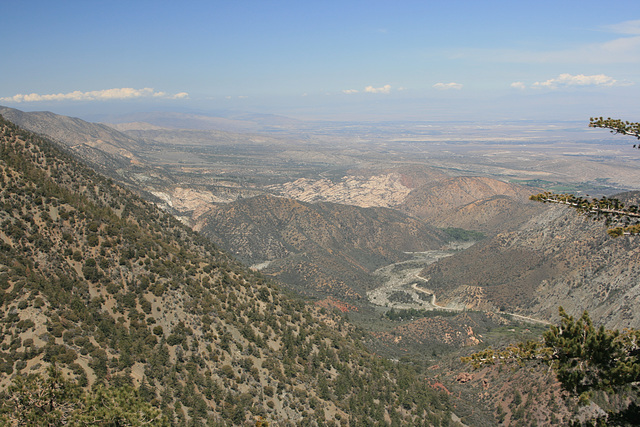
San Andreas Rift Zone


Yes, this is it--the famous San Andreas Fault in southern Californa, boundary of the North American and Pacific Plates. The fault zone runs generally from lower right to upper left. The most currently active trace is parallel to the range front but out in the valley, beyond those low hills on the right. The light-colored rock in the center is sandstone units called the Devil's Punchbowl, a county park. The prominent drainage at lower right-center is Big Rock Creek. The mountains bulking up at the left are the San Gabriel Mountains, which are fault bounded--an uplifted block, in fact--and define the northern boundary of the Los Angeles Basin. The low country visible out to the upper right is part of the Mojave Desert. Seen looking northwesterly from CA State Route 2, the Angeles Crest Highway. It's a remarkably scenic route that doesn't fit most images of SoCal!
Pam J, Maeluk, , William Sutherland have particularly liked this photo
- Keyboard shortcuts:
Jump to top
RSS feed- Latest comments - Subscribe to the comment feeds of this photo
- ipernity © 2007-2024
- Help & Contact
|
Club news
|
About ipernity
|
History |
ipernity Club & Prices |
Guide of good conduct
Donate | Group guidelines | Privacy policy | Terms of use | Statutes | In memoria -
Facebook
Twitter

Admired in:
www.ipernity.com/group/tolerance
Thanks for Posting in
The Hawk's Aerie!!
Admired in ~ I ♥ Nature
Sign-in to write a comment.