

Alternative White Edge 2
White Edge 3
Alternative White Edge 4
White Edge grasses 1
White Edge grasses 2
Curbar Edge
Froggatt Edge cross bedding
Froggatt Edge tors 1
Froggatt Edge tors 2
Afternoon larches 1
Afternoon larches 2
It was a grey day at Beacon Tarn, Cumbria
Sunlit fields of Leam
Hay Wood birches
Hay Wood evening sentinels
Hay Wood quarries
Hay Wood quarry cross bedding
Eastern Edges in the spotlight
Sun on Sir William
Cocking Tor, Ashover
Cocking Tor panorama 2
Amber skyscape
Ashover from the north east escarpment
Guidepost 2
Guidepost 1
Erosion surface
White Edge 1
Columnar jointed sill at Calton Hill quarry, Derby…
Watchers on Froggatt
For Louise and Jim
Cadeby Tunnel interior
Snowy Q-pit
That Old Chestnut?
Chestnuts on the crest
Cadeby Tunnel east portal
Conisbrough and Cadeby Crags viewed from North Cli…
Cadeby Colliery upcast shaft (site of).
The Don valley from the Conisbrough Viaduct
Fields near Garreg Fawr, Lleyn Peninsula, Gwynedd.
Winter resting place
A fine beech
Tree bridges
Mossy wall
Mossy Hallucigenia?
Greenburn copper mine and works, Lake District, Cu…
1/160 • f/9.0 • 20.0 mm • ISO 100 •
Canon EOS 350D DIGITAL
Location
Lat, Lng:
You can copy the above to your favourite mapping app.
Address: unknown
You can copy the above to your favourite mapping app.
Address: unknown
See also...
Keywords
Authorizations, license
-
Visible by: Everyone -
All rights reserved
-
216 visits
White Edge 2
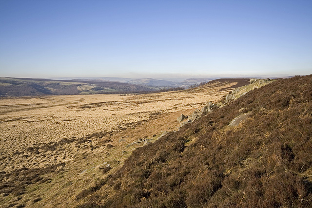

This is a view northwards along the low escarpment of White Edge in the Eastern Edges area of the Peak District National Park. The Derwent valley is visible in the left middle distance. In the far distance on the middle-left skyline is the Kinderscout plateau; Win Hill is in the centre distance and Bamford Edge at about 0.6, 0.6.
The brown smoke haze is a result of controlled burning of the heather moorland in the Strines area to the west of Sheffield.
Unlike most of the Eastern Edges which are formed of Namurian 'Millstone Grit', White Edge is comprised of Crawshaw Sandstone which is stratigraphically just above the base of the Coal Measures.
- Keyboard shortcuts:
Jump to top
RSS feed- Latest comments - Subscribe to the comment feeds of this photo
- ipernity © 2007-2026
- Help & Contact
|
Club news
|
About ipernity
|
History |
ipernity Club & Prices |
Guide of good conduct
Donate | Group guidelines | Privacy policy | Terms of use | Statutes | In memoria -
Facebook
X

Sign-in to write a comment.