Geology and Landscape
Folder: Geology and Earth Science
Photos illustrating clear examples of the influence of geology on landscape
View north to Houndkirk Hill from Houndkirk Road
| |
|
|
A walk on Houndkirk Moor 24
A cool morning with frequent showers, clearing to sunshine by the afternoon.
Looking northwards to Houndkirk Hill from the Houndkirk Road. In the distance are the green-clad tower blocks in the Gleadless Valley on the south-east side of Sheffield, and the wind turbines of the Penny Hill windfarm south of Rotherham.
The clear afternoon light brings out the shadow detail of the scarp edge of Houndkirk Hill, composed of Namurian age ('Millstone Grit Series') Chatsworth Grit.
View WNW to Higger Tor from Houndkirk Road
| |
|
|
A walk on Houndkirk Moor 23
A cool morning with frequent showers, clearing to sunshine by the afternoon.
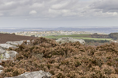
The southern portion of the Houndkirk Road offers fine views to the south and west into the heart of the Peak District. In the middle distance is the flat top of Higger Tor with its fringing crags of Namurian age ('Millstone Grit Series') Chatsworth Grit.
On the distant skyline is the high plateau of Kinder Scout, 12 miles distant.
View west to Over Owler Tor from Houndkirk Road
| |
|
|
A walk on Houndkirk Moor 22
A cool morning with frequent showers, clearing to sunshine by the afternoon.
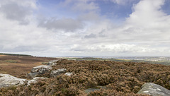
The southern portion of the Houndkirk Road offers fine views to the south and west into the heart of the Peak District. In the middle distance are the gritstone tors of Mother Cap Stone, just left of centre, and Over Owler Tor, to the right. Like Houndkirk Hill and Houndkirk Edge, these are composed of Namurian age ('Millstone Grit Series') Chatsworth Grit.
On the distant skyline are the high moorlands of the Derbyshire-Staffordshire border, beyond Buxton.
View north-east over Houndkirk Moor from the shelt…
| |
|
|
|
A walk on Houndkirk Moor 19
A cool morning with frequent showers, clearing to sunshine by afternoon.
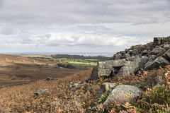
A view north-east from the stone shelter in the previous photo, over the wide expanse of Houndkirk Moor. To the left of centre in the middle distance is Houndkirk Hill. The rocks to the right of centre form Houndkirk Edge. The straight scarp edge marks the line of a fault which runs along the foot of the scarp in a NE-SW direction.
Both scarps are composed of Namurian age ('Millstone Grit Series') Chatsworth Grit
Summit rocks of Houndkirk Edge looking NE to Hound…
| |
|
|
A walk on Houndkirk Moor 17
A cool morning with frequent showers, clearing to sunshine by afternoon.
Looking north-east from the suummit rocks of Houndkirk Edge (not named as such on the Ordnance Survey maps). Houndkirk Hill is just left of centre, with Sheffield city centre in the far distance. Ladty Canning's Plantation is on the far left skyline.
The rocks are Namurian age ('Millstone Grit Series') Chatsworth Grit.
Houndkirk Hill and guidepost view north
| |
|
A walk on Houndkirk Moor 16
A cool morning with frequent showers, clearing to sunshine by afternoon.
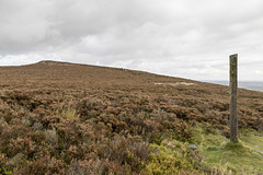
Looking back northwards to the summit of Houndkirk Hill. A narrow path from the summit rocks descends to meet a more significant east-west path where there is a concrete guidepost at the junction. Possibly the post had direction markers at one time, but there is no sign of them now.
Summit of Houndkirk Hill looking NNE
| |
|
A walk on Houndkirk Moor 15
A cool morning with frequent showers, clearing to sunshine by afternoon.
Another view from the summit of Houndkirk Hill, looking NNE. The rocks are Namurian age ('Millstone Grit Series') Chatsworth Grit. The sunlit houses are at Crosspool, on the west side of Sheffield; the Crosspool television tranmitter is prominent just to the right of centre.
Eggborough power station, 32 miles distant, is visible on the skyline left of centre; Drax power station, 37 miles distant, is just visible on the skyline towards the right.
Summit of Houndkirk Hill looking NE
| |
|
A walk on Houndkirk Moor 12
A cool morning with frequent showers, clearing to sunshine by afternoon.
A north-easterly view from the from the summit of Houndkirk Hill. The rocks are Namurian-age ('Millstone Grit Series') Chatsworth Grit. The eastern side slopes gently down towards the A625 Hathersage Road and Dore beyond.
Sheffield is visible in the far distance.
View north-east from Houndkirk Hill escarpment
| |
|
A walk on Houndkirk Moor 11
A cool morning with frequent showers, clearing to sunshine by afternoon.
A north-easterly view from the north-west facing escarpment of Houndkirk Hill. The rocks are Namurian-age ('Millstone Grit Series') Chatsworth Grit.
The woodland strip in shadow, in the centre, is the Bole Hill Plantation on the north side of the Limb Valley. Sheffield city centre is visible in the far distance; Rotherham and Doncaster even further beyond.
Summit rocks of Houndkirk Hill 2
| |
|
|
A walk on Houndkirk Moor 10
A cool morning with frequent showers, clearing to sunshine by afternoon.
A closer view of the edge tor summit rocks on the north-west facing escarpment of Houndkirk Hill. The rocks are Namurian-age ('Millstone Grit Series') Chatsworth Grit.
Summit rocks of Houndkirk Hill 1
| |
|
A walk on Houndkirk Moor 9
A cool morning with frequent showers, clearing to sunshine by afternoon.
A closer view of the summit rocks on the north-west facing escarpment of Houndkirk Hill. The rocks are Namurian-age ('Millstone Grit Series') Chatsworth Grit.
Scarp edge of Houndkirk Hill
| |
|
|
|
A walk on Houndkirk Moor 8
A cool morning with frequent showers, clearing to sunshine by afternoon.
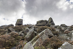
Approaching the summit rocks on the north-west facing escarpment of Houndkirk Hill. The rocks are Namurian-age ('Millstone Grit Series') Chatsworth Grit.
Path to Houndkirk Hill
| |
|
A walk on Houndkirk Moor 5
A cool morning with frequent showers, clearing to sunshine by afternoon.
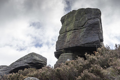
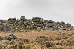
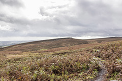
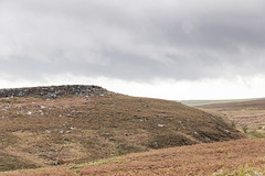
Houndkirk Hill (elevation 389 m) is a compact feature with a prominent scarp edge facing north west. The scarp edge is an outcrop of Namurian age ('Millstone Grit Series') Chatsworth Grit.
The distant scarp edge on the right skyline is informally known as Houndkirk Edge, although not named on the Ordnance Survey maps. It is composed of a lower stratigraphic bed of Chatsworth Grit.
Houndkirk Hill north-west escarpment
| |
|
A walk on Houndkirk Moor 4
A cool morning with frequent showers, clearing to sunshine by afternoon.
Houndkirk Hill (elevation 389 m) is a compact feature with a prominent scarp edge facing north west. The scarp edge is an outcrop of Namurian age ('Millstone Grit Series') Chatsworth Grit.
Lattice Windows sea arches and Barafundle Bay
| |
|
|
|
Broad Haven (south) to Stackpole Head
Viewed from just north of Stackpole Head, the narrow sea arches of 'Lattice Windows' form the headland at the south side of Barafundle Bay.
In contrast to the gentle southerly dip of the Carboniferous Limestone at Stackpole Head, fold structures have resulted in an increasingly steep northerly dip at Lattice Windows.
Stackpole Head from Mowingword Point
| |
|
|
|
Broad Haven (south) to Stackpole Head
The cliffs of Stackpole Head consist of Carboniferous Limestone gently dipping south. There are sea caves and other solution features visible: the prominent bedding plane just below the cliff top displays palaeo-karst pot-hole-like features.
Caldey Island is on the centre skyline; Llanmadoc Hill and Rhosili Down on the Gower Peninsula can be seen in the far distance just above the headland.
Mowingword Bay, Pinnacle Stack and Gun Cliff
| |
|
|
|
Broad Haven (south) to Stackpole Head
Viewed from Mowingword Point, Mowingword Bay, backed by Gun Cliff, is inaccessible except by sea or climbing down the cliffs (climbing equipment and experience needed). The prominent Pinnacle Stack is in the middle of the bay.
Church Rock just offshore from Broad Haven (S) is visible in the upper left.
The flat, Tertiary age '200-foot erosion surface' is well seen in this photo.
Sandy Pit doline panorama
| |
|
|
Broad Haven (south) to Stackpole Head
Immediately inland from Box Bay in the previous photo is the 'Sandy Pit' doline; a large karst solution hollow. There is a connection with the sea at the base, so marine erosion has probably contributed to the enlargement of the hollow.
The name 'Sandy Pit' possibly refers to a partial filling with post-glacial blown sand (subsequently largely exploited and excavated?)
This panoramic view shows the large size of the doline and consists of three landscape photos stitched together with Photoshop software.
Jump to top
RSS feed- Latest items - Subscribe to the latest items added to this album
- ipernity © 2007-2024
- Help & Contact
|
Club news
|
About ipernity
|
History |
ipernity Club & Prices |
Guide of good conduct
Donate | Group guidelines | Privacy policy | Terms of use | Statutes | In memoria -
Facebook
Twitter


