Coastline England
Folder: England
Lifebouy
The North Sea near Huds Head, Northumberland, England.....................................................................
.
..© copyright 2014, All rights reserved, Image may not be used without my explicit written permission
Through the Grass
The North Sea at Cocklawburn , Northumberland, England.
Best on Black.
Through the Mist
A December evening as the sunset picks out North Hill ,
The incoming evening tide brings the mist and darkness will soon arrive.
© copyright 2015, All rights reserved, may not be used without my explicit permission.
May be better enlarged
I'm Coming
Spotted this chap fresh out of the sea having enjoyed a cold water dip
Torbay
Modern and sail powered trawlers in Brixham outer harbour, looking across the bay towards Torquay.
The trawler with the red sail is Pilgrim, BM 45
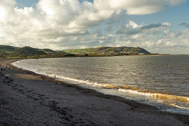
December Sun.
Blue Anchor Bay on the Somerset Coast, Minehead with it's large holiday camp in the distance and North hill as a backdrop,
Large please for detail
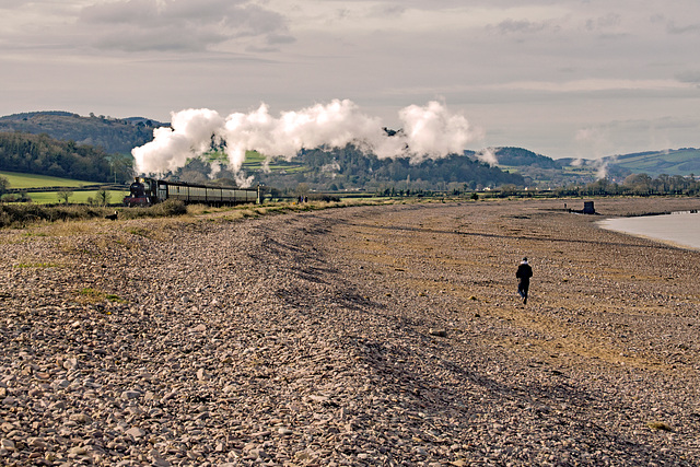
Odney Manor.
The West Somerset Railway Skirts the sea at Blue Anchor as Locomotive 7828 Odney Manor on a Minehead to Bishops Lydeard train prepares to cross the main road and enter Blue Anchor Station.
Large if you please
Link for sight and sound , Smoke along the track www.youtube.com/watch?v=yNoQrOxAx3o
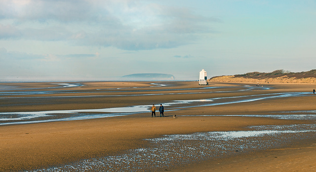
Lighthouse
Winter sun and low tide on Bridgwater Bay at Burnham on Sea, The beach lighthouse was used in conjunction with a high on shore lighthouse to guide shipping into the River Parrett and up to the port of Bridgwater, The bay is part of the Bristol Channel which has the second highest tidal range in the world at 11m (36ft) and at low tide exposes extensive mud flats and sand bars, The island of Steep Holm is the distance.
Large if you please
Many ships have run aground on the sand bars and mud banks so my link for sight and sound,
Stuck on You, www.youtube.com/watch?v=wSCRumqmdQg
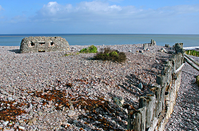
What You Looking at? HFF
A world war two pill box which has a creative modification and has sunk into the pebbles at Porlock Weir in Somerset,
On the coast of the Bristol Channel.
Large Please,
The water in the Bristol Channel during February is extremely cold, so my link for sight and Sound is
www.youtube.com/watch?v=kANkGBy5lJ4
Jump to top
RSS feed- Latest items - Subscribe to the latest items added to this album
- ipernity © 2007-2024
- Help & Contact
|
Club news
|
About ipernity
|
History |
ipernity Club & Prices |
Guide of good conduct
Donate | Group guidelines | Privacy policy | Terms of use | Statutes | In memoria -
Facebook
Twitter


