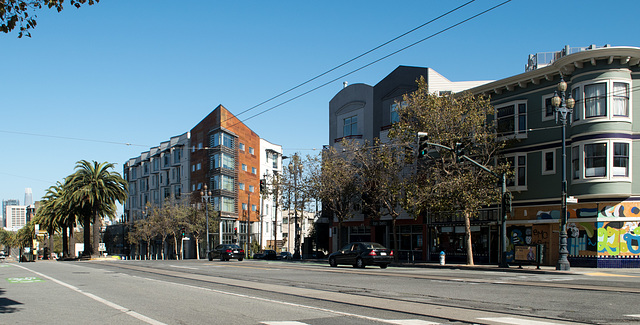
San Francisco 9th & Mission – pandemic (# 0220)
San Francisco Embarcadero& Broadway – pandemic (#…
San Francisco Embarcadero& Broadway – pandemic (#…
San Francisco anti-Trump poster (# 0225)
San Francisco 9th & Mission – pandemic (# 0220)
San Francisco Embarcadero& Broadway – pandemic (#…
San Francisco Embarcadero& Broadway – pandemic (#…
San Francisco anti-Trump poster (# 0225)
SFO Bayfront park / egret / breakfast (# 0567)
SFO ANA flight / pandemic (# 0569)
SFO ANA flight / pandemic (# 0572)
SFO / pandemic (# 0565)
SFO Volga-Dnepr Airlines (# 0573)
SFO traffic jam ! / pandemic (# 0574)
SFO Bayfront park / Westin / egret (# 0575)
Monterey County / CA-198 Peachtree Ranch Wildlife…
Monterey County / CA-198 (# 0578)
Monterey County / CA-198 (# 0580)
Monterey County / CA-198 Peachtree Ranch (# 0582)
Borrego Springs, CA bighorn sheep sculptures (# 0…
Borrego Springs, CA bighorn sheep sculptures (# 0…
Borrego Springs, CA bighorn sheep sculptures (# 0…
Borrego Springs, CA bighorn sheep sculptures (# 06…
San Francisco / Castro redevelopment (# 0561)
San Francisco / Castro redevelopment (# 0560)
San Francisco / Castro redevelopment (# 0559)
San Francisco Castro Twin Peaks bar / outside (# 0…
San Francisco Castro theater (# 0549)
San Francisco Castro dining outside / justice poli…
San Francisco Castro dining (and smartphoning) out…
San Francisco Castro dining outside (# 0547)
Changes? Yes!
San Francisco Castro / homeless covid (# 0558)
San Francisco Castro / homeless covid (# 0557)
San Francisco Lands End / Golden Gate….(# 0545)
San Francisco Lands End / beach mask etiquette… (#…
San Francisco Lands End (# 0545)
Monterey Fisherman's Wharf male mask test (# 0539…
Monterey Fisherman's Wharf mask test (# 0541)
Monterey Fisherman's Wharf mask test (# 0540)
Monterey Fisherman's Wharf mask test (# 0538)
Atascadero / Lincoln environmentalist (# 0537)
Atascadero City Hall fountain (# 0536)
Atascadero Sunken Gardens and City Hall (# 0535)
Morro Bay / morning otter close-ups (# 0533)
Location
See also...
Keywords
San Francisco / Castro redevelopment (# 0563)


A series of four photos documenting the redevelopment/urbanization of one intersection (Market/Sanchez/15th) in the Castro; each photo contains a link to a Google Street View of the area prior to the new construction.
This building is also on a piece of land that was once a gas station – and a more successful (longer lasting) station than the one across the street (the previous picture).
Linked below are three Google Street View pictures from January, 2011. The first link, labeled Market and 15th, is closest to being similar to this view. The second and third try to capture the changes of the entire intersection with a broader view looking down Market towards downtown and then up towards the Castro.
Market & 15th : goo.gl/maps/SYcuJEZHAKyNA6Ug7
Towards downtown: goo.gl/maps/v5GPKZ3oSQjgQaY29
Towards Castro: goo.gl/maps/FKsLGchb7Y255rHCA
- Keyboard shortcuts:
Jump to top
RSS feed- Latest comments - Subscribe to the comment feeds of this photo
- ipernity © 2007-2024
- Help & Contact
|
Club news
|
About ipernity
|
History |
ipernity Club & Prices |
Guide of good conduct
Donate | Group guidelines | Privacy policy | Terms of use | Statutes | In memoria -
Facebook
Twitter

Sign-in to write a comment.