Gudbrandsjuvet
Beach sunset
Frühling lässt sein blaues Band....
Säntis
Gewitterstimmung am Abend
Drei Zinnen
Paternkofel
Ålesund seen from Mt. Aksla.
Squaw Valley Creek Reservoir
Standing Stone.
Greece - Spinalonga
H.F.F. - Umbria
HFF - Panoramablick auf die Berge des Bregenzerwal…
Sunnyside Hospital Aerial Photosphere 20-10-2016a
Blick in Richtung Frühjahr... ©UdoSm
Lake Lucerne (Vierwaldstättersee)
DSN 0340(1)R
Mt Shuksan
Cow Herd
Blick hinüber zur Damülser Mittagsspitze
Wohin der Weg?
Den Weg gehen...
Ballonfahrt über Kappadokien
Showers Lake
Arbor Low (1)
Beside The Waikato.
Delta del Po, zwischen Etsch und Po di Levante
Meiss Lake
Meiss Meadows
Spronser Seen
Prinzengarten
Prinzengarten
Besinnungsweg
Morgendunst - Lechtaler Panoramaweg
...morgens im Nebel
Islands and Mist.
Oktobernebel - Fog in October
Ferns
Völklinger Hutte.
A liquid mirror!
Fischerhütte CWP # 43
Sonntag 16. Oktober 2016...
Inverbervie Aerial Photosphere 05-06-2016
Leavitt Falls
Leavitt Lake
Location
See also...
Keywords
Authorizations, license
-
Visible by: Everyone -
All rights reserved
-
829 visits
View


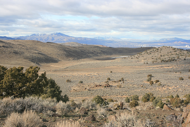
Unnamed basin in the Virginia Range above my house, east of Washoe Valley. It actually has interior drainage and in wet winters accumulates a shallow lake--which doesn't persist over the summer! Looking north; that's Reno, Nevada, in the distant basin on the right; the high-rise is the Grand Sierra Hotel, by the airport. The mountain on the skyline to the left is Peavine Peak (8266 ft/2519 m). Local lore has it that you don't try to plant a garden until the snow is all melted off Peavine--typically mid-May or so.
Clint, , Smiley Derleth, Don Sutherland and 10 other people have particularly liked this photo
- Keyboard shortcuts:
Jump to top
RSS feed- Latest comments - Subscribe to the comment feeds of this photo
- ipernity © 2007-2024
- Help & Contact
|
Club news
|
About ipernity
|
History |
ipernity Club & Prices |
Guide of good conduct
Donate | Group guidelines | Privacy policy | Terms of use | Statutes | In memoria -
Facebook
Twitter

Sign-in to write a comment.