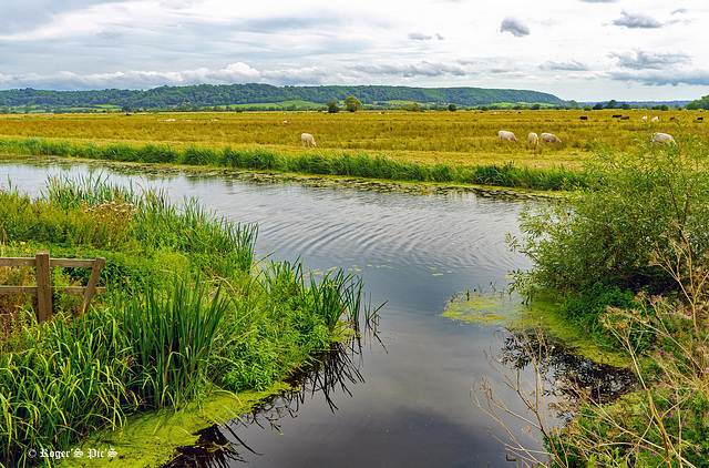
Water Control, (1 pip)
Tall Trees
Look to the West
Restoration Begins
Brean Down !
That Tree Again.
Misty Vale View,
Flying South.
Somerset Autumn
Almost an Ex Bench!
Quantock Autumn!
Walford's Gibbet, (pip)
The Falling Leaves
The Face
Woodland Colour
Autumn Green
Autumn Pathway
Through the Hollow
22 Days , Pip
Walls by Night, pip
Cornhill HFF!
Trees
Flood Levels are Falling
Muscle Fishing
The Pub and the Chapel!
The County Flag!
More Gas Bottle Men.
Free to Roam,
Cold Comfort
At the Bus Stop
Mill.
Darkening Skies
Sea Wall,
Victorian
Liquid Gold.
Platform One!
On the Beach
Country Road, Pip
Brick & Tile Kiln
Penniless Porch,
Somerset Style
The Palace Moat,
No Takers
Mud Bank Moorings
The West Front,
Occasional Use,
Archive image from the Bridgwater and Taunton Cana…
Pebble Beach!
Brean Down View
Sun, Sea and Shadows
Sunset View
Walls aplenty,
May Bank Holiday
Darkness Falls
Dressed in a Hurry
Graylake Reserve (1 pip)
Wind Pump
When The Tide Goes Out
Short Fence
Somerset Levels
Sea Wall, pip
Low Tide,
Waters Edge
Sale!
Church Fence
Cornhill,
Vintage Steam
A Quantock Winter,
Day's End
Coastguard !
The Writing on the Wall, 1 pip & 1 note
Sea Wall
Heritage Mural
Can you smell Carrot ?
National Trust
Autumn Weather
Country Road
Retired !
For Wildlife Watchers.
Dark & Grey Autumnal Day
Cedar's End
Autumn Leaves.
Patchwork.
Exchange
Empty Benches and Evening Sun.
The Romance of Sunset
On the Roof
Down Train,
Flood Tide
Smoke and Steam HFF
Still Water
Breezy Day
Rhyne's & Droves
Now and Then, see pips.
Low Tide and Flowers, + Pip
Blue.
On the Levels
Waiting for the Tide
To the Manor
Up and Away
Coastal Grey Day
Catkins +2 Pips
Snowdrops
Heritage Railway
Sunlight across the River
Tight Squeeze (5pips) HFF
Winter Sun and Long Shadows
Aerial Power Line Survey
Christmas 2007
"Squibbing The Bridge" MERRY CHRISTMAS, (pips)
Going Green
Autumn Afternoon.
November Colour
Silhouettes at Sunset , HFF
Through the Trees, HFF.
Sunbeam.
A Fight for Survival, HFF
1/50 • f/18.0 • 35.0 mm • ISO 160 •
SONY ILCE-7M3
FE 24-70mm F4 ZA OSS
Location
See also...
Keywords
Authorizations, license
-
Visible by: Everyone -
All rights reserved
-
190 visits
King Sedgemoor, (1 Note)


Boundary Rhine runs parallel with the King Sedgemoor Drain, although controlled by sluices water from the Rhyne is allowed to flow into the drain at a number of places, this shot is of the outfall at Greylake on King's Sedgemoor.
The Somerset Levels have an area of about 160,000 acres (650 km2) and are bisected by the Polden Hills; the areas to the south are drained by the River Parrett, and the areas to the north by the rivers Axe and Brue. The Mendip Hills separate the Somerset Levels from the North Somerset Levels. The Somerset Levels consist of marine clay "levels" along the coast and inland peat-based "moors"; agriculturally, about 70 per cent is used as grassland and the rest is arable. Willow and teazel are grown commercially and peat is extracted. (Wikipedia)
To give an idea of the drainage system on the levels I have added a previously posted screen grab from openstreemap,
Large view perhaps,,,,,,,,,,,, Wish you all a nice Friday and a good weekend
©UdoSm, ColRam, HelenaPF, Frans Schols and 43 other people have particularly liked this photo
- Keyboard shortcuts:
Jump to top
RSS feed- Latest comments - Subscribe to the comment feeds of this photo
- ipernity © 2007-2024
- Help & Contact
|
Club news
|
About ipernity
|
History |
ipernity Club & Prices |
Guide of good conduct
Donate | Group guidelines | Privacy policy | Terms of use | Statutes | In memoria -
Facebook
Twitter

This map may confuse I do agree !
Sign-in to write a comment.