

slgwv's photos

IMG 1053 adj
| |
|
|
|
IMG 1052
| |
|
Gray Lake
| |
|
|
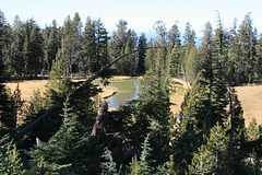
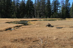
Well, yes, Gray "Pond" would be more appropriate! But it _is_ a perennial body of surface water, and thus of extreme importance to wildlife in these mountains, which are pretty dry despite the patchy forest. Off the Tahoe Rim trail in the Mt. Rose Wilderness Area, Humboldt-Toiyabe National Forest, Nevada. The lake elevation is 9043 ft/2756 m.
IMG 1046
| |
|

IMG 1040 adj
| |
|
IMG 1037 adj
| |
|

Lake Tahoe View
| |
|
|
|
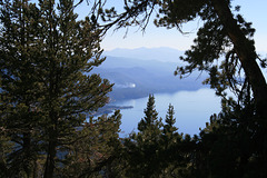
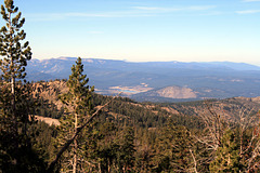
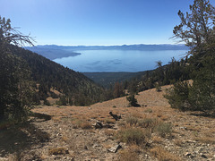
Looking south on the Nevada (east) side. The nearer peninsula is Deadman Point--I don't know the origin of the name! Lake Tahoe is natural, but its level was raised 8 ft (~2.5 m) by a low outlet dam in the early 20th century, for water storage. The maximum depth is near the north end, behind the trees to the right, and is over 1600 ft (~490 m). The lake is the largest alpine lake in North America and is shared between California and Nevada--ironic since Nevada's the driest state in the US! There's an urban legend locally that the basin is a volcanic crater, but in fact it's a fault-block valley. This view is from the Tahoe Rim Trail at around 9400 ft/2865 m.
IMG 1026 adj
| |
|
IMG 1024 adj
| |
|
|

20201030 172828 001
| |
|

20201030 164153 001
| |
|
IMG 8921
| |
|
20201030 151939
| |
|

20201030 150822 001
| |
|
|
Fire on the Mountain
| |
|
|
|
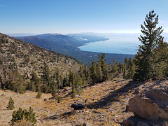
View south over Lake Tahoe from the Tahoe Rim trail, at about 9360 ft/2853 m. We're looking along the east (Nevada) shore of the lake; the settlement below on the left is Incline Village, Nevada. The smoke plume in the distance is in fact from a just-started wildfire, of great concern since fire danger was still very high--the winter rains hadn't started yet. We had cell phone service here and called in the fire, as I'm sure others did. We read later that firefighters held it to an acre or so--hooray!
20201030 140832 001
| |
|

20201030 140636
| |
|
20201030 135622 001
| |
|
|
