

slgwv's photos
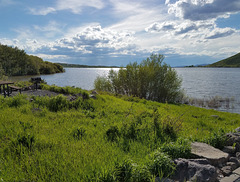
Vega Reservoir
| |
|
|
|
A small reservoir in the drainage of the upper Colorado River, built in the late 50s-early 60s for irrigation storage. At an elevation of ~8000 ft (~2440 m), it's higher than most such artificial lakes. It's popular locally for fishing, and is in a very pretty setting to the north of Grand Mesa, but it's hardly a Destination! I ended up there because my original destination off Grand Mesa was still completely snowed in due to the extraordinary snowfall in 2019. Vega Reservoir looked like an interesting place on the map--it is the centerpiece of a Colorado state park--so it became Plan B! Looking west; a monsoon thunderstorm is visible in the distance. Insets show some other views. The flooded bushes along the shoreline attest to the high water level.
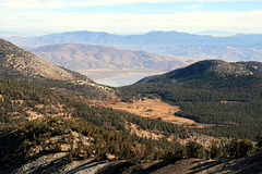
Tahoe Meadows and Washoe Lake
| |
|
|
|
View southeasterly from Relay Peak, at 10,338 ft/3151 m the highest point on the Tahoe Rim Trail (TRT). (The trail runs directly over the peak!) It's on the northeast side of Lake Tahoe in the Carson Range, on the Nevada (east) side. Tahoe Meadows is the prominent low area, highlighted with fall colors, in the foreground. It's a popular hiking area when not snow-covered; and a popular snow-play area in the winter! We accessed the TRT from a trailhead off Tahoe Meadows. The highway visible here and there on this side is Nevada SR 431, the Mt. Rose Highway, and the most direct route from Reno to Lake Tahoe. The lake partly visible thru the gap beyond is Washoe Lake, in Washoe Valley, where I live. The ranks of mountain ranges extending out beyond are in Nevada and show the typical topography of the Basin and Range.

IMG 1115 adj
| |
|
|
|

IMG 1113 adj
| |
|
|
|
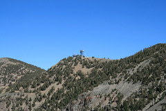
Microwave tower
| |
|
|
Seen off the Tahoe Rim Trail on the way up Relay Peak, on (appropriately named) Relay Ridge. I've put more information on the tower in the enclosing photo. Mt. Houghton (10,490 ft/3197 m) is just barely in the picture at far left.

IMG 1109 adj
| |
|
|
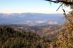
Looking toward California
| |
|
|
|
View westward from off the Tahoe Rim Trail below Relay Peak, Nevada. The skylined mountain crest is the Sierra Nevada. The Sierra Buttes poke over the crest just to right of center (outline), and the wide valley left of center (outlined) holds Interstate-80, Donner Lake and the town of Truckee (both of the latter not being visible) on the way to Donner Pass. The larger body of water just right of center is Prosser Reservoir on Prosser Creek; the smaller water body, below and to the left, is Martis Lake.

IMG 1092 adj
| |
|
|

IMG 1085 adj
| |
|
|
|

IMG 1080 adj
| |
|

IMG 1077 adj
| |
|

IMG 1075 adj
| |
|

IMG 1071 adj
| |
|
|

IMG 1131 adj
| |
|

IMG 1122 adj
| |
|

IMG 1120 adj
| |
|

IMG 1119 adj
| |
|

IMG 8953
| |
|
|
