

slgwv's photos
IMG 0382
| |
|
IMG 0377
| |
|
After the flood...
| |
|
|
|
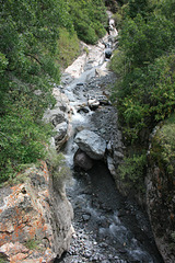
Portland Creek, looking upstream from the Amphitheater Campground bridge the day after the flood. It's back to being a picturesque little stream! At the height of the flood the boulders in the middle were completely covered by muddy water. The downstream view, in its slot canyon, is in the inset.
Portland Creek
| |
|
|
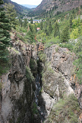
Portland Creek, after the flood, looking down the slot canyon from the Amphitheater Campground bridge. Ouray, Colorado, is beyond.
Canyon Creek
| |
|
|
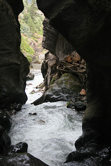
Looking out the slot canyon below Box Canyon Falls, from off the catwalk to the falls view. The old equipment on the right dates from the mining days. Presumably they were using water power to run some equipment (a Pelton wheel?) for mining operations. Ouray city park, Colorado.
IMG 0006
| |
|
Box Canyon Falls
| |
|
|
|
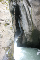
Or rather, the edge thereof. They're around the corner in this slot canyon, and this is as close as you can get. It's from the overlook reached by the catwalk up the canyon. Ouray, Colorado, city park. Still, it's impressive!
To Box Canyon Falls
| |
|
|
|
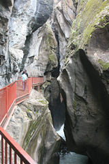
This catwalk leads to an overlook where you can get a glimpse of Box Canyon Falls, outside Ouray, Colorado. In fact the area is an Ouray city park. The falls are around a corner in the slot canyon, so you can only see their edge (inset). Still, it's a spectacular setting!
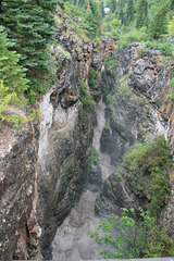
Portland Creek
| |
|
|
In flood, in a slot canyon downstream from the bridge on the way to Amphitheater Campground. A house in Ouray, Colorado, is visible in the distance--I hope they're far enough above the creek!
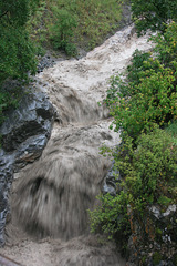
Portland Creek
| |
|
|
|
In flood, in the aftermath of an intense thunderstorm. I'm standing on a bridge here, which led to our campground, and you could hear the rumble of the bed load from the rocks tumbling down the falls. Geology in action! On the other (downstream) side of the bridge, the creek drops into a slot canyon (see inset), on its way to join the Uncompahgre River. Just outside Ouray, Colorado.
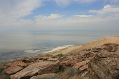
The Great Salt Lake
| |
|
|
|
Utah, USA. Looking northwesterly from Buffalo Point on Antelope Island, Antelope Island State Park. The Great Salt Lake is the largest lake by area (but _not_ by volume!) in the US west of the Mississippi River, and the largest saline lake in the western hemisphere. Its salinity is variable but ranges as high as 27%--by comparison, mean sea water is about 3.3%. It's far too salty for fish but supports a brine shrimp(!) fishery. It's the vastly shrunken remnant of Pleistocene Lake Bonneville, an enormous freshwater lake that covered much of the eastern Great Basin.
Antelope Island is connected to the mainland by an automobile causeway. It's not an "island" at this water level, being connected to the mainland to the south and east by alkali mud flats.
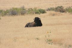
Buffalo Bull
| |
|
|
|
Or "bison", if you want to be technically correct. Bison bison , the American bison. This guy was right by the bike trail--so I detoured thru the cheat grass! Antelope Island State Park, Utah. Antelope Island, in the Great Salt Lake, supports a thriving buffalo herd that's managed by the Utah Dept. of Natural Resources.
IMG 3944
| |
|
IMG 3943
| |
|
IMG 3942
| |
|
IMG 3941
| |
|

IMG 3940
| |
|
IMG 3939
| |
|
