

slgwv's photos

Ouray, Colorado
| |
|
|
|
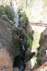
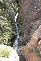
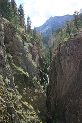
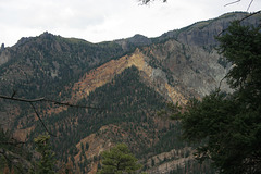
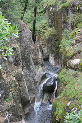
Looking east from the Perimeter Trail above Box Canyon Falls. Ouray is another old mining town in the Colorado Rockies, dating from the late 1800s, that has capitalized on its setting to become a tourist center. It calls itself "Colorado's Switzerland" (!); the elevation of the town itself is 7,792 ft (2375 m), with some of the surrounding peaks over 13K ft.
The spoil apron from the Chief Ouray mine is visible high on the opposite slope. Precious metals (gold & silver) were the focus of the local mining operations. Ouray was a chief of the local Native American tribe, the Utes, who saw the handwriting on the wall and tried to cut the best deal he could for his people.
IMG 0049
| |
|
IMG 0048
| |
|
IMG 0047
| |
|
IMG 0040
| |
|
IMG 9929
| |
|

IMG 9920
| |
|
IMG 0159
| |
|
|
Rusty
| |
|
|
|
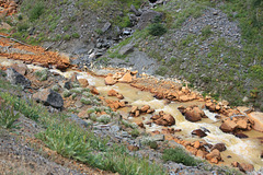
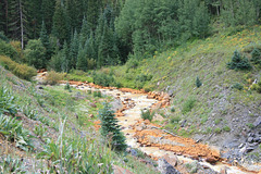
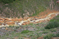
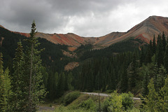
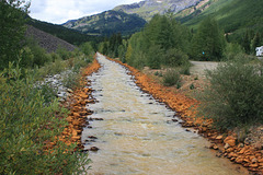
Red Mountain Creek, off US 550 (the "million-dollar highway") between Ouray and Silverton, Colorado. The rusty stain is just that--iron oxyhydroxides--that's mostly a result of acid mine drainage (AMD). Sulfide minerals oxidize in the presence of water and oxygen, yielding sulfuric acid which in turn puts metals, including iron, into solution. The dissolved iron then oxidizes further from atmospheric oxygen and precipitates. Because it's just rust, it's harmless if not particularly attractive. Other dissolved metals, tho, can be considerably more of an environmental hazard. Over the last few decades there have been efforts to isolate the drainage from old tailings heaps upstream to minimize further AMD. The inset shows a close-up of the staining along the creek.
IMG 0156
| |
|

Bear Creek Falls
| |
|
|
|
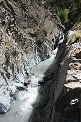
A few miles south of Ouray, Colorado, on US 550, the "million dollar highway." That's the edge of the highway bridge at the top of the photo, right over the falls. I'm sure they would have routed the highway differently these days, but it's following the original alignment of the 1880s toll road. It's still a pretty falls!
IMG 0120
| |
|
IMG 0176
| |
|
IMG 0173
| |
|
IMG 0167
| |
|
IMG 0363
| |
|
Animas River
| |
|
|
|
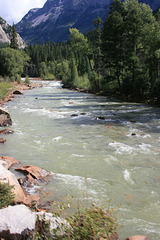
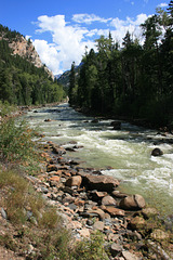
Along the Durango to Silverton narrow-gage excursion train, Colorado. The river's name is shortened from the Spanish original: El Río de las Animas Perdidas , "The River of Lost Souls." The story is that several members of a Spanish expedition in the 1700s were swept away and drowned while trying to cross the river.
Note the rust staining along the river banks. It's from acid-mine drainage, due to sulfide oxidation making sulfuric acid that in turn mobilized metals. Not all of it is a result of mining, but mining certainly exacerbated it! The stain is harmless--it's literally just rust (iron oxides and hydroxides), but it doesn't add to the esthetic experience--
Downtown Silverton
| |
|
|
|
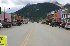
Colorado, USA, looking south along Main Street. Silverton is an old mining town in the Colorado Rockies that has a new lease on life as a tourist attraction. They've deliberately tried to keep the "Old West" motifs with the architecture. It's also the northern terminus of the Durango-Silverton narrow-gage line, a highly popular excursion train, and one of the last surviving relics of what was once a huge network of narrow-gage lines in this area. US highway 550, the "Million Dollar Highway" (of obscure origin--it cost a _lot_ more than that!) is visible crossing the forested slope near the base. It's the automobile route to Durango (to the south) and Ouray (to the north).
The sign at lower left says "State Law--Yield to Pedestrians in Crosswalk." I'm in the crosswalk, but maybe I should have stepped forward a bit to miss the sign. Or maybe it gives foreground interest ;)
