

slgwv's photos
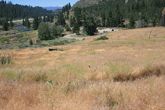
Boca Townsite, California
| |
|
|
|
Not much left! Looking more or less westward toward the Sierra Nevada, skylined in the distance. The river is the Truckee; the railroad (visible here and there in the upper left quadrant) is the original transcontinental route, now part of the Union Pacific. And the freeway is Interstate-80.
Boca means "mouth" in Spanish, and as in English the word can refer to a river mouth. Here it refers to the confluence of the Little Truckee, coming in from the right beyond the parking lot, with the Truckee. Boca lay about 15 miles east of Donner Summit and got its start as a source of timber for the railroad construction in the late 1860s. Its big claim to fame, however, was in a forgotten 19th-century industry: ice harvesting. A millpond on the Little Truckee originally built for the timber operations would freeze over in winter, and the ice would be sawed into blocks and shipped out. Even the improvised insulation of the day could preserve much of the ice over the summer. But by the 1920s the timber was exhausted and natural ice harvesting was becoming uncompetitive with artificial refrigeration. The town was finally dismantled in 1927. The insets on the left show some of the interpretive signs, with contemporary photos, around the townsite; those on the right show some artifacts that have been gathered.
The dry brown grass is cheat grass, an exceptionally noxious invader weed. For obvious reasons, it has led to an increase in wildland fires!
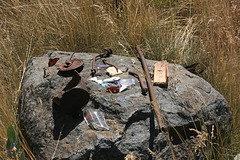
Artifacts from Boca Townsite
IMG 3633 trim
| |
|
IMG 3625
| |
|
Bruneau Canyon, Idaho
| |
|
|
|
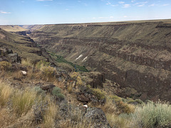
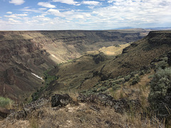
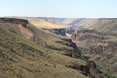
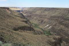
On (unsurprisingly) the Bruneau River. The Bruneau rises in extreme northern Nevada in the Jarbidge Mountains (visible dimly on the skyline) and flows northward into Idaho, eventually joining the Snake River--itself a tributary to the Columbia. It has incised this canyon into the so-called Snake River Plain, one of several northward-draining streams to do so. The Snake River Plain is a high, arid plateau that's nearly flat aside from these canyons! It's underlain by a series of nearly flat-lying basalt flows, some of which appear as the prominent cliff layers in the canyon walls. The white stuff below the basalt cliffs is not snow! It's a light-colored rock unit, probably a sedimentary unit, but I didn't go down to check ;)
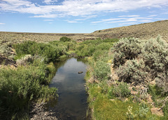
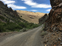
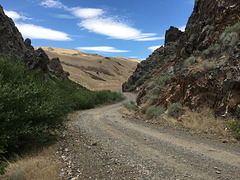
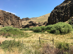
The left inset shows a closeup of the canyon floor by the white outcrop. On checking the USGS 7.5' topo map (Triguero Lake 1979), the tall tree, probably a poplar, is the site of the Frank Triguero homestead, and a pack trail down to the homestead began here--evidently the only access. There are also some ruins visible in the vicinity on the satellite view. The right inset is a view of the canyon downstream (north). There's little surprise that Frank (or his heirs) gave it up, especially as the site would also be vulnerable to flooding.
A political vagary: because the northern fringe of Nevada is in the Columbia River drainage, Nevada has a claim on hydropower produced in the Columbia Basin!
IMG 3615
| |
|
IMG 3612
| |
|
IMG 3605
| |
|
Comfortable
| |
|
|
|
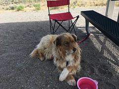
Cole, who's not sure why we have to go on a big hike today! At our camp at Wildhorse Reservoir State Park, Nevada.
IMG 3644
| |
|
IMG 3635
| |
|
IMG 2216
| |
|
IMG 2214
| |
|
IMG 2200
| |
|
IMG 2197 trim
| |
|
IMG 2193
| |
|
Bruneau Canyon
IMG 2179
| |
|
