

slgwv's photos

IMG 3171
| |
|

IMG 3167
| |
|
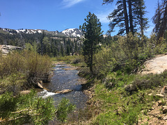
Charity Valley Creek
| |
|
|
|
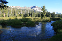
Running well earlier in the season, with lots of snow still melting! The high, partly snowclad peak in the background, whose right side is hidden by the tree, is Markleeville Peak (9415 ft/2870 m). Sierra Nevada, California. Off the Charity Valley trail.
IMG 3148
| |
|

IMG 3147
| |
|

IMG 3140
| |
|
IMG 1091
| |
|

IMG 1085
| |
|
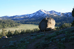
Charity Valley
| |
|
|
|
With glacial erratic. Looking southwesterly; the Blue Lakes Highway crosses the valley just on the other side of the meadow. Sierra Nevada, California. Yes, there is a "Hope" and "Faith" valley in the vicinity, too! ;) The inset shows an erratic-less view. Taken off the Charity Valley trail. The peak across the valley is unnamed, according to the USGS 7.5' topo map.

IMG 1082
| |
|
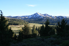
Charity Valley
| |
|
|
|
Without an erratic in the view! And yes, there's a "Faith" and "Hope" valley in the vicinity, too. Sierra Nevada, California.
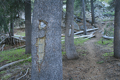
Blazes!
| |
|
|
|
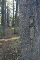
In the old days, trails were often marked by chopping off a section of bark to show the light wood underneath, a "blaze." The practice dates back at least to pioneer times, and maybe even was used by Native Americans. Of course, the blaze injures the tree, and so blazing is considered Politically Incorrect these days. The US Forest Service quit doing it in 1960. You still often see blazes on old trees along trails, tho, as here. This is the Charity Valley trail in the Sierra Nevada, California.
IMG 1069
| |
|
IMG 1067
| |
|

IMG 1063
| |
|

IMG 1058
| |
|

IMG 1035
| |
|

