Buildings
Interiors and exteriors.
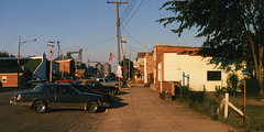
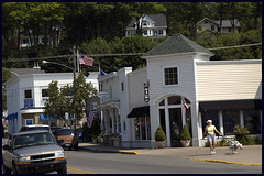
Mulliken Downtown, 1997
| |
|
Downtown Mulliken on a summer day in 1997. My notes for this photo believe it was taken Saturday evening during the town's annual block party, called Homecoming, though things really don't look busy enough to support that notion. Regardless, this is a fair image of Main Street for most of the last decade.
A few notes follow, in case someone is trying to sort these things out.
All the buildings on the left (north) side of Main Street back up to the CSX (originally Pere Marquette Railroad) main line across southern Michigan.
On the left:
* You can't see Mulliken/Merrified Hardware (now CCD Engineering) or the old barber shop, which are to my immediate left.
* The small brick building's the post office.
* The white building's the new library.
* The next building's Creative Taxidermy.
* The large brick building is the clubhouse for Brothers of the Ring.
o The old Village Hall, which is tucked in beside BOTR, is difficult to see.
o The house beyond that is completely hidden in this view.
* The next brick structure is the end of the town's recycling center--before my time this seems to have been a lumber yard.
* Not there yet in '97, but the new Village Hall is between the recycling center and the elevator.
* The (then) still intact and functioning Mulliken Elevator dominates the view at the far end of Main. As I've noted in the past, this set of structures is now being dismantled.
On the right:
* The yard in the foreground is part of a rental property.
* The two storefronts beyond the yard housed a beauty parlor and a veterinarian's office at the time. Both businesses are now gone, though the building is still occupied.
* The next two storefronts, and the courtyard between them, house Farmer's Steakhouse (and the Sain antique business).
* Beyond Farmer's is the (new) fire station/township hall, but it's not visible from here.
* The white frame building is the Masonic Temple.
* Beyond that is Mulliken's downtown park....
Camera: Chinon Genesis III
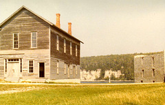
Opera House (Town Hall)
| |
|
Still another picture of Fayette's Opera House and the Company Store, with the limestone cliff that defines Snail Shell Harbor visible in the background. This picture dates from the early eighties; perhaps 1981, but I think a couple years later.
"Opera House." Hmmm. It would be better styled a community hall, near as I can tell; the town government (such as it was) lived in this building, as did one or more businesses. The second floor's a meeting room, where (among other things) visiting entertainers put on their shows. I call it the Opera House because the state park did when I started visiting the town; I'm not sure whether the residents shared the conceit.
Camera: Minolta Zoom 110 SLR
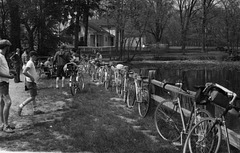
KBC @ Scotts Mill
| |
|
The Kalamazoo Bicycle Club takes an excursion to Scotts Mill County Park, sometime in 1976. As I recall, the park hadn't yet officially opened, but we found the park system's naturalist wandering the place and she gave us a tour. An interesting day.
The building in the background is the miller's home; the mill itself is to the left of and behind the photographer. The fence in this photo is also prominent in the photo I posted a few months back....
This photo may be mine--in which case it's an unusually clear shot from my Minolta Zoom 110--or (more likely) it was taken by my brother (Kalamazoo Richard) with his Olympus OM-1.
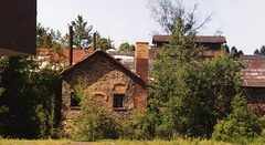
Cliffs Shaft Mine
| |
|
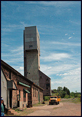
Part of the complex of buildings surviving at the Cliffs Shaft Mine, in Ishpeming; photographed in the early 1990s (my notes say 1992, but I don't fully trust them). This is the greatest and most interesting of the Upper Peninsula's iron mines.
This remarkable (and decidedly photogenic --link from Michigan Tech) mine closed in 1967, but has recently reopened as a museum. Virtually the entire complex still stands.
Quincy Smelter
| |
|
And today we prove the possibility of taking an excellent photograph with an inexpensive camera....
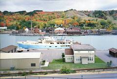
Took this photo by pointing my camera out my hotel window in Houghton on the prettiest fall weekend I remember, in late September of 1990. The Keweenaw National Park was not "real" at this time but while we were in the vicinity we had some contact with the efforts which would create it.
The wreck of a building complex across the Portage River was the Quincy Copper Smelter in Ripley--it still stands, more or less, and folks still hope to restore it. That would be worthwhile, but I'll believe it when it happens. Like Cliffs Shaft Mine and Painesdale's Champion, these buildings were last fully active in 1967, but have not stood up nearly so well.
The ship in the foreground is Ranger III--transportation to Isle Royale National Park--and the buildings in the foreground are a part of that truly remote park.
I was in town for a meeting of the South Shore Special Interest Group (DSS&A SIG) of the Soo Line Historical & Technical Society, which was just forming at the time (the SIG, not the Society). We spent the weekend touring mining locations, looking over old rolling stock, and sharing stories. A good time.
This photo has often been mistaken for a model railroad picture. Nope: A photo from real life.
Camera: Minolta Freedom 100
Fayette
| |
|
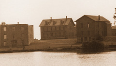
We're back in Fayette. Here (again) are the company store (on the left), the opera house/town hall (on the right)--and the hotel!
When Fayette was an active town--mostly in the 1870s and 1880s--these buildings constituted the bulk of the Fayette "business district." The skilled tradesmen lived out on the peninsula (to the right), while general labor lived near the blast furnace (to the left). Everyone shopped at the store, and met for entertainment and governmental functions at town hall. The hotel--called the Shelton House--was both a boarding house and a host for visitors.
For over a century, now, Fayette's been a tourist destination--a ghost town--and these buildings have survived largely because of formal and informal preservation efforts. A beautiful and attractive place which happens to be a significant historical artifact.
The reason there's no background for this photo is that the buildings are on a relatively skinny spit of land. The photo was shot in June of 1981 from near the superintendent's home.
South Haven
Champion Mine
| |
|
Northern Michigan's mining districts: Heavy industry in the wilderness. Now largely gone to ruin.
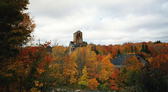
Champion Mine's Rock (Shaft) House #4 in Painesdale on a gorgeous fall day in 1990--another pic from our DSS&A excursion. Like Cliffs Shaft Mine and the Quincy Smelter, this facility closed in 1967. That coincidence of dates is not really a coincidence.
About half the Champion Mine complex still stands and is in reasonably good shape, partly because the mine serves as Adams township's main water source. The shaft house and other structures at the location now belong to a local preservation/historical group, called Painesdale Mine & Shaft, who are turning the place into a museum.
Camera: Minolta Freedom 100
Champion Mine
| |
|
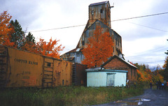
Another picture from Painesdale's Champion Mine on a beautiful autumn day in 1990. Since I was there with a railfan group, the Copper Range boxcars naturally drew some comment, and some speculation about the efforts which might be required to preserve them. There should have been some follow-through, as the cars were eventually sold for scrap.
Camera: Minolta Freedom 100
Work Train
| |
|
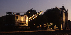
June 1995: I drove downtown to check the mail after work and noticed this interesting train parked behind the Mulliken Elevator. Grabbed the camera, wasted a roll of film, went home.
Joan, who'd just joined the household a few days before, was a little curious about why it took half an hour to check the mail....
Regarding that crane: It's CSX (nee L&N) 41422, built by American Crane and Equipment (they apparently now go by ACECO). Seems to me they were using this big crane for bridge repairs, but it's a distant memory at this point.
All the buildings (silos) in this photo are now gone. The siding's still there, but overgrown and mostly unused....
Camera: Chinon Genesis III
Old Harbor
| |
|
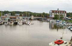
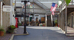
South Haven's Old Harbor Inn is really just too picturesque for words; you've really got to see the place to believe. But our room was undeniably comfortable, had a wonderful view, and is within an easy walk of the beach. Pricing is good, too. What's not to like?
The hotel's restaurant, York's Landing, is at the end of this pretty little lane of shops (they call it Old Harbor Village). Our room was up the stairs from the upper walkway on the right.
Winter Storm in Embryo
| |
|
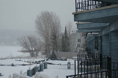
Traverse City. Last Monday's Winter Storm was just beginning to take shape when I stepped out on our room's balcony and took this shot....
Harbor Springs
| |
|
Most everything you need to know about Harbor Springs shows in this picture. Although this shot's basically just a snapshot, it came together far better than I expected. What doesn't show is that virtually every building in the place has a view of Little Traverse Bay.
Before Mom and Dad took to vacationing in Leland, the Harbor Springs vicinity was their usual vacation destination. It's easy to see why they considered this town as a possible home.
Door, with Chips
Calumet
| |
|
The Calumet and Hecla Mining Company built a substantial complex of buildings around the Red Jacket and their other mines early in the twentieth century. Those buildings, now the heart of the Keweenaw National Historical Park , are a truly impressive monument to the miners who toiled far beneath the surface in what was then the planet's deepest mine.
This building, according to the site's map (available at the park but not on their website), was the Drill Shop.
Core Storage Building: Door
| |
|
Another picture of the formidable buildings at the Calumet and Hecla/Red Jacket mine site in Calumet, Michigan.
This building was used for storing cores--samples made by drilling into the earth just to see what the rock contained, deep underground.
Camera: Nikon D70
Photo by Joel Dinda
Cliffs Shaft Mine
| |
|
This is the "C" shaft at Cliffs Shaft Mine in Ishpeming. The guy in the lower left corner--I think his name's John--is a retired Cleveland Cliffs engineer who now volunteers at the museum. An interesting and informative guide, I must say.
The tour's basically of the surface workings, which are better-preserved but less interesting than at Painesdale, and (far) more compact than those at Calumet. All the transportation periphernalia is gone, and much of the equipment went elsewhere when the mine closed. The main buildings remain.
Joan and I were the entire tour group. Never took a mine tour with a group of two, before.
Thriftway
| |
|
Shot while I was buying gas the other day.
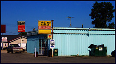
Not pretty, but certainly colorful. And the only grocery store within a five mile radius of my house. You can't see it in the picture, but there's an excellent garden on the edge of the parking lot.
Since this store's on the highway (M-43), it's likely the landmark folks think of when Mulliken comes to mind. Unless they think of Farmer's Tavern, of course.
Swede's, in the background, is the place to eat breakfast in Mulliken.
Jump to top
RSS feed- Latest items - Subscribe to the latest items added to this album
- ipernity © 2007-2024
- Help & Contact
|
Club news
|
About ipernity
|
History |
ipernity Club & Prices |
Guide of good conduct
Donate | Group guidelines | Privacy policy | Terms of use | Statutes | In memoria -
Facebook
Twitter

