Chile
Folder: Latin America
Carretera Austral
| |
|
|
|
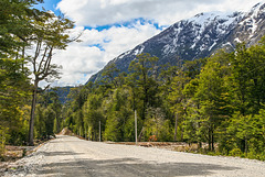
Ruta 7 between Villa Amengual and Villa Mañihuales just south of RN Laguna Las Torres. This stretch of road has already been widened prior to being asphalted. The new rough gravel isn't exactly kind to car tyres;-)
Inset photo: mountains to the west of the road
Carretera Austral
| |
|
|
|
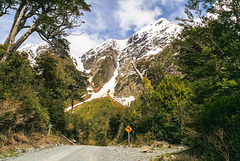
Legendary Carretera Austral runs through Queulat National Park. After climbing Altos de Queulat in a series of hairpin bends it drops into Cisnes Valley. This photo was taken in Sector Portezuelo south of the pass.
Ventisquero colgante
| |
|
|
|
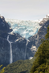
Ventisquero Colgante is the main attraction of Queulat National Park. Although the park covers 1541 km² only small sections along Ruta 7 (Carretera Austral) are open to the public, the large part is undisturbed rainforest, mountains and glacier.
The hanging glacier originates from a small 80 km² icefield and can often be heard and seen calving into the lagoon below it. On our visit a large chunk broke off, sadly we were in the forest at the time and the trees were in the way of a decent photo.
The inset photos are from the eastern viewpoint
and from Laguna de los Témpanos (the footpath to the western mirador was closed).
Café Rossbach - Puyuhuapi
| |
|
|
|
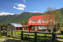
The village of Puyuhuapi was founded in the 1930s by families Uebel, Ludwig and Hopperdietzel from the village of Rossbach (Hranice) in Sudetenland (an area of German settlement in the Czech republic). More family members came in 1947 after WW2.
Río Futaleufú
| |
|
|
|
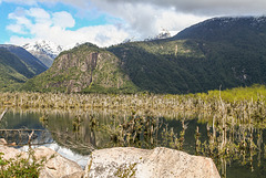
Río Futaleufú makes a big bend before draining into Lago Yelcho. The river in its changing course- probably caused by earthquakes- has drowned a lot of trees but vegetation is clawing its way back (see inset photos).
Futaleufú in spring
| |
|
|
|
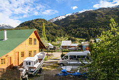
View from Hotel El Barranco. Futaleufu (~2000 inhabitants) is the adminstrative capital of Palena province and a centre of white water rafting on Futaleufu river.
HFF everybody!
Río Futaleufú
| |
|
|
|
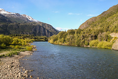
View east over Río Futaleufu. Just behind the bridge is the Argentinean border post followed by the Chilean Avanzada El Limite (see inset photos).
Lago Todos los Santos (PiP)
| |
|
|
|
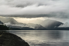
Clouds starting to clear after a day of heavy rain. Inset a mono version and a clickable note of the same view the next morning.
en.wikipedia.org/wiki/Vicente_P%C3%A9rez_Rosales_National_Park
Volcán Osorno (PiP)
| |
|
|
|
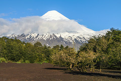
2652m high Osorno seen from Lago Todos los Santos. Osorno is a classical stratovolcano with a glacier on top, its last eruption was in 1869.
The inset photo shows basalt columns on the western side of the volcano.
volcano.si.edu/volcano.cfm?vn=358010
Lago Todos los Santos
| |
|
|
|
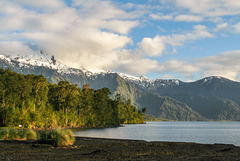
Morning on the shores of Lago Todos los Santos, seen from Petrohué. The 178,5 km² large lake lies in Vicente Pérez Rosales National Park , is surrounded by temperate rain forest and ringed by mountains and volcanoes, among them Osorno, Puntiagudo and Tronadór.
Cerro Pantojo (PiP)
| |
|
|
|
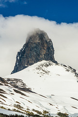
1897m high Cerro Pantojo seen from Paso Samore on the Argentinean/ Chilean border. Cerro Pantojo is the basaltic plug of an eroded pleistocene stratovolcano.
See inset photos for a wider view from the pass.
Hasta siempre
| |
|
|
|
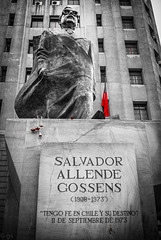
11.09.73 was the day of the miltary coup in Chile, and on 16.09.actor and singer Victor Jara was brutally murdered in Santiago's National stadium where 40.000 were imprisoned, tortured and 70 murdered. Thousands "disappeared", poet Pablo Neruda was poisoned in hospital (someone gave him a deadly botulin injection).
Victor Jara's music lives on:
Te recuerdo Amanda
Zamba del Che
On my first visit to Santiago in 2004 some of the houses around the Plaza de la Constitución still showed bullet holes from the coup, by 2008 everything had been renovated.
The bus of the Carabineros de Chile (noted for their brutality during the dicatorship) gave me the creeps...
In Barrio Paris-Londres there are many plaques in the pavement of "disappeared" and murdered young victims of the coup
Iglesia de San Pedro
| |
|
|
|
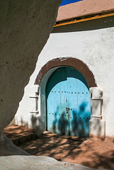
The catholic church of San Pedro de Atacama was built in 1744 and declared a national monument in 1951. It is in Andean style with adobe walls painted white, beams of chañar and algarrobo wood tied with ribbons of llama hide and a roof of cactus wood covered with mud and paja grass.
Tamarugo shadow
| |
|
|
|
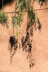
Branches of Prosopis tamarugo casting shadows on a wall in San Pedro de Atacama
Siesta
Cordillera de la Sal
| |
|
|
|
near San Pedro de Atacama, looking over Salar de Atacama to the Cordillera de los Andes
Cordillera de la Sal
| |
|
|
|
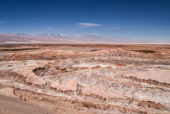
Cordillera de la Sal with Andean chain in the background, seen from the viewpoint on Ruta 23. Cordillera de la Sal is a 125 km long, 2,5 to 10 km wide fold belt that rises up to 300m above the Salar de Atacama.
Evolution of the Cordillera de la Sal
See clickable inset for a view in the other direction
Valle de la Muerte
| |
|
|
|
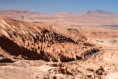
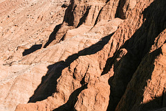
Valle de la Muerte is near San Pedro de Atacama in the Cordillera de la Sal. It is a place of eroded sedimentary rocks and sand dunes. The name Valle de la Muerte (Death Valley) is probably a corruption of Valle de Marte (Valley of Mars).
Jump to top
RSS feed- Latest items - Subscribe to the latest items added to this album
- ipernity © 2007-2024
- Help & Contact
|
Club news
|
About ipernity
|
History |
ipernity Club & Prices |
Guide of good conduct
Donate | Group guidelines | Privacy policy | Terms of use | Statutes | In memoria -
Facebook
Twitter

