Chile
Folder: Latin America
Cuernos del Paine
| |
|
|
|
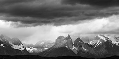
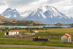
Cuernos and Valle Francés seen from Rio Serrano. Getting up early to see the sunrise turn the mountains red was an exercise in futility- no reds, only shades of grey;-)
Lago Skottsberg
| |
|
|
|
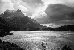
On the path from Refugio Pehoe to Valle Francés with Cuernos del Paine looming in the background. The wind was freshening up seriously
Cuernos del Paine
| |
|
|
|
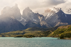
Cuernos del Paine seen across Lago Pehoe. The mountains in the National Park are of granite, heavily eroded by glaciers. The Cuernos are special in that they still have a shale layer on top.
Guanaco
| |
|
|
|
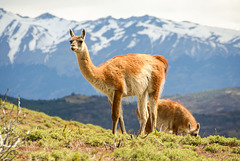
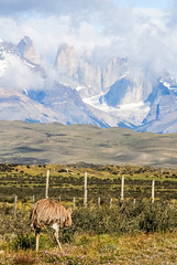
Guanacos are camelids native to South America. They can be found in arid areas like the Altiplano and Patagonia. In Argentinean Patagonia you usually only see them running from a distance whereas in Torres del Paine they are protected and therefore more numerous and less shy.
Torres
| |
|
|
|
"Papa Choique" on the other side of the road from his chicks, against the backdrop of the granite needles of Torres del Paine.
HFF everybody! ( I'm away on an Iper -meeting but will catch up next week)
Choique chicks
| |
|
|
|
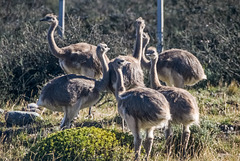
A group of young Darwin's rheas ( rhea pennata , called choique in Patagonia). The males incubate the eggs and look after the young- in this case the male was just on the other side of the road.
10-Week Picture Projects: Textures, Week 9 - Feathery
Laguna Azul
| |
|
|
|
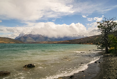
Typical windy weather at Laguna Azul. Clouds have descended on Torres del Paine Massif, only Cerro Almirante Nieto (Paine chico) on the left can be seen.
Laguna Azul
| |
|
|
|
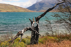
In February 2005 a careless backpacker started a distastrous fire when his cooker was blown over, destroying 155 km² of the national park and 2 km² of native forest. Considering that nothofagus in this climate takes centuries to grow this was a major disaster which was repeated in 2011 when another backpacker caused a fire which destroyed 176 km²/36km² arround Lago Pehoe.
Fines for tourists still are ridiculously low but at least the Czech and Israeli governments donated money for reforestation after their citizens caused the damage.
Estancia Lazo
| |
|
|
|
Cuernos del Paine and Almirante Nieto seen across Laguna Verde from Estancia Lazo.
HFF!
Still running...
Paso Roballos (PiP)
| |
|
|
|
Paso Roballos is one of the most isolated border crossings between Argentina and Chile, reached by gravel roads from Cochrane through Valle Chacabuco on the Chilean side and from Bajo Caracoles on the Argentinean side. From the Chilean border post- run by Carabineros, not the Policia de Investigacianes as usual- (see first inset) you cross some 10 kms of no man's land before reaching the Argentinean border controls.
Paso Roballos ist einer der abgelegensten Grenzübergänge zwischen Argentinien und Chile, der von beiden Seiten nur über Schotterpisten erreichbar ist, auf chilenischer Seite von Cochrane aus über das Valle Chacabuco und auf argentinischer Seite von Bajo Caracoles aus. Zwischen dem chilenischen Grenzposten (erstes PiP), der anders als üblich nicht von der Policia de Investigaciones, sondern von den Carabineros kontrolliert wird, und dem argentinischen Posten liegen mehr als 10 km Niemandsland.
HHF everybody!
Rio Ibáñez (PiP)
| |
|
|
|
88 km long Río Ibáñez originates near Cerro Hudson and drains into Lago General Carrera. In the 1991 Hudson eruption lahars ran down the valley, clogged it up and changed the course of the river. Because of Pinatubo earlier in 1991 the not much smaller Hudson eruption received hardly any international news coverage at the time.
Panorama stitched from 2 photos.
The inset shows the drowned trees of Bosque Muerto a bit further upstream.
Cerro Castillo Panorama (PiP)
| |
|
|
|
Cerro Palo (ca. 2200m) and Cerro Castillo (2675m) seen across the valley of Río Ibáñez.
Inset photo: Cerro Palo
Panorama stitched from 2 photos
River valley (PiP)
| |
|
|
|
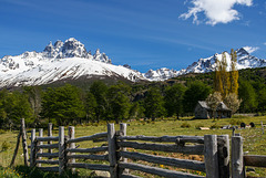
2675m high Cerro Castillo seen from Carretera Austral across the Río Ibáñez valley. The basalt buttresses of Cerro Castillo are the centrepiece of Reserva Nacional Cerro Castillo.
Inset photos show a closer view of Cerro Castillo and some Patagonian spring flora (anemones) growing where this photo was taken.
Stitched from 2 photos originally not intended as a panorama.
Abandoned
| |
|
|
|
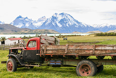
Following the 1991 eruption of Cerro Hudson many farmers had to give up because virtually all their cattle and sheep suffocated under the ashes.
HFF and happy Easter everybody!
Cerro Castillo
| |
|
|
|
Cerro Castillo (2318 m) is part of Reserva Nacional Cerro Castillo which was created in 1970 to protect native species, among them the acutely endangered huemul (south andean deer).
Patagonian spring
| |
|
|
|
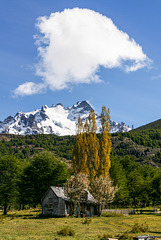
Rural landscape near Balmaceda, south of Coyhaique. The woods which used to cover the area have been burned down to create pastures for sheep- tree stumps and logs can still be seen, also some trees that escaped;-)
HFF and happy All Fools' Day!
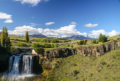
Salto del Rio Pollux
Jump to top
RSS feed- Latest items - Subscribe to the latest items added to this album
- ipernity © 2007-2024
- Help & Contact
|
Club news
|
About ipernity
|
History |
ipernity Club & Prices |
Guide of good conduct
Donate | Group guidelines | Privacy policy | Terms of use | Statutes | In memoria -
Facebook
Twitter

