4-10-17
Folder: unsorted
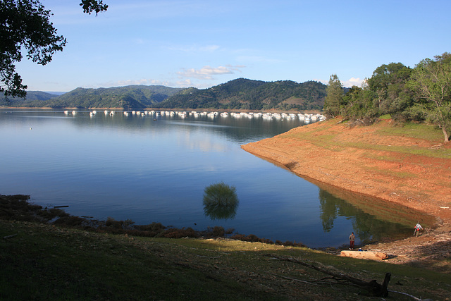
Oroville Reservoir
Formed by Oroville Dam on the Feather River, California, near (yes!) the town of Oroville. (Great gold rush name, too--"oro" = "gold" in Spanish. ;) The reservoir had been extremely hard hit by the drought, and there were lots of earnest prognostications that it would take _years_ to recover, if ever.
Well, it took one season. In mid-February >100,000 cubic feet per second of water (something over 2800 m^3/sec, if I've done the arithmetic right) was pouring down the Feather, and not only did the reservoir fill, it spilled over the concrete bypass spillway to the point that heavy damage ensued. The middle section (all concrete!) was completely eroded out. Fortunately, the hard metamorphic bedrock resisted further erosion, once the loose surface material was washed away, and the overflow established itself in a bedrock channel--looked kinda cool, actually, like a natural slot canyon.
The dam and its clobbered spillway made national news in the US. Dunno about overseas, but there are gobs of videos all over the net; here's one of a series done by the same aerial photographer:
www.youtube.com/watch?v=_2aD53JIDzo
He also has one of reopening the spillway a couple of weeks ago, to the tune of 35K cfs:
www.youtube.com/watch?v=65TMuhsKuVM&t=155s
This is being done to lower the reservoir to make room for the spring runoff! The video also gives a good view of the eroded-out middle of the spillway.
So, what we're looking at in this pic is the newly lowered level, from its all-time high. The driftwood on the shore below consists largely of trees eroded out from the shore by wave action at the high water level. Even now, the water level is _still_ higher than it's been in years; note the flooded tree. Note also that in the satellite view this inlet is completely dry!
And there's still lots of snow waiting to melt in the Sierra--
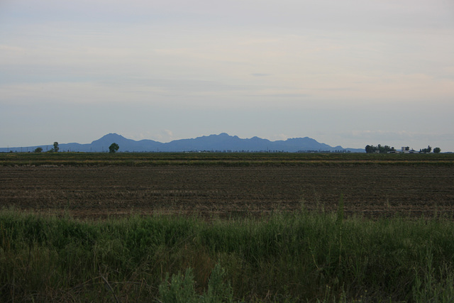
Sutter Buttes
A set of volcanic domes improbably situated out in the middle of California's Central Valley. This was as close as I got this trip due to lack of time! The Buttes are all private land at present, but under an arrangement with the landowners a group leads hikes into them on weekends in the spring and fall. One of these days--
The Buttes are named for John Sutter, who had the misfortune to have gold discovered on his land grant in 1848, leading to the California Gold Rush.
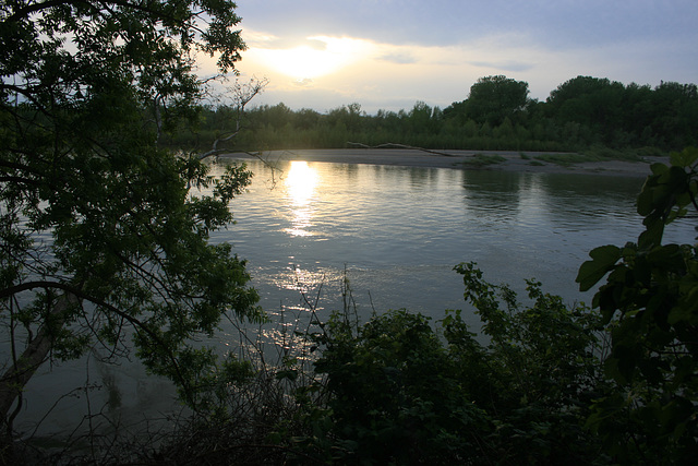
The Sacramento at Sunset
Looking across the Sacramento River toward the setting sun, near Butte City on California SR 162.
Jump to top
RSS feed- Latest items - Subscribe to the latest items added to this album
- ipernity © 2007-2024
- Help & Contact
|
Club news
|
About ipernity
|
History |
ipernity Club & Prices |
Guide of good conduct
Donate | Group guidelines | Privacy policy | Terms of use | Statutes | In memoria -
Facebook
Twitter


