9-05-21 (Stewart-Columbine Loop)
In the Arc Dome Wilderness at the south end of the Toiyabe Range in central Nevada. The Toiyabes extend north-south for some 100 miles (160 km) right in the middle of the state, with much of the crest around 10K feet (3050 m) or more. Arc Dome itself is the highest peak (11773 ft/3588 m) in the range. The Stewart Creek trail starts from the Columbine Campground, a small primitive USFS campgroun…
(read more)
Arc Dome (11,773 ft/3588 m)
| |
|
|
|
High point of the Toiyabe Range, and centerpiece of the eponymous wilderness area at the south end of the range.
Arc Dome Summit Trail junction
Cairns
| |
|
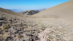
The surface here is so barren that cairns mark the path. It's an extreme environment for vegetation!
Bye, Arc Dome!
| |
|
|
Looking east from the TCT
| |
|
|
Down North Twin River Canyon to Big Smoky Valley. The range in the distance is the Toquima Range, with peaks in that high massif over 11K feet.
Dropping...
TCT northbound.
| |
|
|
The trail crosses the obvious drainage in front of the sparsely forested slope ahead. It's the headwaters of one of the tributaries of North Twin River.
TCT northbound.
| |
|
|
After crossing this drainage the trail crosses the obvious saddle on the opposite side. The inset looks back from there to this point.
Dropping into the drainage
| |
|
It's a pain to be losing altitude when you know you're going to need to regain it! We have to climb up to that saddle.
Looking back south
| |
|
|
Crossed the drainage (whew!). The last thing you want to do at this altitude is recover elevation that you had to lose! The inset is roughly at the point of the view north to here.
Coming into Columbine Canyon
| |
|
|
Still on the TCT northbound here, but in less than 1/4 mile or so the Columbine Creek trail comes in from the left, and we return that way.
TCT junction
Columbine Creek trail
| |
|
|
|
On the descent back to the trailhead. Looking northwesterly out to Reese River Valley.
Canyon of Columbine Creek
| |
|
|
|
Our return route. The location of the trailhead where we started (and will come out) is marked with a note. Looking more or less west to the Reese River Valley.
Down the switchbacks on the Columbine Trail
| |
|
|
Looking back up the Columbine Trail
Aspens again!
| |
|
|
Many trees have graffiti carved into them by sheepherders in the early 20th century. Aspen bark scars are dark, so they've been popular for graffiti--although the practice is seriously frowned on now!
Looking up Columbine Creek trail
| |
|
|
Jump to top
RSS feed- Latest items - Subscribe to the latest items added to this album
- ipernity © 2007-2024
- Help & Contact
|
Club news
|
About ipernity
|
History |
ipernity Club & Prices |
Guide of good conduct
Donate | Group guidelines | Privacy policy | Terms of use | Statutes | In memoria -
Facebook
Twitter


