KINGDOM of FIFE
HFF Everyone
| |
|
|
|
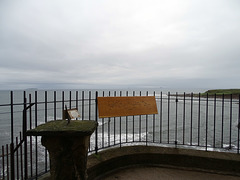
On the Horizon from left to right one can see The Isle of May, which is approximately 8 km off the coast of mainland Scotland. It is 1.8 kilometres long and less than half a kilometre wide. The island is owned and managed by Scottish Natural Heritage as a national nature reserve. The Bass Rock is just right of centre and is a volcanic crag in the Firth of Forth that towers 106 metres above sea level. It is home to a large colony of gannets. To the right is the North Berwick Law, a volcanic plug. The summit bears remnants of an Iron Age hill fort, and the ruins of later military buildings that were once used by lookouts in both the Napoleonic Wars, and in World War II. Since 1709 the law has been topped with a whale's jawbone.
Courtesy of en.wikipedia.org/wiki/North_Berwick_Law
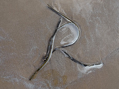
I love letters in the sand
| |
|
|
|
This week Saturday Sels Challenge: let's concentrate on: "Harmony''
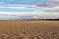
The waves were moving bits of seaweed around with each ebb and flow. This was an 'O' to begin with, but by the time I got the camera ready it had changed into an 'R'.
Nina and Frederik - Listen to the Ocean
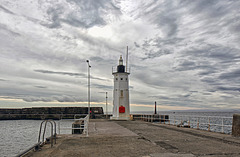
Anstruther lighthouse. HFF everyone.
| |
|
|
|
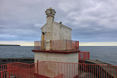
The Chalmers Lighthouse was built in 1880 at the harbour entrance, to commemorate Dr Thomas Chalmers, a mathematician and professor of theology.
The octagonal Lighthouse seen today was built to mark the end of the breakwater and stands 9 metres high. Most of the tower is painted white, whilst the service room below the unusually small lantern is painted black. A light is no longer shown from the tower, although it still operates a nautophone fog signal, housed in one of the window holes around the top of the tower, and a decorative white light is still shown from it's lantern.
A new light, seen in the photo, was established in front of the Lighthouse, consisting of a plain unpainted metal pole with two LED units.
HFF everyone.
Looking towards Dundee
| |
|
|
|
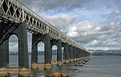
The Tay Bridge (or Tay Rail Bridge) is a railway bridge about two and a quarter miles (three and a half kilometres) long that spans the Firth of Tay in Scotland, between the city of Dundee and Wormit in Fife. It was opened on 20 June 1887.
This 'new' double-track bridge was designed by William Henry Barlow. It was built by William Arrol & Co. 18 metres (59 ft) upstream of, and parallel to, the original bridge. The foundation stone was laid on 6 July 1883 and construction involved 25,000 metric tons of iron and steel, 70,000 metric tons of concrete, ten million bricks (weighing 37,500 metric tons and three million rivets. Fourteen men lost their lives during its construction, most by drowning.
The original Tay Bridge was designed by noted railway engineer Thomas Bouch, It was a lattice-grid design, combining cast and wrought iron. The bridge was opened for passenger traffic on 1 June 1878. On the night of 28 December 1879 at 7.15 pm, the bridge collapsed after its central spans gave way during high winter gales. A train with six carriages carrying seventy-five passengers and crew, crossing at the time of the collapse, plunged into the icy waters of the Tay. All seventy-five were lost.
The stumps of the original bridge piers, seen here, are still visible above the surface of the Tay even at high tide.
HFF and a good Easter to you all
| |
|
|
|
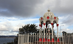
This is a fine example of a Victorian drinking fountain, which celebrates the versatility of cast-iron to decorative effect. It was cast by the Alexander Russell at the Kirkcaldy Foundry in 1824 and was one of a series placed along the length of the "Great Fife Road". The fountain is located in Newport 0n Tay in the Kingdom of Fife.
It is a substantial canopied cast-iron drinking fountain of Moorish design, prominently sited just by the pavement. Concrete stone steps to dais and concrete covered plinth. There are 8 columns on chamfered bases with foliate detailing to base, capital and interior supporting 8 arches with scallop edging. Plaques in roundels above all arches decorated with herons and stags and inscribed 'KEEP THE PAVEMENT DRY'. There is a plaque on the east side inscribed 'THE GIFT OF MRS BLYTH MARTIN 1882'. (The Blyths were a Dundee family). There are stylised creatures between plaques and a ribbed domed roof of traceried metal with floral designs. The fountain is painted cream colour, the plaques and capitals painted red and creatures and roof ribs painted gold. In the background it's possible to see the River Tay road bridge linking the Kingdom of Fife to the county of Angus.
I think it has been recently painted. It didn't look as posh as this when I was a child. ;-)
The fountain was designated as a Category B listed building on 27/11/2002.
The Ripple of the Sands
| |
|
|
|
The West Sands. St.Andrews
| |
|
|
|
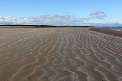
It was on this beach that the opening scenes of Chariots of Fire was filmed.
www.youtube.com/watch?v=L-7Vu7cqB20
St.Andrews Cathedral and Saint Rule's Tower
| |
|
|
|
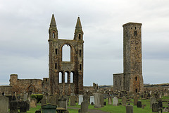
St. Rule's Tower, sometimes referred to as the Square Tower (108 feet high), affords a wonderful panoramic view over the town and harbour and to the surrounding countryside. Access to the tower requires an entrance token which can be obtained at the cathedral visitor centre. The climb to the top of the tower is via a rather narrow and steep spiral staircase (151 steps) on which it is difficult to pass those headed in the opposite direction.
The PiP shows an old pen and ink drawing - date unknown.
When I was a child climbing the the square tower was free for everyone. The buildings haven't changed though.
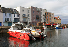
High tide at St.Andrews Harbour
| |
|
|
|
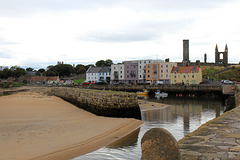
St.Andrews harbour at low tide
| |
|
|
|
In the background one can see the Cathedral of St Andrew (often referred to as St Andrews Cathedral). It is a ruined Roman Catholic cathedral in St Andrews, and was built in 1158 and became the centre of the Medieval Catholic Church in Scotland as the seat of the Archdiocese of St Andrews and the Bishops and Archbishops of St Andrews. It fell into disuse and ruin after Catholic mass was outlawed during the 16th-century Scottish Reformation. It is currently a monument in the custody of Historic Scotland. The ruins indicate that the building was approximately 119m (391 feet) long, and is the largest church to have been built in Scotland.
One can a;so see St Rule's tower located in the Cathedral grounds This tower predates the cathedral, having served as the church of the priory up to the early 12th century. The building was retained to allow worship to continue uninterrupted during the building of its much larger successor.
The views from the top are wonderful.
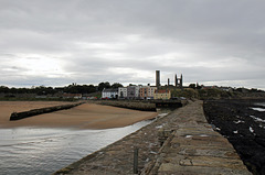
St.Andrews skyline from the end of the pier
| |
|
|
|
On Sunday afternoons, during term time just after church, students in their scarlet gowns take a traditional walk along the long pier and back The more daring students walking back along a narrow and high part of the wall. It's a lovely sight to see.
If it wasn't windy, Ii used to walk along the top wall of the pier, gripping a tight hold of my dad's hand. I didn't walk on the top of the pier this visit, but did climb the ladder to the top to get this photo.
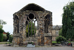
Blackfriars. St.Andrews. In front of the Madras C…
| |
|
|
|
Blackfriars is the modern name for the Dominican friary of St Mary which existed in St Andrews, Scotland, in the later Middle Ages.
Behind this ruin is the Madras College which I attended from the age of 11 for almost a year before we moved to England. I am not listed in the famous Alumni, but one of my good friends, Gavin Brown, is: Professor Gavin Brown (1942 – 2010) - Professor of Pure Mathematics at University of New South Wales, Australia . I used to sit next to him when we were at the Burgh School. He was very brainy.
Deconstructed HFF.
| |
|
|
|
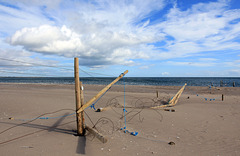
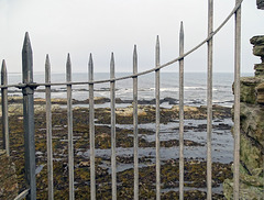
The forecast was for snow last night, and I was hoping to find lots of snowy fences. Instead we've had sleet and rain, so this is my fence photo for January. The fence is supposed to demarcate the boundary to the nature reserve. The wind and tides have put paid to that.
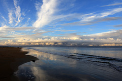
Kingsbarns sunset
| |
|
|
|
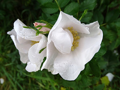
Rosa Rugosa in the rain
| |
|
|
|
View of the North Sea from St.Andrews Castle
| |
|
|
|
Longannet Power station
| |
|
|
|
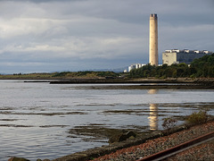
At the time of opening in the early 1970s Longannet was the largest power station in Europe with a capacity of 2,400 MW. Designed by Scottish architects Robert Matthew, Johnson Marshall & Partners, construction began in 1965 on land reclaimed from the Firth of Forth using ash from the Kincardine power station. The first electricity was generated in 1970 and the station was running at full capacity by 1973 once construction of all units was complete.
In 2003 Longannet was identified as Scotland’s largest source of pollution. The power station closed in 2016 after 46 years of producing electricity. The closure marked the end of coal-fired generation in Scotland.
Courtesy of: www.powerstations.uk/longannet-power-station-fife-scotland
The power station is gradually being demolished. See below for video.
Longannet Power Station Annex Demolition
The tower was finally demolished yesterday. www.bbc.co.uk/news/av/uk-scotland-59597883
Jump to top
RSS feed- Latest items - Subscribe to the latest items added to this album
- ipernity © 2007-2024
- Help & Contact
|
Club news
|
About ipernity
|
History |
ipernity Club & Prices |
Guide of good conduct
Donate | Group guidelines | Privacy policy | Terms of use | Statutes | In memoria -
Facebook
Twitter

