

Erhard Bernstein's photos

Exeter Umbrellas (2*PiP)
| |
|
|
|
More than 120 colourful umbrellas will decorate the sky above Exeter High Street from early April to mark the start of spring.
An InExeter initiative to make a colourful splash in the city centre, the bright umbrellas will be installed in the heart of the city. The umbrellas follow the installation of lanterns for Chinese New Year.
Ann Hunter, InExeter manager, says, “The umbrellas will make a bright display this spring and will look beautiful against both blue skies and grey. We hope everyone will share images of the umbrellas across social media using #springinexeter and we are looking forward to seeing the reaction from visitors to Exeter city centre”
Source: www.devonlive.com/news/devon-news/120-umbrellas-hung-over-exeter-1411254
HFF
| |
|
|
|
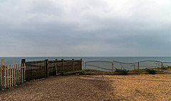
Die Klippenkante bei Birling Gap. Auch in der Senke ist die Klippenhöhe über 10 m
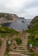
Route closed - (2*PiP)
| |
|
|
|
The beach at the Man O'War Bay isn't accessible ...
Frech explanation (thanks to Winscha): Descendre sur la plage est beaucoup trop dangereux et les gens s'abstiennent.

Exeter Cathedral
| |
|
|
|
From Wikipedia (both German and English):
Die Kathedrale St. Peter, offiziell: The Cathedral Church of St Peter, von Exeter in Devon gilt als das „Hauptbeispiel wuchtig rauschender, gemessener Pracht ohnegleichen“. Begonnen wurde die Kirche 1112 im normannisch-romanischen Stil. Von diesem Bau sind noch die Außenmauern des Langhauses und die beiden kolossalen, heute als Querschiff dienenden, quadratischen Türme erhalten. Der Baumeister des romanischen Vorgängerbaus hatte zu dieser ungewöhnlichen Lösung gegriffen, weil die zuvor entsprechend der englischen Tradition errichteten Vierungstürme eingestürzt waren.
Der gotische Neubau erfolgte ab 1224. Man begann mit der niedrigen Ostkapelle, der sog. Lady Chapel (Marienkapelle), einem einschiffigen Bau von drei Jochen und Flankenkapellen am Westjoch. Danach folgten um 1280/90 der gleich hohe Retrochor und das Langhaus in den Maßen der romanischen Kirche. Zur gleichen Zeit wurde am Südquerhaus das Chapter-House (dt. Kapitelhaus) angebaut (1270–1280).
Exeter Cathedral, properly known as the Cathedral Church of Saint Peter in Exeter, is an Anglican cathedral, and the seat of the Bishop of Exeter, in the city of Exeter, Devon, in South West England. The present building was complete by about 1400, and has several notable features, including an early set of misericords, an astronomical clock and the longest uninterrupted vaulted ceiling in England.
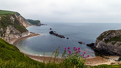
Jurassic Coast: Man O'War Bay (2*PiP)

Durdle Door (PiP)
| |
|
|
|
From Wikipedia (both German and English):
Durdle Door (zurückgehend auf altenglisch thirl ‚Bohrloch‘, ‚Durchbohrung‘) ist eine natürliche Felsbrücke aus Kalkstein an der auch als Tourismusregion bekannten Jurassic Coast, einem von der UNESCO als Weltnaturerbe ausgezeichneten Abschnitt der Südenglischen Kreideküste. Die Gesteinsformation befindet sich in der Grafschaft Dorset in der Nähe von West Lulworth. Das Gelände gehört zum Gebiet des etwa 50 Quadratkilometer umfassenden Lulworth Estate, das sich im Privatbesitz der wohlhabenden Grundbesitzerfamilie Welds befindet, aber für die Öffentlichkeit zugänglich ist.
Durdle Door (sometimes written Durdle Dor) is a natural limestone arch on the Jurassic Coast near Lulworth in Dorset, England. It is privately owned by the Welds, a family who owns 12,000 acres (50 km2) in Dorset in the name of the Lulworth Estate. It is open to the public. The name Durdle is derived from the Old English 'thirl' meaning bore or drill.
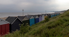
In Reih' und Glied
| |
|
|
|
Am Strand von Southbourne. Am Abend eines eher trüben Tages ist wirklich nichts mehr los ...

Brighton's West Pier (PiP)
| |
|
|
|
www.youtube.com/watch?v=Bms-sYfLqpA
The West Pier is a pier in Brighton, England. It was designed by Eugenius Birch, opening in 1866 and closing in 1975. The pier was the first to be Grade I listed in Britain but has become increasingly derelict since closure.
The pier was constructed during a boom in pleasure pier building in the 1860s, and was designed to attract tourism in Brighton. It was the town's second pier, joining the Royal Suspension Chain Pier of 1823. It was extended in 1893, and a concert hall was added in 1916. The pier reached its peak attendance during this time, with 2 million visitors between 1918 and 1919. Its popularity began to decline after World War II, and concerts were replaced by a funfair and tearoom. A local company took ownership in 1965, but could not meet the increased maintenance cost, and ultimately filed for bankruptcy. They could not find a suitable buyer, so the pier closed in 1975 and subsequently fell into disrepair.
The West Pier Trust now owns the pier and has proposed various plans to renovate it. Some schemes have been opposed by local residents and the owners of the nearby Palace Pier, who have claimed unfair competition. The pier gradually collapsed during the early 21st century. Major sections collapsed in late 2002, and two fires in March and May 2003 left little of the original structure. Subsequently, English Heritage declared it to be beyond repair. Structured demolition took place in 2010 to make way for the observation tower i360; further structural damage from storms has occurred since. (from Wikipedia en.wikipedia.org/wiki/West_Pier )
A personal note: I have now returned from a journey to Southern England and, of course, I will start uploading pictures from this trip regularly soon. However, answering to comments that have been made to my pictures in the meantime and visiting and commenting on my friends' picutres will still take some time and may never be completed. Thank you for your understanding.
Eine persönliche Erklärung: ich bin nun von einer 2-wöchigen Rundreise durch Südengland zurückgekehrt und natürlich werde ich bald regelmäßig Bilder von dieser Reise hochladen. Allerdings wird es noch länger dauern bis ich all die Kommentare zu meinen Bildern beantworte, die in der Zwischenzeit gemacht wurden, genauso wie der Besuch bei den Galerien meiner Fotofreunde. Vielen Dank für euer Verständnis!
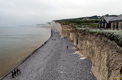
Seven Sisters
| |
|
|
|
From Wikipedia (both German and English):
Als die Sieben Schwestern (englisch Seven Sisters) wird die Kliffküste, die zwischen Eastbourne und Seaford gelegen ist, bezeichnet. Sie sind die eindrucksvollsten Klippen der South Downs in Sussex im Süden Englands. Bei den Seven Sisters handelt es sich um eine Kette aufeinander folgender Kreidefelsen der Küstenlinie. Da es sich um acht Kuppen und sieben Senken handelt, ist strittig, ob sich der Name auf die Kuppen oder die Senken bezieht.[1] Laut einer Ausstellung im Besucherzentrum des National Trust bei Birling Gap ist die Bezeichnung Seven Sisters um 1600 entstanden. Erst danach hat sich durch die kontinuierliche Erosion eine weitere Klippe, die achte Schwester, gebildet. Die historische Bezeichnung ist jedoch erhalten geblieben.
Von Westen nach Osten, beginnend östlich von Cuckmere Haven, tragen sie die folgenden Namen, wobei die Täler dazwischen auch noch individuelle Bezeichnungen führen. In der Liste sind die Klippen fett hervorgehoben:
Haven Brow
Short Bottom
Short Brow
Limekiln Bottom
Rough Brow
Rough Bottom
Brass Point
Gap Bottom
Flagstaff Point (übergehend in den Flagstaff Brow)
Flagstaff Bottom
Flat Hill
Flathill Bottom
Baily's Hill
Michel Dean
Went Hill Brow
Östlich des letzten Felsens befindet sich das Dorf Birling Gap, das stark von der Erosion bedroht ist.
The Seven Sisters is a series of chalk cliffs by the English Channel. They form part of the South Downs in East Sussex, between the towns of Seaford and Eastbourne in southern England. They are within the South Downs National Park which is bounded by the coast, the Cuckmere and the A259 road. They are the remnants of dry valleys in the chalk South Downs, which are gradually being eroded by the sea.
From west to east, the sequence starts just east of Cuckmere Haven. The cliff peaks and the dips between them are individually named. Listed below, the peaks are in bold. There are seven hills, with an eighth one being created by the erosion of the sea.[1]
Haven Brow
Short Bottom
Short Brow
Limekiln Bottom
Rough Brow
Rough Bottom
Brass Point
Gap Bottom
Flagstaff Point (continuing into Flagstaff Brow)
Flagstaff Bottom
Flat Hill
Flathill Bottom
Baily's Hill
Michel Dean[citation needed]
Went Hill Brow (grid reference TV549963).
Just east of the last peak is Birling Gap.
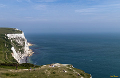
... irgendwo dahinten ist Frankreich ...
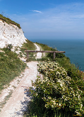
Barrier before Infinity - HFF everybody!
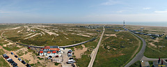
Dungeness: Overview from the Old Lighthouse (6*PiP…
| |
|
|
|
Apart from a very ugly nuclear power plant in my back and the beautiful lenses, there is a lot lot you can see from the Old Lighthouse at Dungeness. Of course, there is the new lighthose, but being a railroad fan, i love to watch what's going on at the Dungeness station of the RH&DR (Romney Hythe & Dymchurch Railway). The station building is mostly a restaurant with the very appropriate name "The end of the line". In front of it, there is an all-male folk dance group performing their act. No, they are not fighting! And I have managed to capture one of the beautiful trains approaching, arriving and leaving this terminal station which is situated in a balloon loop (or reversing loop as it is called in America).
Foto stitched from 6 portrait shots taken with 10 mm focal length.
Sight and sound: www.youtube.com/watch?v=UMVjToYOjbM
R.I.P Roy Orbison, George Harrison & Tom Petty - now Bob Dylan and Jeff Lynne are the two Wilburys left.

IMG 4028
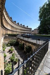
The Circus in Bath
| |
|
|
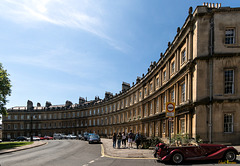
The Circus in Bath
| |
|
|
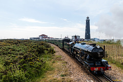
Romney, Hythe & Dymchurch Railway (RH&DR) in front…
| |
|
|
|
The PiP show impressions of the lighthouse's lenses. I have added one with a dog on the train ;-)
From Wikipedia (German and English):
Die Küste von Dungeness wurde im Laufe der Jahre von fünf Leuchttürmen geschützt, von denen der erste nur aus einer Bake bestand.
1615 wurde der erste Leuchtturm errichtet und 1635 durch einen neuen ersetzt, als die Küstenlinie sich verlagerte. Als mehr Kies aufgeschwemmt war, wurde 1792 ein weiterer Leuchtturm gebaut. 1901 folgte der vierte Leuchtturm; dieser wurde stillgelegt, als 1961 der fünfte erbaut und als The Old Lighthouse zu einer Touristenattraktion wurde.
There have been seven lighthouses at Dungeness, five high and two low, with the fifth high one still fully operational today. At first only a beacon was used to warn sailors, but this was replaced by a proper lighthouse in 1615. As the sea retreated, this had to be replaced in 1635 by a new lighthouse nearer to the water's edge known as Lamplough's Tower.
As more shingle was thrown up, a new and more up-to-date lighthouse was built near the sea in 1792 by Samuel Wyatt. This lighthouse was about 35 m (115 ft) high and of the same design as the third Eddystone Lighthouse. From the mid-19th century, it was painted black with a white band to make it more visible in daylight; similar colours have featured on the subsequent lighthouses here. This lighthouse was demolished in 1904, but the lighthouse keepers' accommodation, built in a circle around the base of the tower, still exists.
In 1901 building of the fourth lighthouse, the High Light Tower, started. It was first lit on 31 March 1904 and still stands today. It is no longer in use as a lighthouse but is open as a visitor attraction. It is a circular brick structure, 41 m (135 ft) high and 11 m (36 ft) in diameter at ground level. It has 169 steps, and gives visitors a good view of the shingle beach.
As the sea receded further, and after building the nuclear power station which obscured the light of the 1904 lighthouse, a fifth lighthouse, Dungeness Lighthouse was built.
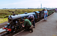
Romney, Hythe & Dymchurch Railway in Dungeness
| |
|
|
|
From Wikipedia (German and English):
Die Romney, Hythe and Dymchurch Railway (RH&DR) ist eine 21,7 Kilometer (13,5 Meilen) lange, in einer Spurweite von 381 Millimetern (15 Zoll) ausgeführte Eisenbahnstrecke in Südengland. Sie führt von Hythe, einem der Cinque Ports, über Dymchurch und New Romney nach Dungeness. Trotz der kleinen Spurweite dient die Liliputbahn ganzjährig dem öffentlichen Verkehr. Sie ist keine Parkeisenbahn und versteht sich auch nicht als Museumsbahn.
The Romney, Hythe & Dymchurch Railway (RH&DR) is a 15 in (381 mm) gauge light railway in Kent, England, operating steam and internal combustion locomotives. The 13 3⁄4-mile (22.1 km) line runs from the Cinque Port of Hythe via Dymchurch, St. Mary's Bay, New Romney and Romney Sands to Dungeness, close to Dungeness nuclear power station and Dungeness Lighthouse.
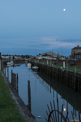
Abend in Rye
| |
|
|
|
