


Glacial and periglacial structures and landforms

Folder: Geology and Earth Science
Photos illustrating landforms resulting from glacial and periglacial processes.
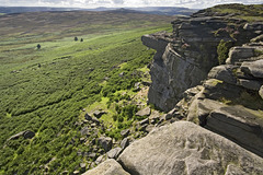
Bamford Moor from High Neb
| |
|
Another late afternoon westerly view of Bamford Moor from High Neb, the highest point on Stanage Edge.
This part of he edge has been quarried for millstones, and some abandoned stones can be seen amongst the grass and bracken.
Stanage Edge is comprised of Rivelin Grit (aka Chatsworth Grit), Namurian age, Upper Carboniferous. The coarse-grained gritstone was deposited in a series of delta distributary channels. The gritstone is normally strongly cross-bedded.
Bamford Moor is composed of the stratigraphically lower and older Kinderscout Grit.
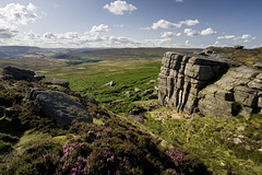
Crow Chin gulley and Jarvis Clough
| |
|
A prominent un-named gulley and gap in Stanage Edge just north of Crow Chin - the point where the Edge takes a sudden bend from NW to NNE.
Jarvis Clough is the small prominent valley in the middle distance. On the far skyline are the Kinder Scout plateau, Bleaklow Head and Derwent Edge.
Stanage Edge is comprised of Rivelin Grit (aka Chatsworth Grit), Namurian age, Upper Carboniferous. The coarse-grained gritstone was deposited in a series of delta distributary channels. The gritstone is normally strongly cross-bedded.
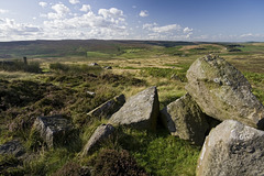
Stanage End view to Moscar
| |
|
At its northern end, Stanage Edge loses its edge-like identity and becomes just a slightly steeper slope running towards Moscar Lodge and the head of the Rivelin valley. Immediately to the south, the Edge has been quarried in the past.
Stanage Edge is comprised of Rivelin Grit (aka Chatsworth Grit), Namurian age, Upper Carboniferous. The coarse-grained gritstone was deposited in a series of delta distributary channels. The gritstone is normally strongly cross-bedded.
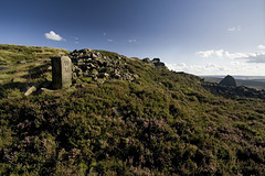
Stanage End boundary stone
| |
|
A boundary stone at Stanage End, the northern extremity of Stanage Edge. There is also quarry debris here.
Stanage Edge is comprised of Rivelin Grit (aka Chatsworth Grit), Namurian age, Upper Carboniferous. The coarse-grained gritstone was deposited in a series of delta distributary channels. The gritstone is normally strongly cross-bedded.
The illuminated face of the boundary stone has the letters 'WM' carved in it, presumably the landowner at the time (early 20th century?). If anyone knows the identity of WM, please post a comment below.
The opposite face to the WM has the letters 'WW' carved in a similar fashion, and this presumably relates to the landowner William Wilson who owned much of the Hallam Moors to the east in the early 20th century and who was also responsible for the carving of the grouse drinking basins shown in earlier photos posted here.
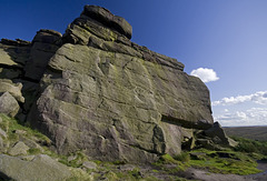
Stanage End Slab
| |
|
The first main climbers' crag at Stanage End, probably an old quarry face. I'm sure it has a name. Anyone care to help out please?
Stanage Edge is comprised of Rivelin Grit (aka Chatsworth Grit), Namurian age, Upper Carboniferous. The coarse-grained gritstone was deposited in a series of delta distributary channels. The gritstone is normally strongly cross-bedded, as seen here.
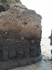
Peat section in the Skipsea Withow Mere, Holdernes…
| |
|
Uploaded as a clue to the GWUK photo here....
www.ipernity.com/doc/earthwatcher/39023396
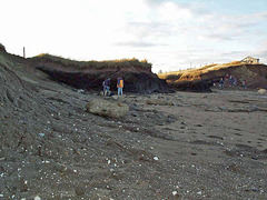
Skipsea Withow Mere, Holderness coast, East Yorksh…
| |
|
Originanally uploaded for the Guesswhere UK group.
A rather old photo taken with an early digital camera, hence rather poor resolution.
This is the Skipsea Withow Mere and the location is the Withow Gap on the Holderness coast in East Yorkshire. The rapidly eroding low cliffs have cut a section through the Withow Mere which is a former (post glacial) lake formed in an ice-hollow on the till ('boulder clay') surface. The lake became filled with both drifted and in-situ vegetation which accounts for the peat we see today.
The grey pebbly deposit in the foreground is the Skipsea Till, a 'boulder clay' of debris bulldozed by the Devensian ice. Were it not for the glacial till, the area of Holderness would not exist and would be completely under the sea.
The Skipsea Withow Mere is a SSSI.
More information here:
www.york.ac.uk/inst/chumpal/EAU-reps/EAU94-61.pdf
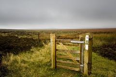
Gate to the Middle of Nowhere
| |
|
Looking over White Path Moss towards Stanage Edge and Stanage Pole (but lost in the mist).
White Path Moss is an extensive flat area of peat bogs and watery pools, very difficult to cross except on a very subtly elevated shallow ridge known as Friar's Ridge.
It is generally accepted that this is a nivation platform, a.k.a. cryoturbation platform. These form where a permanent but relatively shallow snow-patch (as distinct from an ice-sheet) has existed for an extended period of time, perhaps thousands of years. They are well-known from periglacial environments, past and present-day. Beneath the more-or-less stagnant snow-patch, there can be considerable freeze-thaw action, breaking up the top surface of the underlying bedrock and causing it to flow slowly down even the shallowest of slopes. The effect is for this flow material to 'fill in' any pre-existing hollows and generally smooth out the existing landscape, ultimately tending to become a flat surface. In this locality the nivation platform is a broadly linear feature, parallel to the outcrop of Stanage Edge and set back from it by as much as 1.5 km.
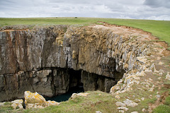
Stackpole Head sea cave
| |
|
Cliffs and sea cave at Stackpole Head, Pembrokeshire.
The shattered limestone at the top of the cliff is probably due in part to intense frost shattering during the last glacial period, the Devensian, when this part of Pembrokeshire was free of ice, but subject to severe cold and permafrost conditions. At that time the sea level would have been much lower - perhaps by as much as 100 metres - and the coast line would have been some way out beyond the present day cliff line.
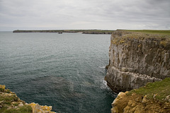
West from Stackpole Head to St Govan's Head
| |
|
Cliffs at Stackpole Head, looking west to St Govan's Head (the far distant headland), Pembrokeshire.
The shattered limestone at the top of the cliff is probably due in part to intense frost shattering during the last glacial period, the Devensian, when this part of Pembrokeshire was free of ice, but subject to severe cold and permafrost conditions. At that time the sea level would have been much lower - perhaps by as much as 100 metres - and the coast line would have been some way out beyond the present day cliff line.
The flatness of the landscape round here is probably a much older erosion surface dating from the Tertiary.
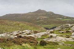
Carn Llidi, Pembrokeshire
| |
|
Originally posted fro the Guesswhere UK group.
This is a view of Carn Llidi, a tor-like miniature mountain (181 m) of gabbro, overlooking St David's, Pembrokeshire. The photo was taken from the Iron Age cliff fort on St David's Head.
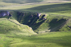
Winnats from Mam Tor
| |
|
The upper portion of Winnats Pass viewed from the summit of Mam Tor in the Peak District National Park.

Froggatt Edge tors 2
| |
|
Rock tors of cross-bedded Chatsworth Grit just set back a few metres from the cliff face of Froggatt Edge in the Peak District National Park.
These tors were formed as a result of periglacial weathering during the last glacial period - the Devensian - when the Peak District was largely free of ice, but still subject to intense cold permafrost conditions. The mushroom shape is probably a result of wind erosion - ground-hugging sand-blasting winds during this cold period.

Froggatt Edge tors 1
| |
|
Rock tors of cross-bedded Chatsworth Grit just set back a few metres from the cliff face of Froggatt Edge in the Peak District National Park.
These tors were formed as a result of periglacial weathering during the last glacial period - the Devensian - when the Peak District was largely free of ice, but still subject to intense cold permafrost conditions. The mushroom shape is probably a result of wind erosion - ground-hugging sand-blasting winds during this cold period.
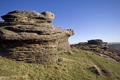
Watchers on Froggatt
| |
|
Originally uploaded for the Guesswhere UK group.
Amphibian rock tors on Froggatt Edge, overlooking the Derwent valley.
I'm sure there is a local name for these, so if anyone knows it, please post it below!
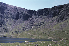
Llyn Idwal and the Idwal Syncline, Snowdonia, Gwyn…
| |
|
This photo shows Llyn Idwal and the Idwal Syncline in the Snowdonia National Park, Gwynedd, North Wales. The summits of Twll Ddu and Y Garn are just out of shot to the left and right, respectively.
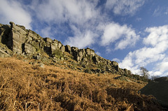
Stanage Edge from Stanage Plantation
| |
|
|
Stanage Edge, longest of the Eastern Edges, viewed from Stanage Plantation in the Peak District National Park, Derbyshire.
Stanage Edge is comprised of Rivelin Grit (aka Chatsworth Grit), Namurian age, Upper Carboniferous. The coarse-grained gritstone was deposited in a series of delta distributary channels. The gritstone is normally strongly cross-bedded.
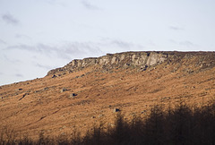
High Neb
| |
|
|
|
At 458 m above sea level, High Neb is the highest part of Stanage Edge. The trees in the foreground are part of Stanage Plantation. The Yorkshire-Derbyshire border runs northward along the Edge from High Neb.
Jump to top
RSS feed- Latest items - Subscribe to the latest items added to this album
- ipernity © 2007-2026
- Help & Contact
|
Club news
|
About ipernity
|
History |
ipernity Club & Prices |
Guide of good conduct
Donate | Group guidelines | Privacy policy | Terms of use | Statutes | In memoria -
Facebook
X
