

Long Beach WA (#1184)
Cape Disappointment North Head lighthouse (#1204)
Cape Disappointment North Head lighthouse (#1205)
Cape Disappointment North Head lighthouse (#1201)
Cape Disappointment North Head lighthouse (#1202)
Cape Disappointment North Head lighthouse (#1203)
Cape Disappointment North Head lighthouse (#1208)
Cape Disappointment North Head lighthouse (#1210)
Cape Disappointment North Head lighthouse (#1211)
Cape Disappointment North Head lighthouse (#1212)
Cape Disappointment North Head lighthouse (#1214)
Cape Disappointment North Head lighthouse (#1215)
Cape Disappointment North Head lighthouse (#1218)
Cape Disappointment North Head lighthouse (#1216)
Cape Disappointment North Head lighthouse (#1219)
Cape Disappointment lighthouse (#1221)
Cape Disappointment lighthouse (#1226)
Cape Disappointment lighthouse (#1227)
Cape Disappointment lighthouse (#1224)
Cape Disappointment lighthouse (#1225)
Cape Disappointment lighthouse/Ilwaco (#1228)
Cape Disappointment lighthouse (#1230)
Ilwaco, WA harbor (#1232)
Long Beach WA (#1182)
Long Beach WA (#1198)
Long Beach WA (#1197)
Astoria Megler Bridge (#1193)
Astoria Megler Bridge (#1290)
Astoria Megler Bridge (#1270)
Astoria Megler Bridge (#1268)
Astoria Megler Bridge (#1264)
Astoria Megler Bridge (#1181)
Neahkahnie Mountain US 101 (#1177)
Neahkahnie Mountain US 101 (#1179)
Western & Pacific RR, Garibaldi, OR (#1176)
Cape Meares Lighthouse Park OR (#1174)
Cape Meares Lighthouse Park OR (#1169)
Cape Meares Lighthouse Park OR (#1172)
Cape Meares Lighthouse Park OR (#1164)
Cape Meares Lighthouse Park OR (#1167)
Cape Meares Lighthouse Park OR (#1168)
Netarts Bay, OR (#1158)
Netarts Bay, OR (#1161)
Netarts Bay, OR (#1160)
Netarts Bay, OR shellfishing (#1156)
Location
Lat, Lng:
You can copy the above to your favourite mapping app.
Address: unknown
You can copy the above to your favourite mapping app.
Address: unknown
Keywords
Authorizations, license
-
Visible by: Everyone -
Attribution + non-Commercial + no derivative
-
270 visits
Long Beach WA (#1185)
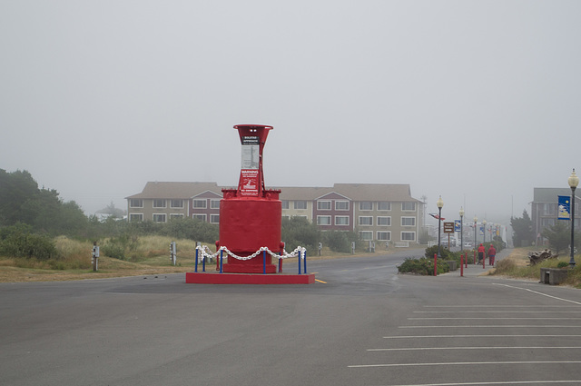

At about the edge of the dunes line, a decommissioned buoy. Tsunami evacuation route signs were posted all around the city, but there isn't really anywhere to go since the city's elevation is 10' (3 meters).
kiiti has particularly liked this photo
- Keyboard shortcuts:
Jump to top
RSS feed- Latest comments - Subscribe to the comment feeds of this photo
- ipernity © 2007-2026
- Help & Contact
|
Club news
|
About ipernity
|
History |
ipernity Club & Prices |
Guide of good conduct
Donate | Group guidelines | Privacy policy | Terms of use | Statutes | In memoria -
Facebook
X

.jpg)
Don Barrett (aka DBs… club has replied to ClintSign-in to write a comment.