

slgwv's photos
Well-Dressed
| |
|
|
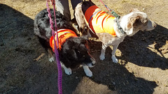
Frank (l) and Shiloh (r). Wearing orange vests so they won't be mistaken for deer! (We also keep them on lead.) Gardner Meadows trailhead, Highland Lakes, California, near Ebbetts Pass in the Sierra Nevada. We're taking a 2-mile connecting trail to the Pacific Crest Trail (PCT).
20200927 135757 001
| |
|
20200927 135539 001
| |
|
Fuel
| |
|
|
|
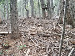
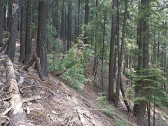
Forest litter in Plumas National Forest, near the Pacific Crest Trail in the vicinity of the Middle Fork of the Feather River. This area all burned off in the North Complex wildfire in the last few week, at least according to the fire maps I've seen. We thought it looked ripe for a wildfire when we were there--alas, we were right.
20200726 142648 001
| |
|
|
|
20191027 123252
| |
|
|

20191027 121123 001
| |
|
|
|

20191027 113111 001
| |
|
Burned off
| |
|
|
|
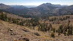
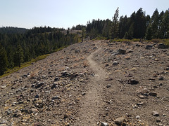
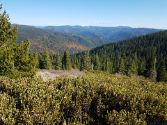
View easterly from near Lookout Rock on the Pacific Crest Trail, in the vicinity of the Middle Fork of the Feather River, in the vague northern part of the Sierra Nevada, California. The prominent left-right trending canyon in the middle distance holds the Middle Fork, and the Pacific Crest trail more or less follows the outlined ridge to its right. The trail crossed the Middle Fork on a steel footbridge (center insert) and follows a route that ends up traversing the near ridge to the right. It comes up to the photo point. We did much of this part of the PCT as day hikes last fall. The Middle Fork is a so-called Wild and Scenic River, so is completely undeveloped, and much of the area is effectively wilderness.
Or rather, this view is how the area looked last fall. Most of this area was burned off in the last few weeks by the Bear Fire, part of the North Complex of California wildfires. The fire started from lightning on Aug 17 in the upper Middle Fork canyon (see note), and didn't grow much initially. Since it was burning in wilderness and no structures were threatened, only minimal attention was paid to it--other wildfires had first claim on resources. However, on September 8 a cold front moved in from the northeast, bringing strong katabatic winds blowing southwesterly, and the fire exploded in that direction. It was reported at one point to have spread 30 miles (50 km) in 24 hours. Several small communities were obliterated, and the fire got all the way to Lake Oroville, even jumping it on the south. There were also a number of fatalities. Containment is currently around 80%, and total acreage burned is over 300,000 acres (>120,000 ha), making it the 5th largest in California history.
Last July we tried to access the PCT at a point beyond that ridge on the right. We were defeated by steep terrain and lots of deadfall, and thought that the forest was seriously at risk for fire (right insert). Well, we (alas) were right. All the forest litter in that pic, as well as the trees, are completely burned off now, to judge by the fire maps.
We're glad we got to see the area before it burned, but it's depressing to contemplate its current condition. I don't know at this point if the wooden planks on the bridge over the Middle Fork survived.
View off the Thunder Cliffs
| |
|
|
|
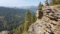
On the Tahoe Rim Trail above California SR 89 looking north. The mountains on the skyline are the Sierra Nevada crest above the Squaw Valley ski resort. We lucked out--altho it was still hazy, the wildfire smoke had thinned out enough to make a hike possible! The Forest Service had also re-opened the forest to day use--it had been completely closed for a couple of weeks due to the high fire danger. The smoke has returned in a big way today (the 21st) because the winds are again from the west and southwest.
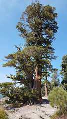
Sierra Juniper
| |
|
|
|
Another big specimen. Juniperus grandis , a,k.a. Juniperus occidentalis australis . On the Tahoe Rim trail above the Thunder Cliffs. Insets with my wife (l) and Frank (r) give scale.
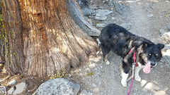
Scale II
| |
|
|
Frank by the base of a very large Sierra juniper ( Juniperus grandis or Juniperus occidentalis australis ) on the Tahoe Rim Trail.
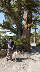
Scale
| |
|
|
Joyce & Shiloh, and a large Sierra juniper ( Juniperus grandis or Juniperus occidentalis australis , on the Tahoe Rim trail.

You can see the mountains!
| |
|
|
|
View west from the back of my house toward the Carson Range. The mountains are no longer obscured by smoke from the California wildfires! The wind (temporarily) had shifted to the northeast, so it was bringing in smoke-free air.
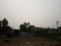
Murky
| |
|
|
|
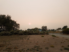
View west from the back of my house last week, looking toward the Carson Range--of which there is no sign! The inset is a similar view (not quite aligned, as shown by the position of the little gray barn) when the winds had shifted northeasterly and had brought in cleaner air. The murk is smoke from the wildfires in California, mostly from the Creek Fire, which is burning in heavy timber about 200 miles (320 km) south. Air quality (unsurprisingly) was in the "unhealthy" range.
20200914 182819 001
| |
|
Social distancing
| |
|
|
|
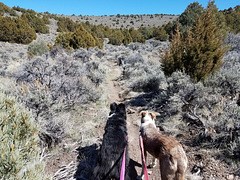
Nevada has closed all non-essential businesses (including the casinos!) because of the coronavirus epidemic, and discourages all but essential travel (doctors, grocery trips, etc.) One specific exemption, tho, is going outside--as long as you avoid groups! So it's perfectly OK to take your dogs on hikes, and it means you can still take advantage of the large amount of open public land in the state. So here we are (Frank on the left, Shiloh on the right) on a trail in BLM (Bureau of Land Management) land in the Virginia Range a few miles east of my house. Usually on a weekday we see no one out here, but with so many people staying home there are more parties out and about than usual. It's still pretty deserted by most standards! ;)
Coastal fortifications at The Presidio
| |
|
|
|
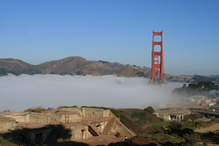
San Francisco, looking north across (yes!) the Golden Gate to the Marin Headlands. "Presidio" means "fort" in Spanish--the original name was El Presidio Real de San Francisco, The Royal Fort of Saint Francis--and the fortification was established by the Spanish in 1776 to try to consolidate their claims on this part of New Spain. The Presidio was inherited by Mexico after Mexican independence, and then by the U.S. after the treaty of Guadalupe Hidalgo in 1848. It remained an important center for US coastal fortifications for something like a century, but by the mid-20th century advances in military technology had rendered it obsolete. (Who needs coastal artillery when radar or a satellite can identify a threat hundreds of miles offshore, and aircraft or a cruise missile can then take it out?) The grounds were finally taken over by the National Park Service in 1994. Many of the old military installations are now being managed as historical sites, some of the buildings have been refurbished and repurposed as high-end office space, and some of the coastal areas by the Bay have been restored as wetlands.
The concrete foundations in the foreground are from U.S. coastal batteries dating from ca. the 1890s (upper left inset). A close-up of one of the cannon foundations is shown in the inset below. None of the actual cannons or their metal mounts are left, presumably having been salvaged as scrap over the years.
The prominent highway cutting across the Marin Headlands opposite is Conzelman Rd, coming out of the Golden Gate National Recreation Area. I came back that way from the Point Bonita lighthouse, and took some pictures looking back this way (inset on the highway, approximately at the photo point).
