

slgwv's photos
20200816 123826 001
| |
|
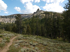
PCT and Spire off Arnot Peak
| |
|
|
|
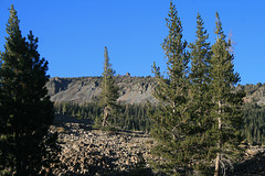
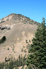
Carson-Iceberg Wilderness, Sierra Nevada, California, looking south. The Pacific Crest Trail (PCT) is on the left; the obvious saddle below is Wolf Creek Pass (not to be confused with the one in Colorado!) The prominent skylined spire evidently doesn't have a name but is at the end of a north-trending ridge off Arnot Peak (10,054 ft/3064 m). Judging by the topo map, the spire is around 9700 ft/2957 m. Elevation of the PCT here is about 8700 ft/2652 m.
20200816 161723
| |
|
IMG 0951 adj
| |
|
|
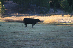
Belling the cow!
| |
|
A cow with a bell, one of a group grazing in Lower Gardner Meadow in the Carson-Iceberg Wilderness. Grazing was grandfathered in as part of the agreement to set up the wilderness area. Sierra Nevada, California.

IMG 0947 adj2
| |
|
|
|
IMG 0945
| |
|

IMG 0944
| |
|
IMG 0942
| |
|
IMG 0940
| |
|
IMG 0939 adj2
| |
|
|
|
Sierra Nevada Crest
| |
|
|
|
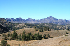
Looking NNW from the Pacific Crest Trail (PCT). The winds had shifted easterly (from the right), so we had a beautiful clear day! Ebbetts Pass, where California route 4 crosses the Sierra, is behind the ridge at the extreme left of the pic. The jaggedy weathering of the rocks here is because they're volcanic, rather than the granite that forms the basement of most of the Sierra. The PCT is running along the low rounded ridge at the bottom of the pic. The hollow behind that ridge, with the trees on the left, contains Noble Lake, our destination.
IMG 0935 adj2
| |
|
|
|
IMG 8777
| |
|

IMG 8775
| |
|

IMG 0931 adj
| |
|

IMG 0930 adj
| |
|
IMG 0929 adj
| |
|
