

slgwv's photos

IMG 0926 adj
| |
|
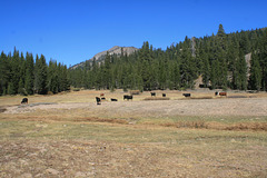
Ah, the sound of cowbells in the wilderness!
| |
|
|
|
These cattle are grazing in Lower Gardner Meadow, in the Carson-Iceberg Wilderness in California's Sierra Nevada. Normally grazing is forbidden in wilderness areas, but it was specifically grandfathered in here as part of the agreement establishing the wilderness area. Many of the cows are wearing bells (see inset), so the clanking of cowbells in the wilderness is a bit incongruous! I don't know if the cowbells make the roundup easier, or warn hikers, or scare the bears, or what.
20200927 173420
| |
|
20200927 173236
| |
|
|
|
20200927 172927
| |
|
20200927 171107 001
| |
|
20200927 170907 001
| |
|
20200927 170240 001
| |
|
20200927 163202 001
| |
|
20200927 162403 001
| |
|
20200927 161606
| |
|
20200927 161558 001
| |
|
20200927 161426 001
| |
|
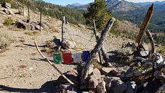
Tibet in the Sierra?
| |
|
|
|
On the Pacific Crest Trail at an unnamed pass in the Sierra Nevada, California, about 7 trail miles south of Ebbetts Pass. Looking south. From a distance we thought someone was drying laundry, but these appear to be prayer flags, covered with writing in what I assume is Sanskrit (inset). Go figure--
We're in the Carson-Iceberg Wilderness here, named for the Carson River and a rock formation called The Iceberg. The barbed-wire fences are still in use because cattle grazing was grandfathered in when the wilderness was established!
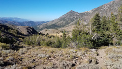
This pass doesn't look like much, but since it's on the Sierra crest it marks a major drainage divide. To the south and west streams flow generally westward, finally joining the San Joaquin and flowing out to the Pacific at San Francisco Bay. Streams flowing easterly, OTOH, eventually join the landlocked Carson River in the Great Basin, which ends at the Humboldt Sink about 120 miles east of here in Nevada.

20200927 161132
| |
|

20200927 161129
| |
|
20200927 160336 001
| |
|
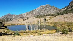
Noble Lake
| |
|
|
|
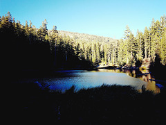
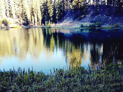
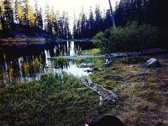
A pretty glacial lake on the Pacific Crest Trail (PCT) about 6 miles (10 km) south of the Ebbetts Pass trailhead, where California SR 4 crosses the Sierra Nevada. The PCT can be seen here and there across the lake, heading into the drainage at the left. The standing dead trees were probably drowned by high water levels in the last few years. The prominent peak on the right is actually a double peak, the nearer, unnamed peak having an elevation of 10,824 ft/3299 m and the farther peak, which is mostly hidden, being Highland Peak (10,935 ft/3333 m). The prominent conical peak off to the left is Silver Peak (10,772 ft/3283 m). The lake elevation is just under 9000 ft/2743 m. This view is looking north; the insert (upper left) shows a northeasterly view from off the PCT to the right. There are also some other views of the lake in the adjacent photos.
