

slgwv's photos

Just beyond the trailhead...
| |
|
|
Looking south. The Stewart Creek trail continues straight ahead and crosses the forested ridge at the obvious low point. The Columbine trail comes in from the left in the obvious large drainage.

Still climbing the ridge...
| |
|
Looking back westerly to the Reese River Valley and the Shoshone Range. Here it's apparent that the path is an old Jeep track.

Looking back northwest
| |
|
|
The valley where we first topped out looks a long way down now! Northern part of the Reese River Valley and the Shoshone Range in the distance.

Up the ridge
| |
|

Still following the ridge
| |
|

View southwest
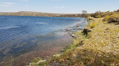
Soda Lake
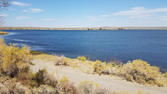
Soda Lake
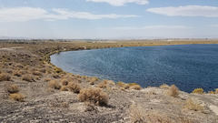
Soda Lake
| |
|
|
Near the south side, looking west to the point where the rim is nonexistent! Again, the location is off.

Soda Lake
| |
|
On the south side, where the rim is low to non-existent. Apparently most of the ejected debris was being blown to the northeast. Again, the position is off and I can't change it.

Soda Lake
| |
|
|
On the south side, looking toward the high part of the rim to the northeast. Again, the position is off and I can't find how to change it.
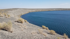
Soda Lake
| |
|
On the north side, looking toward the highest part of the rim to the southeast. Apparently the winds were coming from the southwest during the eruption, because most of the erupted debris ("tephra") piled up to the northeast! Most of the tephra is just sediment that was ejected in the explosion, but it includes some basaltic cinders derived from the magma body. They're the dark particles.
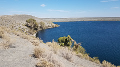
Soda Lake
| |
|
|
On the north side. The location is off and apparently the location adjustment no longer exists.

IMG 9176
| |
|
|
|

IMG 9170
| |
|
|
|

IMG 9110
| |
|
|

IMG 9099
| |
|
|

IMG 9069
| |
|
