


Yosemite National Park

Folder: United States


Half Dome and El Capitan
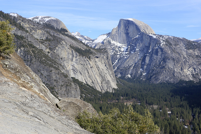
This the Yosemite Valley with El Capitan on the left and Half Dome in the distance. It was our first view of the park as we drove in from the southwest on the Wawona Road.
Yosemite National Park
We are home again after three weeks plus on the road. Have taken a few days to catch up but are now settled in again. We left home on February 24th and returned on March 18th. We drove over 6000 miles (1000 km), were in six different states, seven different national parks and one national monument, hiked over sixty miles (100 km) and experienced temperatures ranging from 15 F (-9 C) to 80 F (27 C). We slept 17 nights in the back of our vehicle and two nights in motels. It was a great trip but we are glad to be home.
The national parks we visited were Yosemite, pictured here, King's Canyon, Sequoia, Joshua Tree, Saguaro, Grand Canyon and Death Valley. The national monument was Organ Pipe Cactus on the USA/Mexico border. We went winter weather, snow and ice in Grand Canyon to summer temperatures and drought in Death Valley. We had not planned on visiting Death Valley but woke up the second day of our stay in Grand Canyon to six inches of snow and winter temperatures and were unable to do the hiking we had planned.
The states we traveled in were Washington where we went first to our son and daughter in the far northwest corner of the state, Oregon, California, Arizona, Nevada and Idaho. We only traveled through Oregon, Nevada and Idaho and spent most of our time in California and Arizona. Even in California, however, the weather was cold and wintry in the Sierra Nevadas and we had to forego several hikes we had planned on doing. We enjoyed the warmer weather where we had it and endured the cold when necessary.
These photos were taken in our first park, Yosemite National Park in California, where we spent three days and did three hikes though one had to be aborted on account of an icy trail. The inset was our first view of Half Dome and El Capitan coming into Yosemite via the Wawona Road. The main photo was taken on a hike up the Upper Falls trail on the south side of the valley which was relatively snow free. Half Dome is visible in the center-right of the photo and El Capitan is on the left of the photo, the valley floor on the right also.
Yosemite was very busy even though it was still winter in the park. We had to camp outside the park and drive in each day. We explored as much of the park as we were able but want to go back in warmer weather and see the rest of the park. We were unable to do the Glacier Point Road or the Tioga Pass Road and would like to do the hike to Nevada Falls that was aborted and several other hikes we were unable do on account of ice and snow. Perhaps we'll go back sometime in the autumn when the weather is more amenable.

Bridalveil Falls
This is Bridalveil Falls in Yosemite National Park. The trail to the falls was closed for maintenance when we were there but we were able to photograph the falls from a distance. I do not know how many different waterfalls have the same name but I know of three others in Utah, in Oregon and in Washington.
Merced River
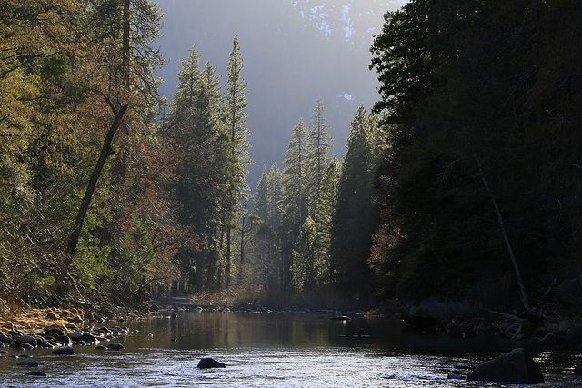
This is the Merced River in Yosemite National Park. The photo was taken in Yosemite Valley as we prepared to hike up to Vernal and Nevada Falls, a hike that we were later forced to abort close to Vernal Falls due to snow and ice on the trails.

Merced River
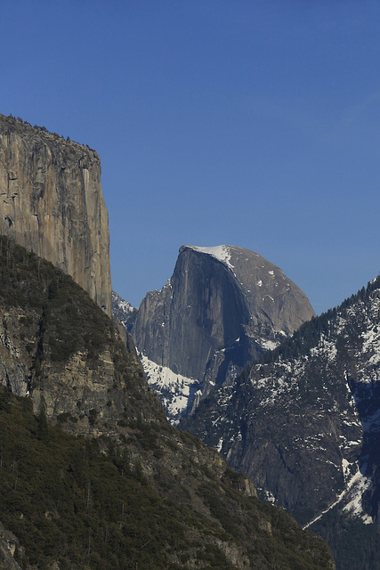
The first morning of our stay in Yosemite National Park we attempted to hike the John Muir trail to Nevada Falls but had to turn back near Vernal Falls because of ice and snow on the trail. We had an early morning start and crossed the Merced River here to get to the trailhead.
El Capitan
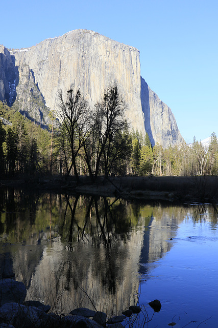
On our first evening in Yosemite it was very busy in the park, the last night of firefall for the season. We stopped at a quiet layby along the road out of the park and took some photos of El capitan reflected in the Merced River before moving on to our night's encampment.
Yosemite Valley
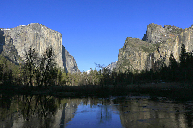
This is Yosemite Valley from the Valley View turnoff. El Capitan is on the left and Bridalveil Falls is visible on the right. The river is the Merced River.

Yosemite Sunset
Taken from a layby on the El Portal Road, this was Yosemite Valley at Sunset. El Capitan is on the left and Half Dome is just visible on the right.
Jump to top
RSS feed- Latest items - Subscribe to the latest items added to this album
- ipernity © 2007-2026
- Help & Contact
|
Club news
|
About ipernity
|
History |
ipernity Club & Prices |
Guide of good conduct
Donate | Group guidelines | Privacy policy | Terms of use | Statutes | In memoria -
Facebook
X
