Lakes, Lochs,Reservoirs,Tarns, Ponds
A Loweswater view
| |
|
|
|
A low view from the banks of Loweswater here in the Lake District. As you can see the typical are weather comes into play here but I hope it does not mar your enjoyment of this.
Flyfishing on Loweswater
| |
|
|
|
An idyllic location for such a sport here on banks of Loweswater. The silence of the scene broken only by bird calls and the sound of my shutter. We are looking here towards the southern end of the lake which is only two kilometres distance from the next lake of Crummuck Water. Our walk continues in that direction with this lake before we double back much higher.
As always, made to be viewed full size here.
A Loweswater fence.
| |
|
|
|
One of the Western 'Lake Districts' lesser known lakes here. This side of the lake has a trail running almost the entire length and with one or two fences like this jutting into the water, an ideal opportunity for me to get more photos for our HFF group.
A slight difference in artistic style here with this sepia monochrome version. Hope you enjoy it.
HFF. Have a safe and enjoyable weekend.
High view to Crummock Water
| |
|
|
|
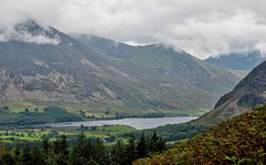
Still on the Corpse Road we get a better view of the next lake here as we walk above Loweswater. Beyond Crummock is yet another lake; Buttermere, considered as one of the Lake Districts most beautiful lakes.
See Pip for alternative view
"Crummock Water is a lake in the Lake District in Cumbria, North West England situated between Buttermere to the south and Loweswater to the north. Crummock Water is 2.5 miles long, 0.75 mile wide and 140 feet deep."
Enjoy full size
HFF - Anybody for a boat ride?
| |
|
|
|
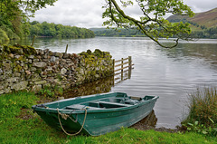
Another Loweswater fence shot for you here. In fact this is the same fence as in my last HFF offering (see Pip). This view west, towards our west coast beyond the hills has none of the exciting high vistas as can be seen to the other end behind me but I think you will agree that it is quite agreeable all the same.
HFF and I wish you all, a safe weekend, Herb
The grandeur of Loweswater
| |
|
|
|
A five photo panoramic view of the whole of this lake as seen from the high Corpse road.
To the left. Just above the corner hills you can just make out the Solway Firth and to the right we see Crummock Water in the far distance. We now carry on walking left before returning to our car parked on the left side of this lake. With this photo, one can easily place most of my preceding photos on here.
Enjoy full screen
A visit to Crummock Water
| |
|
|
|
Our second full day here in the Lakes and its Crummock Water for us, despite the bad weather forecast and a constant drizzle as we set off. - So here we are just starting along this muddy Western shore from the South. Rain gear donned and a quick wipe to clear the water drops from my lens,to capture this one. I am sure that this is the average look of the lake and its surroundings. Fortunately, the weather was to improve before we got back.
Enjoy.
A Crummock Water trek
| |
|
|
|
Onwards we trek along the shores of this lake. Underfoot is quite wet along this path but at some places stones and rocks make things a little easier. Here in the seepage is evidence of natural oils and mineral leakage too with the reddish pools. The interesting volcanic-like fell to our left is called 'Rannerdale Knotts'. - Our way continues perhaps for another mile before our turn-around.
Enjoy full screen.
Crummock Water moods
| |
|
|
|
Another view from the eastern shore of this water showing the weather and lighting on the local fells.
Enjoy full screen
The Wonders of Mallorca: Embassament des Gorg Bla…
| |
|
|
|
A day out in the mountains today and we head back up past the Cúber reservoir to its neighbouring reservoir of the Blue Gorge (Embassament des Gorg Blau). We are walking the full circuit of this with the hope of better weather never to really materialise. When one reads the description below, we can only imagine what it was like here before the reservoir was created.
“Gorg Blau is located in valleys between the Puig Major & Puig de Massanella and it is an artificial reservoir on the island of Majorca. Since 1971, together with Cuber, it provides water to the city of Palma and the surrounding areas. Gorg Blau starts at the reservoir, named the Gorg Blau Torrent and finishes in the Pareis Torrent. In 2003 it was declared as a natural monument by the Balearic Islands Government. Before the reservoir’s creation, in 1906, the place became famous by the combination of the elevation of the torrent’s walls, the blue of the waters & the bridge, which inspired artists such as poets, photographers or painters, a success that gave the place touristic quality and postcard photo.”
Enjoy full size.
The Wonders of Mallorca: The Blue Gorge
| |
|
|
|
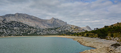
Another view of this artificial lake high in the Mallorcan mountains. As can be seen here the water level is quite low after another very hot Summer.
The Wonders of Mallorca: Lakeside view
| |
|
|
|
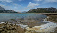
Another view of the Embassament des Gorg Blau here in the North West of Majorca. Surrounded by mountains, the most important Puig Major & Puig de Massanella we have only the sound of lapping waves to distract our senses. A fine walk around this reservoir today.
Enjoy full size.
The Wonders of Mallorca: Blue Gorge Refugio
| |
|
|
|
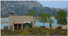
As we continue this hike around this reservoir, we come across a Spanish Refugio. This shelter for hikers to stay the night has obviously been recently renovated but manages to keep its charm.
Enjoy full size.
To Ennerdale Water
| |
|
|
|
A view from Ennerdale Bridge of this Western lake and its surroundings. In a few days time we shall walk around the lake but in the meantime enjoy it from here.
The Pip shows a slightly different view on my way to this spot. As you can see, this is sheep country.
Essential full screen
A first look at WastWater
| |
|
|
|
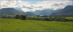
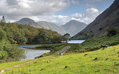
As we pass Low Wood on the left we find ourselves at the very southern end of this lonely West Lake District lake, called more correctly a ‘Water’ in common with all but one of the sixteen ‘Lake District’ lakes not being called lakes at all, instead being ‘Meres’ and ‘Waters’. The most prominent hill here is Yewbarrow at 628m resembling the upturned hull of a boat or a barrow.
As usual the landscape is dotted with local sheep. The PiP’s, are taken from the same hillside and possibly in your opinion may have merited having been the main photo here.
Enjoy full screen
Yewbarrow. A 'fell' of character.
| |
|
|
|
A closer look at this impressive fell bordering Wast Water. At 628 metres (just over 2000ft) high and in shape resembling the upturned hull of a boat or a barrow it certainly is impressive, especially looking at it a bit closer as here.
As in most landscape photos, light is essential in bringing out the form and displaying each cliff and crag. We can also discern bracken. This is a favourite tough climb with steep crags at either end providing a good challenge for most walkers.
Geoogy: The summit is formed from the tuff, lapilli-tuff and breccia of the Lingmell Formation. The eastern slopes display the rhyolitic rocks of the Long Top Member and Crinkle Member. The crags on the western face are outcrops of the plagioclase-phyric andesite lavas of the Birker Fell Formation. (Wiki)
Enjoy full screen
A Crummock Water Overflow
| |
|
|
|
A fine lake with many steams and small rivers to fill it up must have an outlet, and here we see a view looking south in rather damp weather conditions. The River Cocker starts it life from this point here at the lakes northern end, flowing northwards into Lorton Vale ending up at the town of Cockermouth where it joins the larger river Derwent that flows west into the Irish Sea from Derwent Water. The lake itself sits between Loweswater to the north and Buttermere to the south and is 2.5miles long, 0.75miles wide and 140 feet deep (4km x 1.2km x 42.6m). Its circular shore circuit is 6.2m (10km) long as it has to do a couple of small detours.)
See PiPs for Buttermere and Loweswater.
HFF. Have a safe and enjoyable weekend.
A first glimpse of Loweswater
| |
|
|
|
As we start this day out, we are greeted by these beautiful 'Belted Galloway' cows as we approach Loweswater in our English Lake District. Of course the weather is quite typical of this area and we have had to postpone this walk till later in the day as it was raining so hard earlier. We spoke to the framer, who owned these cows, and apparently they had only been introduced into this field moments before I took this, in fact the very small herd of around twelve cows had only just arrived from the county of Staffordshire the day before.They must be better suited to this area as the Scottish county of Galloway can be seen in the distance higher and behind me about 30 miles away across the Solway Firth.
Enjoy full size.
Jump to top
RSS feed- Latest items - Subscribe to the latest items added to this album
- ipernity © 2007-2024
- Help & Contact
|
Club news
|
About ipernity
|
History |
ipernity Club & Prices |
Guide of good conduct
Donate | Group guidelines | Privacy policy | Terms of use | Statutes | In memoria -
Facebook
Twitter


