Wat Phu Champasak
Wat Phu
Buddha image in Wat Phu
Wat Phu up on the hill
Debris of the Wat Phu
High way vendors selling snack food ...
Way to Wat Phu
800 years old heap of rubble
Wat Phu down the hill
View to the Wat Phu complex
Obeisance to Buddha before entering Wat Phou
Lao women selling herbal drinks in front of the wa…
Location
See also...
Keywords
Authorizations, license
-
Visible by: Everyone -
All rights reserved
-
493 visits
View from the hill to Baan Nongsa


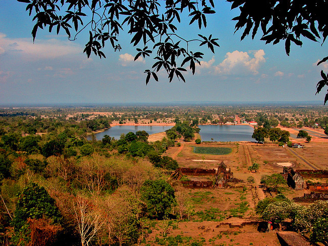
In this photo, looking east from the sanctuary partway up the mountain, we see the temple's causeway, which runs east-southeast and terminates in two grand barays (excavated reservoirs). The "middle baray," seen end-on in this photo, measures 200x600 meters. Its great length recedes much further into the distance than one can accurately judge here, being approximately equal to the distance from its near bank to the base of the mountain. The north baray (photo left) is wider, and lies due east of the sanctuary. The barays were probably built by Suryavarman II (1113-1150).
One asks why the axis of the temple is south of due east, and why the two barays are situated as they are. The answer lies in astronomy: the barays were designed to reflect the image of the sun, from the middle baray at the vernal equinox, and from the north baray at the summer solistice.
One asks why the axis of the temple is south of due east, and why the two barays are situated as they are. The answer lies in astronomy: the barays were designed to reflect the image of the sun, from the middle baray at the vernal equinox, and from the north baray at the summer solistice.
- Keyboard shortcuts:
Jump to top
RSS feed- Latest comments - Subscribe to the comment feeds of this photo
- ipernity © 2007-2024
- Help & Contact
|
Club news
|
About ipernity
|
History |
ipernity Club & Prices |
Guide of good conduct
Donate | Group guidelines | Privacy policy | Terms of use | Statutes | In memoria -
Facebook
Twitter

Sign-in to write a comment.