Eaton County
The Old Maid
| |
|
|
|
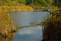
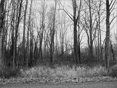
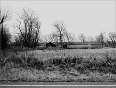
The folks who settled Eaton County, Michigan, called the swamp that covered much of Windsor Township " The Old Maid Swamp ." Nowadays, to the extent it's called anything, it's the Secondary Complex Marsh or (if you're an old state employee) Lake Austin. At least in this corner of the bog.
I think we should resurrect the old name....
Photo shot from the parking lot of the Secretary of State building, where I worked more or less forever without knowing the swamp's True Name.
Someone Said it Snowed
| |
|
|
|
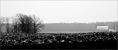
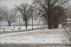
A year ago we woke to a light dusting of snow. I shot a few pix.
This photo's another view of Hoytville from across the field--you'll perhaps recognize that barn from earlier photographs....
==========
The 366 Snaps pic was taken from our front porch.
==========
This photograph is an outtake from my 2012 photo-a-day project, 366 Snaps .
Number of project photos taken: 12
Title of " roll :" Snow!
Other photos taken on 11/25/2012: Joan and I helped my brother and sister rake leaves. I took a few not-very-good pix with the F10.
Shop Earn Share
| |
|
|
|
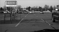
A year ago wasn't the first time I acted on my April 4 scouting trip down Eaton Highway, but it was definitely the most direct followup as I duplicated the route. But this time I wasn't scouting--instead, I was photographing the barns and farmyards along the road. Got some good pix.
==========
The photo above, obviously, isn't one of those farmyards. One purpose of the trip was a bit of shopping; while I was stopped, I snapped this. Speaks for itself, perhaps. Hope your shopping today goes well.
==========
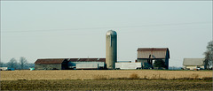
The 366 Snaps photo (below) could be accurately described as a followup to the April 4 photo, as it happens. This is the same farmyard, from a different angle. The discussion the photo generated on Flickr is worth a look .
==========
This photograph is an outtake from my 2012 photo-a-day project, 366 Snaps .
Number of project photos taken: 51
Title of " roll :" GL & Back, plus birds
Other photos taken on 11/29/2012: none.
Barn, Eaton Highway
| |
|
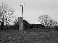
I mentioned in this morning's commentary that I got some good pix a year ago along Eaton Highway. This is one of those.
Woodlot, Mt Hope Highway
| |
|
|
|
Most of the local farms have woodlots, but the bulk of 'em are far off the roads. This one's a personal favorite just because of its roadside location.
==========
This photograph is an outtake from my 2012 photo-a-day project, 366 Snaps .
366 Snaps project discussion and stats for December 3 .
Barn, St. Joe & Mulliken
| |
|
|
My favorite of the local barns, a couple miles due south of my house. While there's nothing really special about the structure, I've always thought it attractive and often find it in my day's photographic haul.
==========
Early in the 366 Snaps project I mostly photographed in the house, the yard, and the village, with occasional excursions to Grand Ledge and Portland for a bit of variety. Around mid-year the unplanned routine of Kalamazoo trips added some geographic diversity, but not enough. So I added the local backroads to the mix.
About half the time I'd trace one of my regular bicycle routes. I have four such courses, and all four are represented here in the project. A year ago I followed what I call my Boyer loop, after one of the local roads--except I reversed the usual ride.
Backwards is useful. The world looks different when you turn things around.
==========
Many local fields are bordered by lines of trees intended as windbreaks. The windbreak photo I posted to 366 Snaps is on Boyer, north of Needmore road. I played a lot in Bibble with that photo, and found two other variants in the outtakes folder. While I've elected not to share those, it's often fun to experiment a bit with your processing tools. Another way, I suppose, of turning things around....
==========
This photograph is an outtake from my 2012 photo-a-day project, 366 Snaps .
Number of project photos taken: 31
Title of " roll :" Around Roxand
Other photos taken on 12/9/2012: none.
Thornapple Valley
| |
|
|
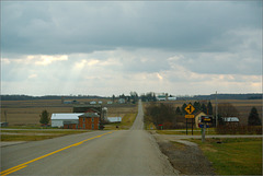
When you reach the east end of Needmore Highway you likely turn south, and are rewarded with this view.
This was generally the highlight of my drive to work, but I'd admired the view long before I moved to Mulliken. A couple miles out--just beyond the more distant farmyards--Otto Road dips yet again, down to the river. When I was a serious bicyclist my most strenuous workouts involved those climbs. Nowadays I mostly avoid hills, which is pretty easy around here.
You could turn north, but Otto and Needmore both jog, and the left turn's a bit off the line. A north turn takes you to the RC plane airport .
==========
The 366 Snaps pix were attempts to capture the falling snow in an image; most failed.
==========
This photograph is a non-outtake from my 2012 photo-a-day project, 366 Snaps .
Number of project photos taken: 19
Title of " roll :" Snow in the Banana Republic [ a comment on Michigan's then-newly-signed "RTW" law, about which I'm still angry ]
Other photos taken on 12/11/2012: Two "Sky Shots," one of which is displayed above.
Into the Amish Settlement
| |
|
|
|
My plan, a year ago, was to get that Amish picture I'd missed a few days earlier . Headed down Mulliken Road to Gresham Highway, turned the corner (and shot this picture right at the Gresham church), and headed into Amish territory.
Found kids all over the place, heading for the Amish school. On foot, on bikes, in carriages, even a few on a cute little two-wheeled rig I don't know the words to describe. But they weren't at school yet, and shooting pix of moving Amish kids from my moving car really wasn't what I wanted to do. So I took other photographs.
==========
For 366 Snaps I posted a photo of a couple failing barns further down Gresham, well on the way to Vermontville. (Much to my surprise, Flickr contact Aunt Owwee found them familiar .) That farm's within the Amish colony and may or may not be Amish; regardless, it's not the obviously Amish photo I had in mind. But I rather like it.
==========
The day's 366 Snaps photos were, let us say, hurried--framed well, but poorly executed. While I'd remembered how to take pix with the FujiFilm F10, I'd not yet adapted to its pace.
The Finepix F10's the best-designed compact camera I've owned, digital or film--but it's an old design. Old as in: A 6 megapixel sensor, a 3x zoom telephoto lens, and a slow focusing system. These didn't bother me when I used an F10 as an everyday camera, but returning to it after using more capable cameras was surprisingly painful.
I rather expected this. You may have noticed I began practicing with the camera in mid-November. But still it took me longer to adjust than I planned, and the project suffered a bit for that.
By the end of the month I was working comfortably with the little box, though, and used it as my pocket cam until it completely failed in February.
==========
This photograph is an outtake from my 2012 photo-a-day project, 366 Snaps .
Number of project photos taken: 36
Title of " roll :" We Have Amish Neighbors
Other photos taken on 12/12/2012: I photographed birds all afternoon with the big Nikon. None were particularly good.
Silos
| |
|
|
|
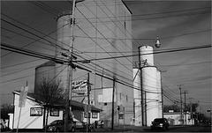
At the north end of downtown Grand Ledge. The elevator's abandoned, now, but the oldest structures on the lot evidently date from the 1870s. This operation became obsolete when ADM built a rather larger grain plant a couple miles away.
==========
This photograph is an outtake from my 2012 photo-a-day project, 366 Snaps .
366 Snaps project discussion and stats for December 14 .
Barns
| |
|
|
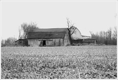
One of these structures was once known as " The World's First All-Steel Barn ."
I've a story for that field, too, but not for today.
==========
Last December 15's 366 Snaps session was odd and fulfilling. I stopped at the store for my morning RC Cola, then headed out amongst the local farms--Charlotte Highway to Eaton Highway to Gates Road to Saginaw Highway to Dow Road to Grace Highway back to Gates back to Saginaw back to Mulliken (which is the same road as Charlotte), and home. The excursion didn't take me far, but occupied most of an hour.
Along the way I shot 32 photographs. About half got messed up--I was still too impatient for the FujiFilm camera--but the other half were keepers. This was the last of the set.
A good haul.
I'd originally planned to post five images today, none of which were this one, but I've changed m' mind....
==========
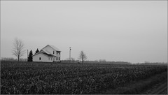
The lonely farmhouse photo I posted to 366 Snaps speaks for itself, I think.
==========
This photograph is an outtake from my 2012 photo-a-day project, 366 Snaps .
Number of project photos taken: 32
Title of " roll :" Roxand mostly
Other photos taken on 12/15/2012: none.
A House in a Field
| |
|
|
Sentinel
| |
|
|
|
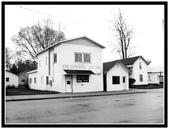
Last December 16 was a Sunday, so I bought my morning RC Cola at Sunfield. The 366 Snaps plan was a photo of the lumberyard; once I got that, I looked around for other pix on Sunfield's Main Street.
While you can't really call the Sentinel's building an architectural masterpiece, it's certainly neat that one of the local small towns still turns out a weekly paper. ( Their website's afflicted with an annoying soundtrack; be warned .)
Quality Hardwoods, as we've noted before, anchors one end of Main. Their website describes their business as forest management .
==========
This photograph is an outtake from my 2012 photo-a-day project, 366 Snaps .
Number of project photos taken: 8
Title of " roll :" Sunnyfield
Other photos taken on 12/16/2012: none.
Abandoned
| |
|
|
|
These structures are out in the middle of a field near where I used to work. The trees marking the fields' edges looked better before a tornado wandered through fifteen or so years back.
That underbrush in the foreground runs along what the maps call the Old Maid Drain. I've discussed the Old Maid before .
==========
I had a specific photo in mind for 366 Snaps a year ago, but took a roundabout route to the site, snapping an occasional photo on my way. I stopped for breakfast, then visited the credit union (thus the near-work photo, above), then headed for Moyer Road, where I expected, and found, my photograph.
I grew up in Kalamazoo, and southern Kalamazoo County's had large agricultural sprinklers as long as I can remember. When I moved to Eaton County--parts of which are certainly as flat as the land surrounding Schoolcraft and Vicksburg--I found fields without the elaborate irrigation systems I'd grown accustomed to. If asked, I'd have said there were no large sprinklers near my house.
Until one day I spotted the system I photographed for 366 Snaps . It can be seen from Mulliken Road if you're heading south to Clinton Trail, a route I travel regularly--but visible only in winter, and it's only briefly so if you're moving at speed. So I may have missed seeing it for years.
There are some oddities: The field it waters wouldn't seem ideal for the device, which I usually see on larger farms. And it borders the Thornapple River, so one wonders whether the project was, strictly speaking, necessary.
But I'm not the farmer. I trust he--and his bankers--were convinced it's helpful.
==========
This photograph is an outtake from my 2012 photo-a-day project, 366 Snaps .
Number of project photos taken: 17
Title of " roll :" Here & There
Other photos taken on 12/17/2012: none.
The Lone Pine
| |
|
|
First Snow
| |
|
|
From a few years back. This is the view from our deck, or the garage. It's not much different from today's view--except the stubble in the foreground's become a lawn, and the row of trees along the street's been removed.
Field of Snows
| |
|
|
|
This photo lacks the sharpness and clarity I generally prefer, but gosh it shows the way things have looked around here lately.
Driveway
| |
|
|
|
Showed you this drive just the other day. Here , for one instance. And here , somewhat earlier.
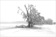
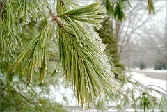
Ice Storms are Pretty, but Tend to Break Stuff...
Jump to top
RSS feed- Latest items - Subscribe to the latest items added to this album
- ipernity © 2007-2024
- Help & Contact
|
Club news
|
About ipernity
|
History |
ipernity Club & Prices |
Guide of good conduct
Donate | Group guidelines | Privacy policy | Terms of use | Statutes | In memoria -
Facebook
Twitter

