Earthwatcher's photos
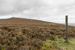
Houndkirk Hill and guidepost view north
| |
|
A walk on Houndkirk Moor 16
A cool morning with frequent showers, clearing to sunshine by afternoon.
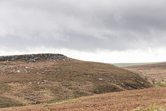
Looking back northwards to the summit of Houndkirk Hill. A narrow path from the summit rocks descends to meet a more significant east-west path where there is a concrete guidepost at the junction. Possibly the post had direction markers at one time, but there is no sign of them now.
Summit of Houndkirk Hill looking NNE
| |
|
A walk on Houndkirk Moor 15
A cool morning with frequent showers, clearing to sunshine by afternoon.
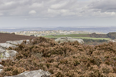
Another view from the summit of Houndkirk Hill, looking NNE. The rocks are Namurian age ('Millstone Grit Series') Chatsworth Grit. The sunlit houses are at Crosspool, on the west side of Sheffield; the Crosspool television tranmitter is prominent just to the right of centre.
Eggborough power station, 32 miles distant, is visible on the skyline left of centre; Drax power station, 37 miles distant, is just visible on the skyline towards the right.
Summit of Houndkirk Hill looking E over Beauchief
| |
|
A walk on Houndkirk Moor 14
A cool morning with frequent showers, clearing to sunshine by afternoon.
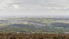
An easterly view from the summit of Houndkirk Hill, looking over the south Sheffield suburb of Beauchief ('Beech-iff') and beyond. Norton Water Tower is prominent in the centre; the two tower blocks at Herdings visible to the left of centre.
In the very far distance on the skyline is West Burton power station on the River Trent, near Gainsborough, 32 miles away.
Summit of Houndkirk Hill looking south
| |
|
A walk on Houndkirk Moor 13
A cool morning with frequent showers, clearing to sunshine by afternoon.
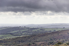
Another shower sweeps in from the west, partly obscuring this southerly view from the summit of Houndkirk Hill.
The dark hill in the centre is near Cocking Tor just south-west of Ashover, some 13 miles away.
Summit of Houndkirk Hill looking NE
| |
|
A walk on Houndkirk Moor 12
A cool morning with frequent showers, clearing to sunshine by afternoon.
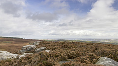
A north-easterly view from the from the summit of Houndkirk Hill. The rocks are Namurian-age ('Millstone Grit Series') Chatsworth Grit. The eastern side slopes gently down towards the A625 Hathersage Road and Dore beyond.
Sheffield is visible in the far distance.
View north-east from Houndkirk Hill escarpment
| |
|
A walk on Houndkirk Moor 11
A cool morning with frequent showers, clearing to sunshine by afternoon.
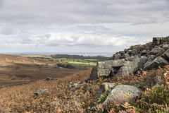
A north-easterly view from the north-west facing escarpment of Houndkirk Hill. The rocks are Namurian-age ('Millstone Grit Series') Chatsworth Grit.
The woodland strip in shadow, in the centre, is the Bole Hill Plantation on the north side of the Limb Valley. Sheffield city centre is visible in the far distance; Rotherham and Doncaster even further beyond.
Summit rocks of Houndkirk Hill 2
| |
|
|
A walk on Houndkirk Moor 10
A cool morning with frequent showers, clearing to sunshine by afternoon.
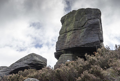
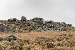
A closer view of the edge tor summit rocks on the north-west facing escarpment of Houndkirk Hill. The rocks are Namurian-age ('Millstone Grit Series') Chatsworth Grit.
Summit rocks of Houndkirk Hill 1
| |
|
A walk on Houndkirk Moor 9
A cool morning with frequent showers, clearing to sunshine by afternoon.
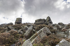
A closer view of the summit rocks on the north-west facing escarpment of Houndkirk Hill. The rocks are Namurian-age ('Millstone Grit Series') Chatsworth Grit.
Scarp edge of Houndkirk Hill
| |
|
|
|
A walk on Houndkirk Moor 8
A cool morning with frequent showers, clearing to sunshine by afternoon.
Approaching the summit rocks on the north-west facing escarpment of Houndkirk Hill. The rocks are Namurian-age ('Millstone Grit Series') Chatsworth Grit.
Looking north over Houndkirk Moor
| |
|
A walk on Houndkirk Moor 7
A cool morning with frequent showers, clearing to sunshine by afternoon.
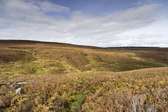
A northward view from the slopes of Houndkirk Hill, looking towards Burbage Moor and Lady Canning's Plantation on the right skyline.
God's Spring
| |
|
A walk on Houndkirk Moor 6
A cool morning with frequent showers, clearing to sunshine by afternoon.
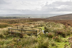
God's Spring emerges on the slopes of Houndkirk Moor, probably at the base of the main (upper bed) of Chatsworth Grit. The spring itself is protected by the wooden fence; the stream then flows south-east to join the Redcar Brook near Dore.
The rising hillside on the right leads up to Houndkirk Hill.
Path to Houndkirk Hill
| |
|
A walk on Houndkirk Moor 5
A cool morning with frequent showers, clearing to sunshine by afternoon.
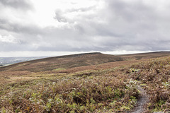
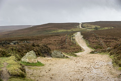
Houndkirk Hill (elevation 389 m) is a compact feature with a prominent scarp edge facing north west. The scarp edge is an outcrop of Namurian age ('Millstone Grit Series') Chatsworth Grit.
The distant scarp edge on the right skyline is informally known as Houndkirk Edge, although not named on the Ordnance Survey maps. It is composed of a lower stratigraphic bed of Chatsworth Grit.
Houndkirk Hill north-west escarpment
| |
|
A walk on Houndkirk Moor 4
A cool morning with frequent showers, clearing to sunshine by afternoon.
Houndkirk Hill (elevation 389 m) is a compact feature with a prominent scarp edge facing north west. The scarp edge is an outcrop of Namurian age ('Millstone Grit Series') Chatsworth Grit.
Houndkirk Road looking south west
| |
|
|
A walk on Houndkirk Moor 3
A cool morning with frequent showers, clearing to sunshine by afternoon.
Looking south-west along the Houndkirk Road. This is the old turnpike road from Hathersage to Sheffield, built in 1758 along the route of previous packhorse tracks. It was later by-passed by the Dore Turnpike (now the A625), constructed in the 1812.
View west over Limb Valley from Lady Canning's Pla…
| |
|
|
A walk on Houndkirk Moor 2
A cool morning with frequent showers, clearing to sunshine by afternoon.
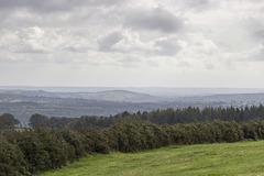
A westerly view over the the fields of Barberfields Farm and the Limb Valley taken from the car park pull-in by Lady Canning's Plantation. The wooded hillside on the right is the beech woodland of Bole Hill Plantation.
View south east over Dore and Totley from Lady Can…
| |
|
A walk on Houndkirk Moor 1
A cool morning with frequent showers, clearing to sunshine by afternoon.
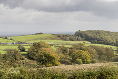
A view south-east over Dore and Totley taken from the car park pull in by Lady Canning's Plantation. The wooded hill just left of centre is at Unstone Green 6.5 miles away, just north of Chesterfield. The far distant skyline is the escarpment of the Permian age Magnesian Limestone, with Bolsover Castle 13.5 miles away, visible as a prominent lump in the centre.
Spurn north end view SW over the Spurn Neck
| |
|
|
|
A visit to Spurn Point 26
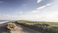
Looking south-west from the landward end of Spurn, over the narrow Spurn Neck (the high spring tide wash-over zone). Spurn Point itself, and the two lighthouses, are visible on the skyline towards the right.
Spurn east beach bank, swales and ripples 2
| |
|
|
|
A visit to Spurn Point 25
Sand and gravel bars (possibly with a foundation of the Wolstonian age Basement Till) parallel to the coast allow the formation of elongate tidal pools, which become completely flooded by the incoming tide.
In this view the darker clayey gravel bar is in the middle distance on the left. In the foreground are large, metre-scale linguoid ripples: 'swales'. These are highly asymmetrical, with the steep lee sides facing south, indicating a predominant current direction from north to south (left to right). This is consistent with the southward longshore drift along the east of England coast
The linguoid swales in turn display centimetre-scale sand ripples on the stoss slopes. The ripples tend to be more symmetrical, indicating a current direction alternating between northward (to the left) flow on the flooding tide and southward flow (to the right) when the tide is ebbing.
In this photo the incoming tide is just beginning to flood the low swale zone.

