Coastal
Photos taken at or near the coast.
Millook Haven cliff detail 4
| |
|
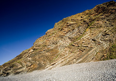
Cascades of recumbent chevron folds in the turbidite sequence of the Crackington Formation (upper Carboniferous) at Millook Haven, north Cornwall, lit by the late afternoon sun.
The northward-dipping (to the left) limbs of the folds are the inverted (upside-down) limbs.
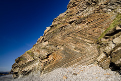
Millook Haven cliff detail 3
| |
|
Cascades of recumbent chevron folds in the turbidite sequence of the Crackington Formation (upper Carboniferous) at Millook Haven, north Cornwall, lit by the late afternoon sun.
The northward-dipping (to the left) limbs of the folds are the inverted (upside-down) limbs.
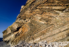
Millook Haven cliff detail 2
| |
|
|
Cascades of recumbent chevron folds in the turbidite sequence of the Crackington Formation (upper Carboniferous) at Millook Haven, north Cornwall, lit by the late afternoon sun.
The northward-dipping (to the left) limbs of the folds are the inverted (upside-down) limbs.
The walking-stick in the lower middle is approx. 0.9 m long.
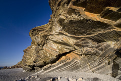
Millook Haven cliff detail 1
| |
|
Cascades of recumbent chevron folds in the turbidite sequence of the Crackington Formation (upper Carboniferous) at Millook Haven, north Cornwall, lit by the late afternoon sun.
The northward-dipping (to the left) limbs of the folds are the inverted (upside-down) limbs.
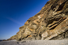
Millook Haven cliff
| |
|
Cascades of recumbent chevron folds in the turbidite sequence of the Crackington Formation (upper Carboniferous) at Millook Haven, north Cornwall, lit by the late afternoon sun.
The northward-dipping (to the left) limbs of the folds are the inverted (upside-down) limbs.
Afternoon light on The Strangles beach
| |
|
|
Originally uploaded as a clue for a Guesswhere UK photo.
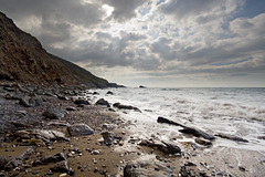
The Strangles beach near Crackington Haven, north Cornwall, looking to the southwest.
Folded and inverted turbidites at Millook Haven, C…
| |
|
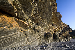
An unusual view of the intensely folded turbidite sequence in the Crackington Formation (upper Carboniferous) at Millook Haven, north Cornwall.
The northward-dipping limbs of the folds e.g. the striped sequence in the lower left quadrant are the inverted (upside-down) limbs.
Upside-down rocks at Millook Haven, Cornwall
| |
|
|
|
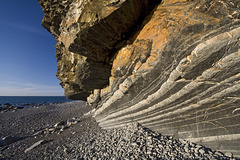
The is an unusual detail view of the rocks at Millook Haven, north Cornwall.
The striped rocks are turbidites belonging to the Crackington Formation (upper Carboniferous). Way-up structures in the sandstone bands such as fining-up sequences, small-scale slump structures, ripple marks and grooves, etc, demonstrate that these northward dipping rocks (part of the famous chevron fold sequence) have been inverted and are upside-down.
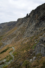
The Strangles cliffs, near Crackington Haven, Nort…
| |
|
Originally uploaded for the Guesswhere UK group.
This is a view of the upper cliff overlooking The Strangles, near Crackington Haven, north Cornwall. The cliff is comprised of the Crackington Formation: upper Carboniferous turbidites and shales, which have been subjected to intense folding and a near-horizontal axial-planar, slaty cleavage is well developed in the shaly parts of the sequence, as in this location. The cliff has been extensively quarried in the past for slates.
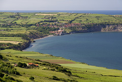
Robin Hood's Bay from Stoupe Brow 2
| |
|
Looking northwards to Robin Hood's Bay from Stoupe Brow beneath the Ravenscar radio mast. A zoomed-in view in the late afternoon sunshine.
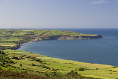
Robin Hood's Bay from Stoupe Brow 1
| |
|
A late afternoon view northwards to Robin Hood's Bay from Stoupe Brow beneath the Ravenscar radio mast.
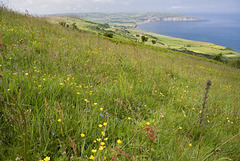
Stoupe Brow meadow
| |
|
A field as rich as any alpine meadow on Stoupe Brow beneath the Ravenscar radio mast. Looking northwards to Robin Hood's Bay (sea feature and village).
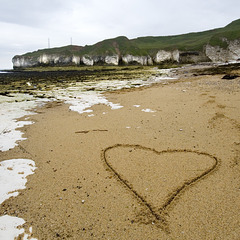
I Love Flamborough
| |
|
The title says it all really....
Selwicks, Bay, Flamborough, East Yorkshire.
Note the capping of brown glacial till ('boulder clay') overlying the Chalk cliffs.
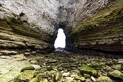
Molk Hole arch
| |
|
Molk Hole is an intriguing irregularly-shaped inlet at the north end of Selwicks Bay, Flamborough. A fascinating area of Chalk cliffs, sea caves and arches, hollowed out along fault and fracture zones in part of the Howardian Hills-Flamborough Fault Belt.
A lovely place to explore at low tide.
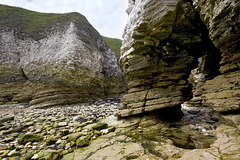
Molk Hole 2
| |
|
Molk Hole is an intriguing irregularly-shaped inlet at the north end of Selwicks Bay, Flamborough. A fascinating area of Chalk cliffs, sea caves and arches, hollowed out along fault and fracture zones in part of the Howardian Hills-Flamborough Fault Belt.
A lovely place to explore at low tide.
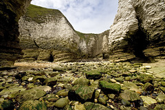
Molk Hole 1
| |
|
|
Molk Hole is an intriguing irregularly-shaped inlet at the north end of Selwicks Bay, Flamborough. A fascinating area of Chalk cliffs, sea caves and arches, hollowed out along fault and fracture zones in part of the Howardian Hills-Flamborough Fault Belt.
A lovely place to explore at low tide.
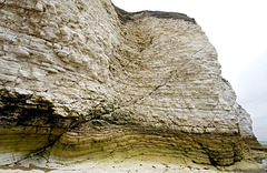
Selwicks Bay faults
| |
|
Small faults cutting the Chalk at the north end of Selwicks Bay, Flamborough. The Chalk here is disturbed by the Howardian Hills-Flamborough fault belt, although this particular bit is not particularly deformed.
I also liked the colours and textures in the lower part of the cliff.
Selwicks Bay panorama
| |
|
Disturbed Chalk in the Howardian Hills-Flamborough Fault belt at West Cliff, Selwicks Bay, Flamborough, East Yorkshire.
A panoramic stitching of 4 photos, using Canon's Photostitch software.
Jump to top
RSS feed- Latest items - Subscribe to the latest items added to this album
- ipernity © 2007-2024
- Help & Contact
|
Club news
|
About ipernity
|
History |
ipernity Club & Prices |
Guide of good conduct
Donate | Group guidelines | Privacy policy | Terms of use | Statutes | In memoria -
Facebook
Twitter

