Sacramento / Fall neighborhood (1623)
Hanford, CA / historic Lacey Milling Co. (1614)
Hanford, CA / former US Post Office (1610)
Hanford, CA / downtown (1611)
Hanford, CA / historic Kings County Courthouse (16…
Corcoran / abandoned grain elevator & Amtrak San J…
Corcoran / Southbound Amtrak San Joaquin (1595)
Corcoran / Southbound Amtrak San Joaquin (1597)
California HSR/BNSF freight Wasco Viaduct (1579)
California HSR/BNSF freight Wasco Viaduct (1578)
California High-speed rail Wasco Viaduct (1576)
California High-speed rail Wasco Viaduct (1574)
Hanford, CA hometown holiday parade (0325)
Hanford, CA hometown holiday parade (0326)
Hanford, CA hometown holiday parade (0327)
Hanford, CA hometown holiday parade (0328)
Hanford, CA hometown holiday towing(0330)
Hanford, CA hometown holiday jail ( 0331)
Hanford, CA hometown holiday parade (0336)
Redlands historic Santa Fe station (# 0631)
Redlands time-machine (# 0636)
San Bernardino Metrolink Arrow / downtown (# 1532)
Location
See also...
Keywords
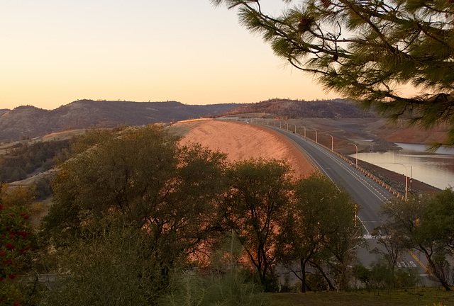
Oroville Dam (1631)


The road that goes along most of the top of the Oroville Dam for close to a mile, taken from an observation point above the dam.
This picture of the dam were taken much later than I had planned, due to a traffic accident that had closed down part of the freeway for about an hour much earlier in the day.
This picture of the dam were taken much later than I had planned, due to a traffic accident that had closed down part of the freeway for about an hour much earlier in the day.
kiiti, Paolo Tanino have particularly liked this photo
- Keyboard shortcuts:
Jump to top
RSS feed- Latest comments - Subscribe to the comment feeds of this photo
- ipernity © 2007-2024
- Help & Contact
|
Club news
|
About ipernity
|
History |
ipernity Club & Prices |
Guide of good conduct
Donate | Group guidelines | Privacy policy | Terms of use | Statutes | In memoria -
Facebook
Twitter

Sign-in to write a comment.