Shooting information for this photo
← Back to the photo page
Want to know more about EXIF?
Check wikipedia page about Exchangeable image file format (EXIF)
Check wikipedia page about Exchangeable image file format (EXIF)
Some of EXIF data are only available in English.
| Camera: | Minolta Co., Ltd. DiMAGE 7 |
|---|---|
| Exposure: | 0.16667 sec. (1/6) |
| Aperture: | f/2.8 |
| Focal Length: | 7.3 mm |
| Flash: | Off, Did not fire |
| Exposure mode: | Program AE |
| Max Aperture: | 2.8 |
| Resolution: | 72 x 72 dpi |
| Dimension: | 1922 x 1920 pixels |
| Original Date: | 2018:08:04 15:35:16 |
| Created on: | 2018:08:04 15:35:16 |
| Modified on: | 2018:08:06 12:41:36 |
| Software: | Ver.2.01e |
| Copyright: | David H Edwards |
| Artist | David H Edwards |
| BW Filter | 0 |
| Bracket Step | 2/3 EV |
| Brightness | -0.25 |
| Brightness Value | 4294.667296 |
| Color Balance Blue | 2.43359375 |
| Color Balance Green | 1 |
| Color Balance Red | 1.05078125 |
| Color Filter | 0 |
| Color Mode | Natural color |
| Color Space | sRGB |
| Compressed Image Size | 14745600 |
| Compression | JPEG (old-style) |
| Contrast | Normal |
| Country | United Kingdom |
| Country Code | GBR |
| Creator | David H Edwards |
| DEC Position | Saturation |
| Date/Time Created | 2018:08:04 15:35:16+00:00 |
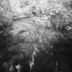
| Description | This tributary flows (slowly) out of Swanbourne lake, under this bridge, to the main River Arun |
| Digital Zoom | Off |
| Drive Mode | Single |
| Exif Version | 0220 |
| Exposure Compensation | 0 |
| Exposure Index | 0 |
| Exposure Mode | Program |
| File Number Memory | On |
| File Source | Unknown (0) |
| Flash Exposure Compensation | 0 |
| Flash Fired | No |
| Flash Mode | Fill flash |
| Flashpix Version | 0100 |
| Focal Plane Resolution Unit | Unknown (0) |
| Focal Plane X Resolution | 0 |
| Focal Plane Y Resolution | 0 |
| Focus Area | Wide Focus (normal) |
| Focus Distance | 2 m |
| Focus Mode | AF |
| Folder Name | Data Form |
| ISO | 200, 200 |
| ISO Setting | Auto |
| Image Description | This tributary flows (slowly) out of Swanbourne lake to the main River Arun |
| Image Size | 1922x1920 |
| Internal Flash | No |
| Interoperability Version | 0100 |
| Interval Length | 2 |
| Interval Mode | Time-lapse Movie |
| Interval Number | 99 |
| Last File Number | 696 |
| Light Source | Tungsten (Incandescent) |
| Light Value | 4.6 |
| Location | Mill Road |
| Macro Mode | Off |
| Maker Note Version | 0TLM |
| Max Aperture | 2.8 |
| Metering Mode | Multi-segment |
| Minolta Image Size | Full |
| Minolta Model ID | DiMAGE 7, X1, X21 or X31 |
| Minolta Quality | Super Fine |
| Preview Image Length | 62126 |
| Preview Image Start | 2616648 |
| Primary Chromaticities | 0 0 0 0 0 0 |
| Reference Black White | 0 0 0 0 0 0 |
| Related Image Height | 1920 |
| Related Image Width | 2560 |
| Resolution Unit | inches |
| Rights | David H Edwards |
| Saturation | Normal |
| Scene Type | Unknown (0) |
| Sensing Method | Unknown (0) |
| Sharpness | Normal |
| Spot Focus Point X | 1280 |
| Spot Focus Point Y | 960 |
| State | West Sussex |
| Subject | Arundel, GBR, geo:lat=50.86013708, geo:lon=-0.55344163, geotagged, Hoya 720, infrared, infra-red, IR, Mill Road, United Kingdom, West Sussex |
| Subject Distance | 0 m |
| Subject Program | None |
| Thumbnail Offset | 2226 |
| Title | River Arun, with weed |
| White Balance | Tungsten |
| White Point | 0 0 |
| Wide Focus Zone | Center zone (horizontal orientation) |
| XMP Toolkit | XMP Core 5.1.2 |
| Y Cb Cr Coefficients | 0 0 0 |
| Y Cb Cr Positioning | Unknown (0) |
GPS Information |
|
| GPS Altitude | 3 m Above Sea Level |
| GPS Altitude Ref | Above Sea Level |
| GPS Date Stamp | 2018:08:04 |
| GPS Date/Time | 2018:08:04 14:35:16Z |
| GPS Latitude | 50 deg 51' 36.49" N |
| GPS Latitude Ref | North |
| GPS Longitude | 0 deg 33' 12.39" W |
| GPS Longitude Ref | West |
| GPS Map Datum | WGS-84 |
| GPS Position | 50 deg 51' 36.49" N, 0 deg 33' 12.39" W |
| GPS Time Stamp | 14:35:16 |
| GPS Version ID | 2.2.0.0 |
Jump to top
- ipernity © 2007-2024
- Help & Contact
|
Club news
|
About ipernity
|
History |
ipernity Club & Prices |
Guide of good conduct
Donate | Group guidelines | Privacy policy | Terms of use | Statutes | In memoria -
Facebook
Twitter
