England - Coastal North Yorkshire (Sandsend to Ravenscar but mainly Whitby)
Folder: Yorkshire
Whitby is a seaside town, port and civil parish in the Borough of Scarborough and English county of North Yorkshire. It is located within the historic boundaries of the North Riding of Yorkshire. Situated on the east coast of Yorkshire at the mouth of the River Esk, Whitby has an established maritime, mineral and tourist heritage. Its East Cliff is home to the ruins of Whitby Abbey, where Cædmon, …
(read more)
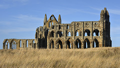
Whitby Abbey Church from the south (3 x PiPs)
| |
|
|
|
Perhaps better enlarged
The huge, gaunt shell of Whitby’s abbey church is one of Yorkshire’s most memorable landmarks, visible from miles away from land or sea. Yet the monastery only represents a part of the history of the headland upon which it stands. People have lived here since at least Roman times, when there was probably a signal station on the cliff edge. In the 7th, 8th and 9th centuries there was a thriving Anglican community here, with a famous minster (or monastery) of monks and nuns, founded by St. Hild, at its heart. The minster and settlement had disappeared by the end of the ninth century, presumably following Viking raids along the coast. The name ‘Whitby’ is Danish: the present town, was almost certainly founded by Danish settlers some time in the 10th century.
The great Benedictine monastery dominated the headland and the town below from its foundation in the late 11th century until its suppression in 1539.
Its site and the surrounding estates were then bought by the Chomleys, a newly rich landowning family. They demolished the monastic buildings but preserved the shell of the church, and adapted the former abbot’s lodgings as a residence, adding a grand new wing to it in the 1670’s.
By the later 18th century the Chomleys moved away, but by then the shell of the abbey had become a picturesque ruin and a historic monument. In the 20th century the abbey was placed in the care of the Ministry of Works, and in 1984 the ruins were transferred to English Heritage.
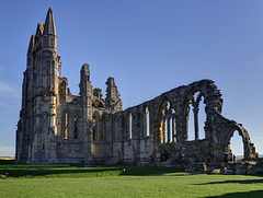
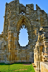
Whitby Abbey Church - North Transept and Nave wall
| |
|
|
|
Perhaps better enlarged
Transepts are the short arms in a cross-shaped church; the place where they intersect with the long axis is called the crossing. Transepts allowed for extra-side chapels with alters which could be separately dedicated. At Whitby, an eroded late medieval inscription in the north transept used to say 'John of Brumton, sometime servant of God' dedicated an alter to the 'Blessed Mary' there. At Whitby, the north transept stands to its full height and is well preserved, whereas the south transept fell in 1736.
Much of the Nave of the Abbey collapsed in 1762, although enough remains standing to demonstrate its scale and plan. The north wall of the Nave (shown here) has three simple 13th century lancet windows, the remaining windows date from the 14th century and are much larger with elaborate tracery.
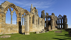
View east from the West Front & Nave towards North…
| |
|
|
|
Perhaps better enlarged
Much of the nave of the Abbey collapsed in 1762, although enough remains standing to demonstrate its scale and plan. This Gothic building replaced an earlier Romanesque nave from the early 12th century. The north wall of the nave (shown here) has three simple 13th century lancet windows, the two remaining windows date from the 14th century and are much larger with elaborate tracery.
The nave at Whitby is not exactly aligned with the presbytery and transepts, in fact, it is misaligned by about four degrees. There is no parallel to this in any other major English medieval church.
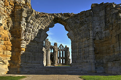
Whitby Abbey Church - West Front (2 x PiPs)
| |
|
|
|
Perhaps better enlarged
The remains of the west front are in a battered and weathered condition: the shell seems to be 14th century, but the window tracery looks to be of mid 15th century date (see PiP). On the 14th December 1914, four cruisers of the Imperial German Navy appeared off the headland and fired on the town from a range of a mile and an half (2.4 km), damaging the signal station, the coastguard cottages and the west front of the abbey itself. The Ministry of Works rebuilt it, using historic masonry, in the 1920's.
Whitby Abbey Church - West Front 15th century wind…
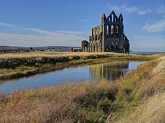
Whitby Abbey Church and pond
| |
|
|
|
The ruins of Whitby Abbey that can be seen today date from the 13th century onwards. The first Benidictine church on the headland was a smaller, but still impressive, stone building in the Romanesque style, probably begun in abut 1109.
The Romanesque church stood until the 13th century, when abbots, priors and bishops all over England were launching ambitious projects to rebuild what, in most cases, were already large and impressive churches. It seems likely that a spirit of competition mingled with a wish to demonstrate their devotion to God.
Dedicated to St. Peter and St. Hild, Whitby Abbey Church is more than 90 metres long - the size of a small cathedral (Ripon Cathedral is about the same length). The abbey church was not built to serve the local community.
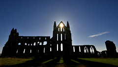
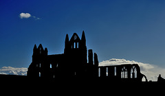
Whitby Abbey Church silhouette
| |
|
|
|
Perhaps better enlarged
Dedicated to St. Peter and St. Hild, Whitby Abbey Church is more than 90 metres long - the size of a small cathedral (Ripon Cathedral is about the same length). The abbey church was not built to serve the local community. The town was served by a large early 12th century parish church; The Church of St. Mary (below), which had itself been provided by the abbey, and which still stands.
HFF from Whitby everyone
Whitby rooftops and chimneys
| |
|
|
|
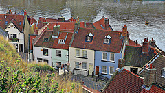
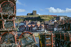
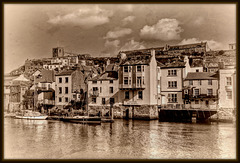
These cottages are situated on the eastern side of Whitby harbour, below the Church of St.Mary and Whitby Abbey.
Perhaps better enlarged
Whitby Town and Harbour - North Yorkshire
| |
|
|
|
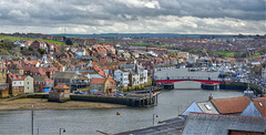
Whitby is a seaside town, port and civil parish in the Borough of Scarborough and English county of North Yorkshire. It is located within the historic boundaries of the North Riding of Yorkshire. Situated on the east coast of Yorkshire at the mouth of the River Esk, Whitby has an established maritime, mineral and tourist heritage. Its East Cliff is home to the ruins of Whitby Abbey, where Cædmon, the earliest recognised English poet, lived. The fishing port developed during the Middle Ages, supporting important herring and whaling fleets, and was (along with the nearby fishing village of Staithes) where Captain Cook learned seamanship.
The earliest record of a permanent settlement is in 656, when as Streanœhealh it was the place where Oswy, the Christian king of Northumbria, founded the first abbey, under the abbess Hilda. The Synod of Whitbywas held there in 664. In 867, the monastery was destroyed by Viking raiders. Another monastery was founded in 1078. It was in this period that the town gained its current name, Whitby (from "white settlement" in Old Norse). In the following centuries Whitby functioned as a fishing settlement until, in the 18th century, it developed as a port and centre for shipbuilding and whaling, the trade in locally mined alum, and the manufacture of Whitby jet jewellery.
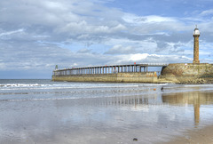
The abbey ruin at the top of the East Cliff is the town's oldest and most prominent landmark. Other significant features include the swing bridge, which crosses the River Esk and the harbour, which is sheltered by the grade II listed East and West piers. The town's maritime heritage is commemorated by statues of Captain Cook and William Scoresby, as well as the whalebone arch that sits at the top of the West Cliff. The town also has a strong literary tradition and has featured in literary works, television and cinema, most famously in Bram Stoker's novel Dracula.
HFF from sunny Whitby, North Yorkshire
| |
|
|
|
Waiting for Summer Visitors (HFF everyone) (1 x Pi…
| |
|
|
|
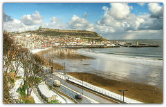
View to the southeast from the village of Sandsend towards Whitby, approximately 4-5 km.
Light snow shower over Scarborough's South Bay
Church of St. Mary high over Whitby Harbour, North…
| |
|
|
|
Best enlarged
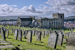
The Church of Saint Mary is an Anglican parish church serving the town of Whitby in North Yorkshire England. It was founded around 1110, although its interior dates chiefly from the late 18th century. The church was designated a Grade I listed building on 23 February 1954. It is situated on the town's east cliff, overlooking the mouth of the River Esk overlooking the town, close to the ruins of Whitby Abbey. Church Steps, a flight of 199 steps lead up the hill to the church from the streets below. The church graveyard is used as a setting in Bram Stoker's novel, Dracula.
A Norman church was built on the site around 1110 and added to and altered over the centuries. The tower and transepts are from the 12th and 13th centuries. The tower is square and crenellated, as are the walls.
One of the oldest parts of the church is the quire which has three round-headed windows at its east end. Its side walls originally had three bays with similar windows but have been altered. It has three aumbries, one with a small piscina. The nave has five bays and is contemporary with the quire, its south wall is much altered but three external buttresses remain. When the church was enlarged in 1818 most of the north wall was removed and replaced by columns to accommodate an aisle, four large square-headed windows were inserted on the south side, the south porch was built in 1823 and a north porch built in the new annexe. The ceilings over the nave are boarded with several skylights. The transept was built in the 13th century and has three altered lancet windows in its northern arm while its southern arm is considerably changed and its windows all replaced.
The three-stage west tower has a squat appearance, its corners supported by flat buttresses and its embattled parapet is a 16th-century addition. Of its ring of eight bells, six are inscribed, "Whitby 1762 Lester and Pack of London fecit" and two were added in 1897.
The Church of St. Mary and Graveyard, Whitby, Nort…
| |
|
|
|
Best enlarged
The Church of Saint Mary is an Anglican parish church serving the town of Whitby in North Yorkshire England. It was founded around 1110, although its interior dates chiefly from the late 18th century. The church was designated a Grade I listed building on 23 February 1954. It is situated on the town's east cliff, overlooking the mouth of the River Esk overlooking the town, close to the ruins of Whitby Abbey. Church Steps, a flight of 199 steps lead up the hill to the church from the streets below. The church graveyard is used as a setting in Bram Stoker's novel, Dracula.
A Norman church was built on the site around 1110 and added to and altered over the centuries. The tower and transepts are from the 12th and 13th centuries. The tower is square and crenellated, as are the walls.
One of the oldest parts of the church is the quire which has three round-headed windows at its east end. Its side walls originally had three bays with similar windows but have been altered. It has three aumbries, one with a small piscina. The nave has five bays and is contemporary with the quire, its south wall is much altered but three external buttresses remain. When the church was enlarged in 1818 most of the north wall was removed and replaced by columns to accommodate an aisle, four large square-headed windows were inserted on the south side, the south porch was built in 1823 and a north porch built in the new annexe. The ceilings over the nave are boarded with several skylights. The transept was built in the 13th century and has three altered lancet windows in its northern arm while its southern arm is considerably changed and its windows all replaced.
The three-stage west tower has a squat appearance, its corners supported by flat buttresses and its embattled parapet is a 16th-century addition. Of its ring of eight bells, six are inscribed, "Whitby 1762 Lester and Pack of London fecit" and two were added in 1897.
Whitby of Old
Silhouette
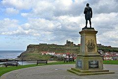
Statue of Captain James Cook RN, Whitby, North Yor…
| |
|
|
|
Best enlarged
Captain James Cook FRS RN (1728 – 1779) was a British explorer, navigator, cartographer, and captain in the Royal Navy. Cook made detailed maps of Newfoundland (Cook's map would be used into the 20th century—copies of it being referenced by those sailing Newfoundland's waters for 200 years). Cook went on to make three voyages to the Pacific Ocean, during which he achieved the first recorded European contact with the eastern coastline of Australia and the Hawaiian Islands, and the first recorded circumnavigation of New Zealand.
Cook joined the British merchant navy as a teenager and joined the Royal Navy in 1755. He saw action in the Seven Years' War, and subsequently surveyed and mapped much of the entrance to the Saint Lawrence River during the siege of Quebec. This helped bring Cook to the attention of the Admiralty and Royal Society. This notice came at a crucial moment in both Cook's career and the direction of British overseas exploration, and led to his commission in 1766 as commander of HM Bark Endeavour for the first of three Pacific voyages.
In three voyages Cook sailed thousands of miles across largely uncharted areas of the globe. He mapped lands from New Zealand to Hawaii in the Pacific Ocean in greater detail and on a scale not previously achieved. As he progressed on his voyages of discovery he surveyed and named features, and recorded islands and coastlines on European maps for the first time. He displayed a combination of seamanship, superior surveying and cartographic skills, physical courage and an ability to lead men in adverse conditions.
Cook was attacked and killed while attempting to kidnap the native chief of Hawaii during his third exploratory voyage in the Pacific in 1779. He left a legacy of scientific and geographical knowledge which was to influence his successors well into the 20th century, and numerous memorials worldwide have been dedicated to him.
HMS Endeavour , also known as HM Bark Endeavour, (first voyage) was a British Royal Navy research vessel that Lieutenant James Cook commanded on his first voyage of discovery, to Australia and New Zealand, from 1769 to 1771.
She was launched in 1764 as the collier Earl of Pembroke, and the navy purchased her in 1768 for a scientific mission to the Pacific Ocean and to explore the seas for the surmised Terra Australis Incognita or "unknown southern land". The navy renamed and commissioned her as His Majesty's Bark the Endeavour. She departed Plymouth in August 1768, rounded Cape Horn, and reached Tahiti in time to observe the 1769 transit of Venus across the Sun. She then set sail into the largely uncharted ocean to the south, stopping at the Pacific islands of Huahine, Bora Bora, and Raiatea to allow Cook to claim them for Great Britain. In September 1769, she anchored off New Zealand, the first European vessel to reach the islands since Abel Tasman's Heemskerck 127 years earlier.
In April 1770, Endeavour became the first ship to reach the east coast of Australia, when Cook went ashore at what is now known as Botany Bay. Endeavour then sailed north along the Australian coast. She narrowly avoided disaster after running aground on the Great Barrier Reef, and Cook had to throw her guns overboard to lighten her. He then beached her on the mainland for seven weeks to permit rudimentary repairs to her hull. On 10 October 1770, she limped into port in Batavia (now named Jakarta) in the Dutch East Indies for more substantial repairs, her crew sworn to secrecy about the lands they had visited. She resumed her westward journey on 26 December, rounded the Cape of Good Hope on 13 March 1771, and reached the English port of Dover on 12 July, having been at sea for nearly three years.
A replica of Endeavour was launched in 1994 and is berthed alongside the Australian National Maritime Museum in Sydney Harbour. The US space shuttle Endeavour is named after the ship and she is depicted on the New Zealand fifty-cent coin.
HMS Resolution , (second and third voyages), began her career as the North Sea collier Marquis of Granby, launched at Whitby in 1770, and purchased by the Royal Navy in 1771 for £4,151 (equivalent to £490,777.23 today). She was fitted out at Deptford with the most advanced navigational aids of the day, including an azimuth compass made by Henry Gregory, ice anchors, and the latest apparatus for distilling fresh water from sea water.
Resolution departed Sheerness on 21 June 1772, carrying 118 people, including 20 volunteers who had sailed on Cook's first voyage in HMS Endeavour in 1768–1771, and two years of provisions. She joined HMS Adventure at Plymouth and the two ships departed English waters on 13 July 1772.
On 17 January 1773, Resolution was the first ship to cross the Antarctic Circle and crossed twice more on the voyage. The third crossing, on 3 February 1774, was the most southerly penetration, reaching latitude 71°10′ South at longitude 106°54′ West. She returned to Britain in 1775.
A year later Cook left Plymouth on an expedition to search for the North West Passage. His two ships were HMS Resolution and Discovery, the latter commanded by Charles Clerke. They sailed to Cape Town, Kerguelen Island in the southern Indian Ocean, Adventure Bay in Van Diemen’s Land, and Queen Charlotte Sound in New Zealand. They then revisited the Friendly and Society Islands. Sailing northwards, Cook discovered the Sandwich Islands (Hawaii) and reached the North American coast in March 1778.
The ships followed the coast northwards to Alaska and the Bering Strait and reached 70°44’N, before being driven back by ice. They returned to the Sandwich Islands and on 14 February 1779 Cook was killed by Hawaiians at Kealakekua Bay. Clerke took over the command and in the summer of 1779 the expedition again tried unsuccessfully to penetrate the pack ice beyond Bering Strait. Clerke died in August 1779 and John Gore and James King commanded the ships on the voyage home via Macao and Cape Town. They reached London in October 1780.
Cooks's Early Years
James Cook was born on 7 November 1728 in the village of Marton in Yorkshire and baptised on 14 November, in the parish church of St Cuthbert, where his name can be seen in the church register. He was the second of eight children of James Cook, a Scottish farm labourer from Ednam in Roxburghshire, and his locally born wife, Grace Pace, from Thornaby-on-Tees. In 1736, his family moved to Airey Holme farm at Great Ayton, where his father's employer, Thomas Skottowe, paid for him to attend the local school. In 1741, after five years' schooling, he began work for his father, who had been promoted to farm manager.
In 1745, when he was 16, Cook moved 20 miles (32 km) to the fishing village of Staithes, to be apprenticed as a shop boy to grocer and haberdasher William Sanderson.
After 18 months, not proving suitable for shop work, Cook travelled to the nearby port town of Whitby to be introduced to friends of Sanderson's, John and Henry Walker.The Walkers, who were Quakers, were prominent local ship-owners in the coal trade. Their house is now the Captain Cook Memorial Museum. Cook was taken on as a merchant navy apprentice in their small fleet of vessels, plying coal along the English coast. As part of his apprenticeship, Cook applied himself to the study of algebra, geometry, trigonometry, navigation and astronomy—all skills he would need one day to command his own ship.
His three-year apprenticeship completed, Cook began working on trading ships in the Baltic Sea. After passing his examinations in 1752, he soon progressed through the merchant navy ranks, starting with his promotion in that year to mate aboard the collier brig Friendship. In 1755, within a month of being offered command of this vessel, he volunteered for service in the Royal Navy, when Britain was re-arming for what was to become the Seven Years' War. Despite the need to start back at the bottom of the naval hierarchy, Cook realised his career would advance more quickly in military service and entered the Navy at Wapping on 17 June 1755.
Jump to top
RSS feed- Latest items - Subscribe to the latest items added to this album
- ipernity © 2007-2024
- Help & Contact
|
Club news
|
About ipernity
|
History |
ipernity Club & Prices |
Guide of good conduct
Donate | Group guidelines | Privacy policy | Terms of use | Statutes | In memoria -
Facebook
Twitter

