Heide's favorite photos
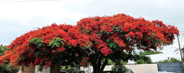
La Ravine-des-Cabris (974, Ile de la Réunion) 24 novembre 2021.
Flamboyant en pleine floraison.
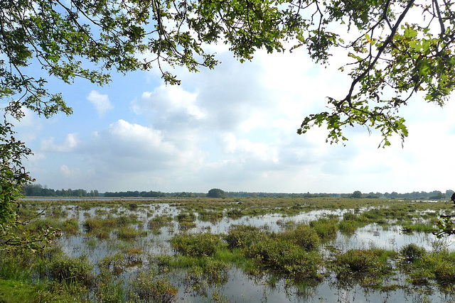
Nederland - Drents-Friese Wold
The Nationaal Park Drents-Friese Wold is one of the largest areas of natural beauty in the Netherlands. The park consists of more than 6,000 hectares of forest, heathland, fens, shifting sands, pools and ponds, swamps and brook valley grasslands.
Drents-Friese Wold is located in the border region of the northern Dutch provinces of Drenthe and Friesland. During our visit we were pleasantly surprised by the varied landscape. I can not remember having seen such a diversity of landscapes in one of the twenty national parks in my country.
In the year 2000 it became a national park; in addition, the Drents-Friese Wold is one of the most beautiful and important nature areas in Europe and has therefore been designated as a “Nature2000 area”.
The park is managed by four organizations and eighty private owners.
Nederland - Twello, De Parckelaer
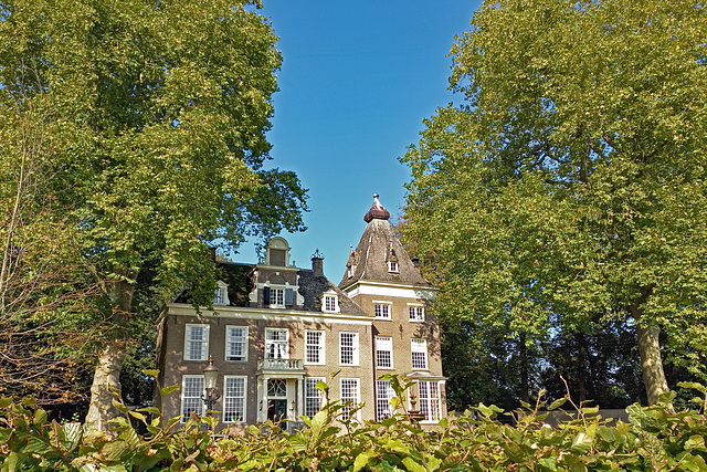
Originally De Parckelaer was a so called havezate (manorial farm). The oldest mention of the house dates from 1434. Just like the nearby Kruisvoorde manor house, the building belonged to the Van Mermuden family. Later, the manor came into the possession of the Van Essen and Van Reede families, important noblemen on the Veluwe.
The present building dates from the end of the 17th century or the beginning of the 18th century. In 1843, the building became the property of the commissioner Jacob Roeters van Lennep. Commissioned by his son the building was given a new frontage in 1868. The entrance was also provided with a cast-iron roof with a balcony on the first floor.
At the end of the 19th century, the house was empty and fell into disrepair. Fortunately, the Parckelaer's demolition was prevented. In 1990 and the following years, the building was restored. De Parckelaer became a national Dutch heritage site in 1991. The estate is still privately owned and not open to the public.
Nederland - Twello, Huize Kruisvoorde
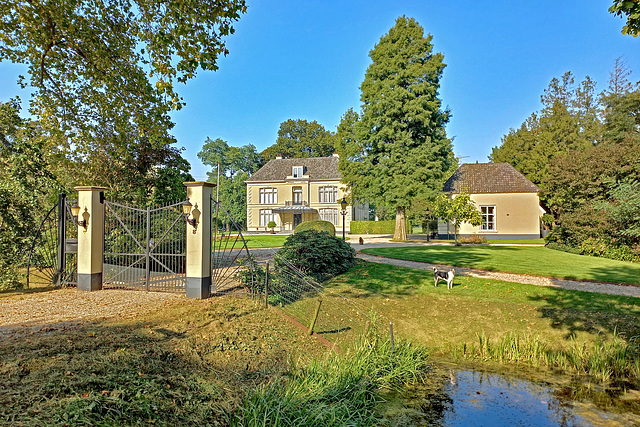
Huize Kruisvoorde is a monumental country house. Part of this former ‘havezate’ (manorial farm) dates from the 16th century. The building is also known as Crusefort , Cruystenvoorde or Cruysvoorde . The name probably refers to a voorde , a ford at a crossing of the trade route to Deventer and the dug waterway Terwoldse Wetering .
Huize Kruisvoorde was looted in 1572, during the Eighty Years' War. In the 18th century, a front wing was added to the building. A century later, the manor was given a coat of plaster, but this was removed at the beginning of the 20th century. An imposing square tower was then added to the building.
Huize Kruisvoorde - like nearby De Parckelaer - became a Dutch heritage site in 1971. Nowadays, the country house is privately owned.
Nederland - Velp, Kasteel Biljoen
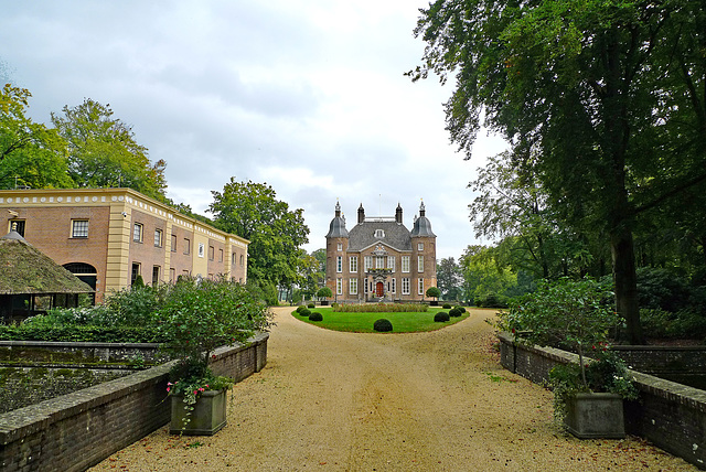
Kasteel Biljoen , originally called Broekerhof , was a place were taxes were collected. It was first mentioned in 1076 as it was a large farm, which was donated to the chapter of St. Peter in Utrecht by Emperor Heinrich IV. Around the year of 1530 Duke Karel van Gelder built the first Noble House, partly with materials from the nearby Kasteel Overhagen .
In 1535, the Duke of Gelre sold the castle due to a lack of money. It had various owners until it came into the possession of Alexander van Spaen in 1661. He rebuilt the house into the present day castle with four equal corner towers, each crowned by a helmet-shaped roof. The family Van Spaen rebuilt the castle again in the the 18th century.
In 1795 French troops were quartered in the castle. After they left the castle was plundered and the interior largely destroyed. In 1849 baron Van Hardenbroek allowed Anna Pavlovna of Russia to use it temporarily. In 1872 it was inherited by the family Lüps, until 2008. Today (2021) Kasteel Biljoen is owned by an American family and the castle itself is closed off to public visits.
Nederland - Hoog Soeren, Het Aardhuis
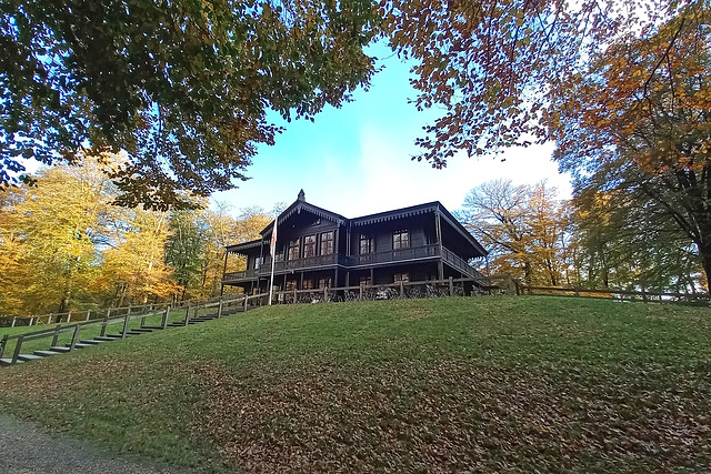
Het Aardhuis was commissioned by King Willem III and designed by court architect Henri Camp in 1861. Originally, the chalet-like building was mainly used as a military meeting centre and as a place to rest after a hunt. Prince Hendrik also liked to stay in Het Aardhuis which he used while hunting. That is why it is mainly known as a hunting chalet.
Het Aardhuis is situated on the Aardmansberg (from which the name is derived), which at 102 metres is one of the highest points in the Veluwe. This location offered Willem III a magnificent view of the manoeuvres that the soldiers from a nearby camp were performing on the heathlands.
In 1972, Queen Juliana decided to give the impressive black wooden building a different purpose. From a hunting chalet, it became an information centre about nature and wildlife. Today, the ground floor of Het Aardhuis houses a café-restaurant. On the first floor, one of the rooms is still furnished as it was in the days of King Willem III and Prince Hendrik, with a lot of attention for hunting (PiP3). Another larger room serves as an information centre for Kroondomein Het Loo (Het Loo Royal Estate).
Nederland - Hoog Soeren, Aardhuispark
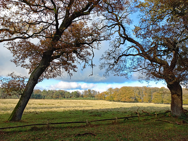
The Aardhuispark is a fenced-off part of Kroondomein Het Loo (The Loo Royal Estate). It is situated - as the name suggests - around Het Aardhuis . The park offers a mixture of open landscape with a wildlife meadow, lanes with old beech and oak trees and water pools.
A three-kilometre walking route has been marked out in the park. This route also leads to a hideout for wildlife spotting. During my last visit, I saw a group of 15 to 20 deer grazing and resting there (PiP1).
Nederland - Nieuw Milligen, Kootwijkerveen
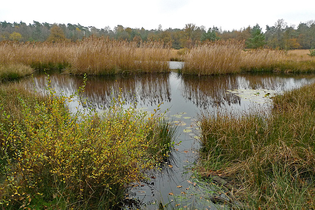
Unlike the name suggests, the Kootwijkerveen is not located near Kootijk, but somewhere hidden in the woods between the hamlets of Nieuw Milligen and Assel. It is a nature reserve that is unusual for the Netherlands: a peat lake surrounded on all sides by wooded shifting sand hills.
The Kootwijkerveen has a long history that goes back to the Ice Age. It was originally a marshland area on the western slope of the Veluwe . Because of an impermeable layer, the water remains there and creates ideal conditions for the formation of moor peat.
Peat was extracted here up until the Second World War. Later, pasture land was created. In the 1970s, the Dutch government organisation for forestry and the management of nature reserves ( Staatsbosbeheer ), began restoration work. The result is a beautiful lake at 40 metres above sea level: a wet oasis in the middle of dry sandy soil; created by ice ages, peat cutters and nature managers.
The Kootwijkerveen can be visited along a signposted walking route, which starts at a car park near Nieuw Milligen.
Jump to top
RSS feed- Latest favorites - Subscribe to the favorite docs of Heide
- ipernity © 2007-2024
- Help & Contact
|
Club news
|
About ipernity
|
History |
ipernity Club & Prices |
Guide of good conduct
Donate | Group guidelines | Privacy policy | Terms of use | Statutes | In memoria -
Facebook
Twitter

