Aschi "Freestone"'s photos
Canada Tour / Dawson Fall's 2xPIP
| |
|
|
|
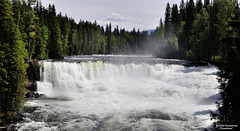
Dawson Falls Wells Gray Park, BC
Wells GrayPark is known for its waterfalls, Wells Gray is also called the "waterfall park".
In fact, an average of 107 cubic meters of water plunge into the depths here. A tremendous natural spectacle is offered here.
The fall stage, in the Murtle River , is barely 15 meters high , but has a width of 91 meters , so the Dawson Falls are also called "Little Niagara Falls "
Canada Tour / Clearwater River valley
| |
|
|
|
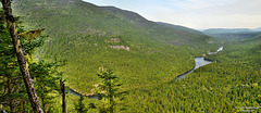
Take in the Whole Expanse
To take in the scale and majesty of such a grand and pristine place, there are diverse ways to enjoy breathtaking scenery in Wells Gray Park. One of them is the Shaden Lookout , located near Spahats Falls. From here you have a spectacular view of the Clearwater River valley, a great place to picnic.
Canada Tour / Spahats Creek Falls
| |
|
|
|
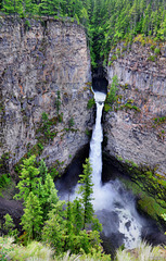
Wells Gray Provincial Park
Spahats Creek Falls, a waterfall on Spahats Creek in Wells Gray Provincial Park in British Columbia, Canada. The height of the waterfall is given as 60 m, but if the second stage is included, it is more like 75-80 m high.
Spahats Creek flows into the Clearwater River .
Spahats the aboriginal name for bear thus Bear Creek.
Canada Tour
| |
|
|
|
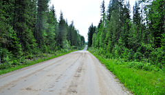
On the road on gravel roads to Wells Gray Park
Wells Gray has plenty to offer for virtually all outdoor interests:
Magnificent alpine meadows,good birding and wildlife viewing opportunities.
Hikesand trails for all abilities, from a few minutes to several days with map and compass,
boating, canoeing and kayaking, information on various topics.
Canada Tour/ Fraser River 1 xPiP
| |
|
|
|
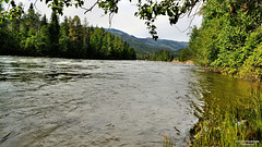
Along the Fraser River
Fraser River is the longest river in British Columbia with a length of 1,375 km. It originates on the west side of the Rocky Mountains in Mount Robson Provincial Park and ends in the Strait of Georgia near Vancouver. The river was a transportation route and a source of food for the indigenous people of the region. In 1858, gold was found on sandbars south of Yale , triggering the Fraser River gold rush.
The river initially flows slowly northwest in meandering channels along the flat valley floor of the Rocky Mountain Trench to Prince George, BC, where it makes a bend to the south,
south of Quesnel it enters Fraser Canyon. Here the river has cut 300-600 m deep into the bedrock. At Hell's Gate, south of Boston Bar, the river is narrowed to 35 m.
At Hope, the river turns west, and the gradient of the river becomes flatter. The valley becomes wide to a delta about 50 km wide, the river empties into the Strait of Georgia at Vancouver . The water that flows through the Fraser River comes mainly from the snowmelt, the largest flow from May to July and the smallest from January to March.
Canada Tour
| |
|
|
|
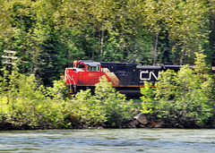
One of Canada's leading transportation and logistics companies.
The CN team consists of approximately 23,000 railroad workers and is essential to the Canadian economy it transports more than C$250 billion worth of goods annually for a wide variety of industries, from commodity products to manufactured goods to consumer goods , over a rail network of approximately 20,000 route miles in Canada and Central America.
Canada Tour / Mount Robson
| |
|
|
|
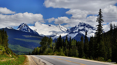
Mount Robson Park the second oldest park in British Columbia. This park offers everything from drivable campgrounds to remote, rarely visited valleys.
Mount Robson, at 3,954 meters, is the highest peak in the Canadian Rockies and towers over the surrounding peaks.
As part of the Canadian Rocky Mountains World Heritage Site, Mount Robson Park protects the headwaters of the Fraser River.
Canada Tour
| |
|
|
|
On the Road on the Highway of Tears
The Highway of Tears is a 724 km stretch of Yellowhead Highway 16 in British Columbia where quite a few (mostly Indigenous) women have disappeared or been found murdered. The Highway of Tears , part of a , nationwide crisis regarding missing and murdered Indigenous women and girls. The national government launched a national investigation into these cases.
Twenty-three First Nations (indigenous people's groups) border Highway 16. The regions are characterized by poverty, and until 2017 there was no accurate public transportation, many locals were forced to travel by hitchhiking.
The exact number of women who have disappeared or been murdered along Highway 16 is disputed.
Canada Tour
| |
|
|
|
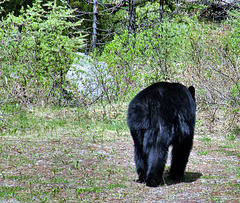
The bear emerged from the bushes next to us and comfortably retreated back into the bushes . A great encounter with this furry guy.
The most dangerous are: Mother bear with offspring,
animals used to food from humans (garbage bears),
Animals defending the food they have just snatched
Basic rules of behavior towards bears, never approach the animal or even feed it,never surprise the animal
In Canada's west there are not only bears, but also wild cougars.
Canada Tour
| |
|
|
|
Bears and other animals on Maligne Road
On the Maligne Road , one can also observe wild animals well, if one has the eyes open.
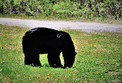
On the way back from Maligne Lake we met him.
Brown, black or grizzly bears are quite numerous and deserve respect. Since man is encroaching more and more into the bears' territories, dangerous encounters occur from time to time.
Bears can climb trees and run as fast as a horse. They are incredibly strong and capable of tearing apart cars to get to something edible.
Canada Tour 3 xPiP
| |
|
|
|
What we have encountered among other things,
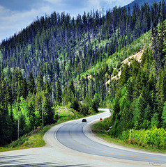
the forest plots burned down by rangers as a precaution, partly to form firebreaks and partly for fertilization, which looked a bit unreal.
Canada Tour 3 xPiP
| |
|
|
|
On the trip around Maligne Lake
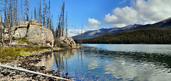
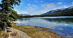
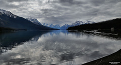
The famous Maligne Lake, one of the most lensed lakes in Canada. As also the largest glacial lake in the Rocky Mountains.
Framed by mountains, the water crystal clear. You can hike along both sides of the shore, which gives always changing beautiful views of the lake to enjoy .
Canada Tour 1 xPiP
| |
|
|
|
Maligne Lake Jasper National Park
Maligne Lake is the largest natural lake in the Canadian Rockies. Surrounded by snow- and ice-covered mountains, it stretches
22 km long past tranquil Spirit Island . Open forest of lodgepole pine and spruce, home to moose, harlequin ducks and many other species of wildlife, surrounds the lake.
Maligne Lake was originally known to the Aboriginal people as Chaba Imne, Beaver Lake.
The most famous image of the Canadian Rockies is that of Spirit Island in the middle of Maligne Lake. The island is not accessible by road or hiking trail. The only way to reach Spirit Island is by excursion boats or private, non-motorised boats.
Canada Tour
| |
|
|
|
On a sunny day, Medicine Lake looks like an alpine lake. In summer, Medicine Lake is blue-green .
When the warm weather subsides, a curious thing happens: the lake disappears.
Medicine Lake becomes "The Vanishing Lake" as the indigenous people call it.
Jasper National Park is located on the territory of many indigenous peoples, they were the ones who gave Medicine Lake its name. Not only was it curious for them to see a lake drain year after year, there is no obvious drainage system that makes the lake magical. It seems to be the work of the "big medicine" that makes the water disappear every year.
An underground drain runs 17 kilometres downstream and reappears below Maligne Canyon. It is the longest underground drainage system in Canada.
Canada Tour 2xPiP
| |
|
|
|
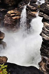
But the sheer force and volume of the Athabasca River plunging into a narrow gorge make Athabasca Falls one of the most powerful waterfalls in the Canadian Rockies.
The Athabasca River, the largest river system in Jasper National Park. The river and falls are fed by water from the Columbia Icefield glaciers, mountain snowmelt and rainwater.
After the water masses have fallen over these steep steps, the Athabasca River flows more leisurely again.
Canada Tour 2xPIP
| |
|
|
|
In the distance a mighty roar we approach the
Athabasca Falls, Jasper National Park
The 23 meter high Athabasca Falls is not very high for the Canadian Rockies, but its size makes it one of the largest waterfalls. It pours over a layer of hard quartzite, cutting into the softer limestone below, intricate structures, potholes a short canyon, were created.
Canada Tour 2xPiP
| |
|
|
|
Sunwapta Falls Jasper National Park
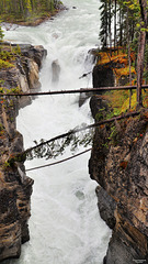
Sunwapta Falls, a raging waterfall , just one of many waterfalls.
At Sunwapta Falls, the smaller Chaba Valley and the larger Athabasca Valley join to form a spectacular step waterfall that has carved a deep limestone gorge into the rock a few feet below the jetty.
Canada Tour 1xPiP
| |
|
|
|
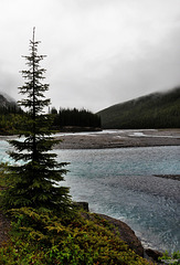
On the way north, in Jasper National Park, the river flows leisurely through the valley.
Jump to top
- ipernity © 2007-2024
- Help & Contact
|
Club news
|
About ipernity
|
History |
ipernity Club & Prices |
Guide of good conduct
Donate | Group guidelines | Privacy policy | Terms of use | Statutes | In memoria -
Facebook
Twitter

