Venezuela, Wild Pineapple in the Jungle
Venezuela, Wild Pineapples in the Jungle
Venezuela, the Jungle on the Way to the Angel Fall…
Venezuela, The River of Kerepakupai Merú
Venezuela, Natural Swimming Pool at the Lower Casc…
Venezuela, The Chief of the Angel Falls
Venezuela, The Angel Falls
Sunrise over the Angel falls
Sunrise over the Angel falls
Sunrise over the Angel falls
Venezuela, Arrival to the Start Point for a Hike t…
Venezuela, On the Way to the Angel Falls, Here it…
Venezuela, On the Way to the Angel Falls upstream…
Venezuela, On the Way Upstream the River of Chur…
Venezuela, The Cliffs of Auyantepui on the Way Ups…
Venezuela, The Cliffs of Auyantepui on the Way Ups…
Venezuela, Waterfall on the Right Nameless Tributa…
Venezuela, Upstream at High Speed along the River…
Venezuela, Upstream at High Speed along the River…
Venezuela, Upstream at High Speed along the River…
Venezuela, On the Way to Angel Falls upstream alon…
Venezuela, The Northern Cliffs of Auyantepui
Venezuela, On the Way to the Angel Falls upstream…
Venezuela, Uruyen - Airfield, Hotel and Restaurant
Venezuela, Uruyen - Airfield and Hotel
Venezuela, Uruyen Airfield, Ready to Fly over Auya…
Venezuela, Flying over the Selva
Venezuela, Flat Surface of the Top of Auyantepui
Venezuela, Northern Cliffs of Auyantepui and Mount…
Venezuela, Flying over Auyantepui
Venezuela, Aerial view of Devil's Gorge
Venezuela, National Park of Canaima
Venezuela, The River of Churun
Venezuela, Rapids on the River of Churun
Downstream of the Red River of Churun, Skirting th…
Venezuela, Downstream at High Speed along the Rive…
Venezuela, Downstream at High Speed along the Rive…
Venezuela, Downstream at High Speed along the Rive…
Venezuela, Approaching to the Devil's Valley along…
Venezuela, Here the boat ride to the Angel waterfa…
Venezuela, Angel Waterfall
Venezuela, Auyantepui from the North
Venezuela, Auyantepui from the North
Venezuela, Downstream at High Speed along the Carr…
Venezuela, The Carrao River and the North-Western…
Location
See also...
Keywords
Authorizations, license
-
Visible by: Everyone -
All rights reserved
-
137 visits
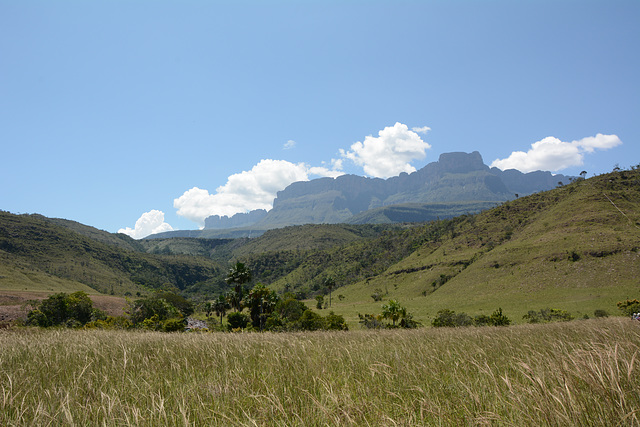
Venezuela, View from the South to Auyantepui (2450m)


Auyántepui is one of the largest (but not the highest) tepuis in the Guiana Highlands, with a summit area of 666.9 km2 (257.5 sq mi). The uneven, heart-shaped summit plateau of Auyántepui is heavily inclined, rising from around 1,600 metres (5,200 ft) in the northwest to a maximum of 2,450 m (8,040 ft) in the southeast. It is incised from the north by a vast valley, the Cañón del Diablo (Devil's Canyon), formed by the Churún River.
Ronald Stachowiak, Gudrun, Marco F. Delminho and 2 other people have particularly liked this photo
- Keyboard shortcuts:
Jump to top
RSS feed- Latest comments - Subscribe to the comment feeds of this photo
- ipernity © 2007-2024
- Help & Contact
|
Club news
|
About ipernity
|
History |
ipernity Club & Prices |
Guide of good conduct
Donate | Group guidelines | Privacy policy | Terms of use | Statutes | In memoria -
Facebook
Twitter

Sign-in to write a comment.