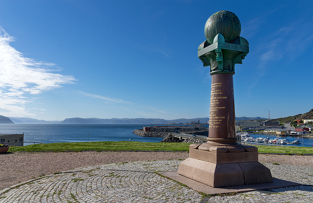
Hammerfest
Hammerfest
Hammerfest
Hammerfest
Hammerfest
Hammerfest
Volvo N 84
the horseshoe block
out of order
lost pier
Narvik
heavy load
iron ore
Luossavaara-Kiirunavaara Aktiebolag
red boxes
ISUZU
reverse gear
red diesel in the green
iron ore transport locomotive no. 27 - 1931
iron ore transport locomotive no. 27 - 1931
in rust we trust
Kvalsundbrua
rusty & blue
3 x Bukser og Berging
skeleton - 2
skeleton - 1
worn-out
Spaceship Alta
cute one
Spaceship Alta
Spaceship Alta
red boats only....please
life is colorful
the crossing
Kvænangenfjord
Sabu on big tour
9/50 - Sabu on big tour
Alta evening
Skorpa
from zero to the summits
Skibotn harbour
weather_kitchen
DSC04152 x1p
beach_spider
Lyngsalpen
Location
See also...
Keywords
Authorizations, license
-
Visible by: Everyone -
All rights reserved
-
559 visits
Hammerfest - Struve Geodetic Arc


The Struve Geodetic Arc is a chain of survey triangulations stretching from Hammerfest in Norway to the Black Sea, through ten countries and over 2,820 km, which yielded the first accurate measurement of a meridian. This is the northernmost point and is situated at 70° 40′ 12″ North and 23° 39′ 48″ East, erected 1854.
Heidiho, Ernest CH, , Bergfex and 22 other people have particularly liked this photo
- Keyboard shortcuts:
Jump to top
RSS feed- Latest comments - Subscribe to the comment feeds of this photo
- ipernity © 2007-2024
- Help & Contact
|
Club news
|
About ipernity
|
History |
ipernity Club & Prices |
Guide of good conduct
Donate | Group guidelines | Privacy policy | Terms of use | Statutes | In memoria -
Facebook
Twitter

Da will ich auch mal hin ...
Sign-in to write a comment.