Nederland: natuur en landschap
Folder: Nederland - the Netherlands
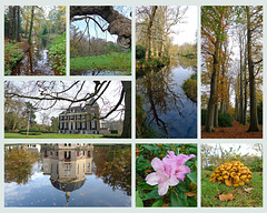
Foto's van Nederlandse landschappen en natuur.
Voor foto's van bloembollen zie: www.ipernity.com/doc/294067/album/1303332
Nederland - Eijsden
| |
|
|
|
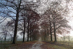
Kasteel Eijsden (Castle Eijsden) is a Dutch state monument. The castle is located on the banks of the river Meuse nearby where the small river Voer flows into it.
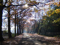
The picture shows a long driveway with stately trees on the east side of the complex, leading up to a Maria chapel.
Nederland - Epe, Renderklippen
| |
|
|
|
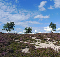
Renderklippen: one of the lateral moraines (about 15 meters high), covered with flowering heather.
More info (Dutch): nl.wikipedia.org/wiki/Renderklippen
Nederland – Epe/Heerde, Renderklippen
| |
|
|
|
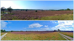
Renderklippen is a nature reserve, which is characterised by vast stretches of moorland that lie on moraines. These moraines were created during the last ice age. Archaeological excavations have shown that the area was already inhabited as early as 700 BC.
There are several vantage points ranging in height from 25 to 30 metres throughout the undulating landscape, where one can enjoy breathtaking vistas. Because the Renderklippen nature reserve is located far from major cities, it is one of the few places in the Netherlands where it can still be really dark at night.
Especially at the end of the summer, when the heather is in bloom, the Renderklippen is transformed into a landscape more purple than purple. For me, it is one of the most beautiful heather landscapes in the Netherlands
Nederland - Epen, Geuldal
| |
|
|
|
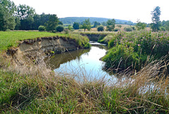
The Geul is a river that has its source in Belgium, about 300 meters above sea level near the German border. It flows about 20 kilometers in Belgium before enterig the Netherlands. After a further 38 kilometers through the most southern part of the province of Limburg the Geul flows into the Meuse, north of the city of Maastricht. A drop of more than 240 meters makes it to the fastest-flowing river of the Netherlands. Along the way the river gets water from no less than one hundred and thirty side streams.
The valley of the Geul in the Netherlands is a breathtaking piece of (more or less) unspoilt nature. Areas with meadows are interspersed with wooded slopes of the ‘mountains’ of southern Limburg. The valley with the meandering Geul offers cultural highlights and architectural, like quaint villages with half-timbered (farm)houses, watermills, churches and castles.
Nederland - Fochteloërveen
| |
|
|
|
At the end of the last Ice Age - about 10 000 years ago - an expansive area of peat bogs covered a big piece of the provinces of Drenthe, Friesland and even a piece of Germany. From the late Middle Ages of, the peat was excavated and transported with ships to the cities in the western part of the Netherlands and was used as heating on a small scale. Large-scale land clearance for agriculture between 1600 and 1900 fundamentally changed the character of the region.
The rugged peat moor of Fochteloërveen (3.000 ha) and a few smaller cores was all that was left. The peat degraded and turned into earth after the peat bog was drained for tree-planting and farming. Like all Dutch peat areas the quality of the habitats, especially of active raised bog, was impoverished severely during the last decades. Now the raised bog area is one of the few bogs in the Netherlands where living peat can be found and it is even growing again.
Since 1999 the hydrological conditions of the most species rich peat area of the peat bog were improved by an ingenious system of dams. It was a great surprise that, starting in 2001, cranes were breeding in this area. They were the first breeding cranes in the Netherlands since the 18th century. Nowadays also the number of non-breeding cranes in summer is increasing.
The nature reserve has a couple of walking and cycling paths and a lookout tower with breathtaking views over the area. It is owned and managed by Natuurmonumenten , a Dutch society for nature conservation.
Nederland - Kasteel Geldrop, Bloemenhof
| |
|
|
|
Kasteel Geldrop (Geldrop Castle) - dating back to the year of 1350 - is located right in the center of Geldrop.
The former vegetable garden and orchard was laid out around 1870 by Hubertus Paulus Hoevenaar jr., operator of sugar factories in the East Indies. In 2002, this vegetable garden was transformed into the Bloemenhof , a stunning garden, which is full of blooming flowers in summer, when the borders are filled with exuberant plant combinations, such as old shrub roses, grasses and cut flowers.
Nederland - Glimmen, Appelbergen
| |
|
|
|
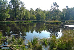
Nature area Appelbergen is a former military training area where troops assembled for field exercises. It is located east of the village of Glimmen on the Hondsrug . This complex of several ridges was formed by the land ice at the end of the Saale glaciation (370.000 to 130.000 years ago).
All over Appelbergen one can find traces of the last ice age (the Weichselian glaciation, 115.000 years to 10.000 years ago). For instance pingos, or hills of ice, which rose up and then collapsed when the ice melted. Nowadays they show up like round pools.
In the Appelbergen is the Grote Veen (main image and PiPs 1 and 2) a large peat bog with a round shape. Most probably it is one of the pingos. In World War II the Germans killed 34 people and buried them secretly here; 19 were found, but the other 15 have never been recovered. A part of the Grote Veen has been dug out in order to find these war victims. Despite the fact that nothing was found, a sober monument has been erected in 2004 in memory of them (PiP3).
Nederland - Het Gooi
| |
|
|
|
Het Gooi (also named ’t Gooi or Gooiland ) is an area centred on the spur of the Utrechtse Heuvelrug (Utrecht Hill Ridge). It has a highest point with the Tafelberg (36,4 meters above sea level). But nature and landscape are completely different from the surrounding countryside, which is flat and lies below sea level.
Het Gooi was originally covered with woods and heath. Nowadays the landscape is still dominated by a dry, sandy ridge. Some of the woods and heath have survived. We were pleasantly surprised by the beauty of the landscape with an alternation of forests, small green meadows and especially the vast heathlands.
All nature areas are managed by the Goois Natuurreservaat ( Gooi Nature Reserve Foundation).
Het Gooi is not only known for its natural beauty, but also for the villas of its wealthy inhabitants. The area is well known as the home of the rich and famous !!
Nederland - ‘s-Graveland, buitenplaatsen
| |
|
|
|
The history of the estates in ‘s Graveland dates back to the year of 1625 (during the Dutch Golden Age). In that year wealthy Amsterdam merchants did get permission to cultivate an area west of Hilversum The sandy soil was excavated and (partly) transported by boat to Amsterdam, where it was used for the expansion of the city. On the way back, the ships took manure and rubbish with them to enrich the infertile soil of 's-Graveland. Initially farms were founded on the lots and leased to farmers. Later several estates were created with country houses with park-like gardens.
Nowadays the area is a beautiful nature reserve around the various country houses, such as Boekesteyn , Trompenburgh and Gooilust . The area is characterized by long stately lanes, mostly lined with beech trees, water features and forest ponds, ornamental gardens and hills with rhododendrons. There are many special and old trees, the oldest of which are hundreds of years old. The bird-rich forests are interspersed with green meadows.
Almost all estates are managed by Natuurmonumenten (Society for Preservation of Nature Monuments in the Netherlands) and are freely accessible.
Nederland - Griendtsveen
Nederland - 't Harde, Zwaluwenburg
| |
|
|
|
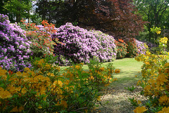
Part of the estate grounds of Kasteel Zwaluwenburg ( www.ipernity.com/doc/294067/27937469/in/album/537955 ) is so called 'Klein Zwitserland' (Little Switzerland). It is a little bit hilly area with winding narrow paths. In spring it is full with flowering rhododendrons and azaleas of different colours.
Nederland - ‘t Harde, Ampies Berg
| |
|
|
|
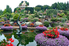
I don’t know if Ampies Berg (Ampies Mountain) is the most beautiful garden, but for sure it is the most remarkable one I have ever seen. As soon as I entered the garden I was overwhelmed by the explosion of colours of hundreds and hundreds of different flowers and plants.
It is a long time ago when Ampie and Batje Bouw during a holiday were inspired by the Austrian landscape. At home he decided to make a piece of Austria is his own garden with waterfall, a pond, beautiful flowers and a mountain with a height of fifteen meters. They have been working for more than fifty years creating their own floral paradise.
Nederland - Harderwijk, Beekhuizerzand
| |
|
|
|
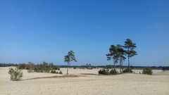
Beekhuizerzand: a Dutch mini desert.
It is one of the few remaining drift sand areas in the Netherlands and even Europe. Beekhuizerzand is an area of about 200 hectares. It had to be restored in 2004 from a wooded area to the drift sand in its current shape. Many pines have been cut for this transformation. The top layer of the soil was removed; causing the wind can do its work again.
Drift sand areas are unique natural landscapes in western Europe, most of them can be found in the Netherlands. They have their own flora and fauna. Characteristic plants and animals are the lichens and the sand lizards. The temperatures in a drift sand area can vary considerably. Sometimes it freezes at night, but during the day the temperature can rise to 40 degrees Celsius.
Nederland - Zeeland, Hedwigepolder
| |
|
|
|
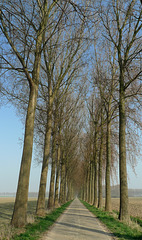
Hedwigepolder, or officially Hertogin Hedwige Polder. The name refers to Hedwige de Ligne, Duchess of Arenberg, wife of Engelbert IX Duke of Arenberg. The streets in the polder bear the names of the Duke and Duchess and their three children.
Hedwigepolder is located on the border between the Netherlands and Belgium, just south of the harbours of Antwerp. The area became a polder already before the Eighty Years' War. During this war, in 1584, Dutch soldiers inundated for strategic reasons the area. In the 17th century diking restarted and in 1907 the Hedwigepolder was the last territory, which was reclaimed from the sea in the eastern corner of the Dutch province of Zeeland.
Although there was (and is) a lot of protest the Hedwigepolder, an area of fertile farmland, soon will be returned to the sea, being part of an agreement between Belgium and the Netherlands to compensate for land, lost through the deepening of the River Scheldt, a waterway connecting the port of Antwerp to the North Sea. It becomes (again) part of the so called ‘Verdronken Land van Saeftinghe’ (The Drowned Land of Saeftinghe).
Picture: the poplar lined Engelbertstraat.
More info ‘Verdronken Land van Saeftinghe’: saeftinghe.eu/en
Nederland - Heerde, Pluizenmeer
| |
|
|
|
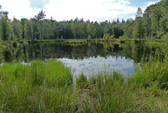
Heerde: Pluizenmeer or Pluizenmeertje. It is named after 'veenpluis' (common cottongrass), which is growing along this little lake. In the older days it was used for washing the sheep from nearby 'Renderklippen'.
Nederland - Heerde, Pluizenmeer
| |
|
|
|
Pluizenmeer or Pluizenmeertje is a so called mere, which is filled with rainwater that does not sink into the ground because of an impermeable layer. This little ‘lake’ is named after veenpluis (common cottongrass), which used to grow here a lot. In the older days it was used for washing the sheep from nearby Renderklippen .
Nederland - Hoenderloo, toverhazelaar
| |
|
|
|
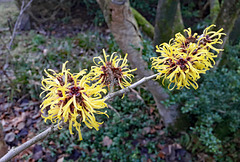
The special thing about the toverhazelaar (Witch Hazel) is that this shrub blooms in the winter months (from the end of December/beginning of January with yellow/orange spidery flowers).
The name toverhazelaar comes from the English "Witch-hazel", which is actually derived from "Wice-hazel". Because of this flexibility, this hazel is also said to have been frequently used as a dowsing rod.
The first witch-hazel imported into the Netherlands was the American 'Hamamelis virginiana'. This was a medicinal plant among the Indians. It is still used for medicinal purposes today
Nederland - Hoog Buurlo
Jump to top
RSS feed- Latest items - Subscribe to the latest items added to this album
- ipernity © 2007-2024
- Help & Contact
|
Club news
|
About ipernity
|
History |
ipernity Club & Prices |
Guide of good conduct
Donate | Group guidelines | Privacy policy | Terms of use | Statutes | In memoria -
Facebook
Twitter

