Jaap van 't Veen's photos
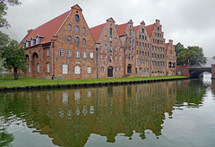
Germany - Lübeck, Salzspeicher
| |
|
|
|
The ‘Salzspeicher’ (Salt Warehouses) are six gabled brick buildings on the banks of the Obertrave, next to the well known ‘Holstentor’. The warehouses were built between 1579 and 1745 in the style of the Brick Renaissance.
Originally, the buildings were used to store the salt that was mined in the Oldesloe saltworks (nearby Lüneburg) and brought to Lübeck over the Stecknitz canal and Trave. From the ‘Salzspeicher’ in Lübeck the salt was transported to Scandinavian and Baltic countries, where it was used for the preservation of fish. This salt trade from the late Middle Ages onward was a major reason for the wealth and power of Lübeck.
Italy - Desenzano del Garda
| |
|
|
|
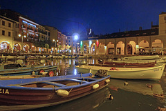
Desenzano - located on the south-western shore of Lake Garda - was already in the past a favourite vacation spot for the élite from Verona. And today it is till a popular Italian holiday destination, which attracts myriad tourists from everywhere in Europe.
The peaceful ‘Porto Vecchio (Old Harbour) - already mentioned in 1274 - was expanded in the current configuration at the time of the Venetian Republic in service of the flourishing grain market. The ancient dock overlooks Palazzo Todeschini, with its arches it is dating back to the end of the 16th century.
Nowadays little boats are moored in the harbour, which is lined with several cafes, bars and restaurants. The well restored business houses along the ‘Porto Vecchio’ are reminders of a glorious past of Desenzano del Garda.
Wales - Brecon
| |
|
|
|
Brecon Cathedral - or officially “Cathedral Church of St John the Evangelist” - started life in 1093 as the Benedictine Priory of St John the Evangelist, built by the Normans on the site of an earlier Celtic church. At the dissolution of the monasteries in 1537 it became Brecon's Parish Church. It became a cathedral only in 1923 on the establishment of the Diocese of Swansea and Brecon.
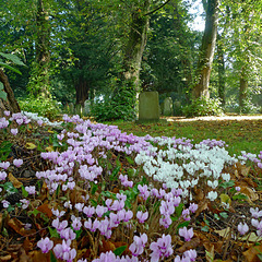
Adjacent to the cathedral lies the graveyard in one of the most charming, serene and peaceful settings I have ever seen for a graveyard. Old tombstones and Celtic crosses are scattered throughout the yard sometimes overgrown with plants or moss in a park-like area and during my visit with huge fields of wild cyclamen.
België: Antwerpen-Centraal
| |
|
|
|
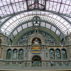
Antwerpen-Centraal (Antwerp Central) is the name of the main railway station in Antwerp. The original station building was constructed between 1895 and 1905; it replaced the wooden train station from the mid 19th century.
The stone clad terminus buildings were designed by the Bruges architect L. Delacenserie. It has a huge dome above the waiting room and eight smaller towers of which six were demolished during the 1950s. Fortunately they were reconstructed in 2009 together with several ornaments, including large lion statues. The rich interior is lavishly decorated with more than twenty different kinds of marble and stone.
Nowadays the railway station is considered being the finest example of railway architecture in Belgium. In 2009 the American magazine “Newsweek” judged Antwerpen-Centraal the world's fourth greatest train station. Five years later it was awarded by the British-American magazine “Mashable” with the first place for the most beautiful railway station in the world.
Argentina - Salinas Grandes (Jujuy)
| |
|
|
|
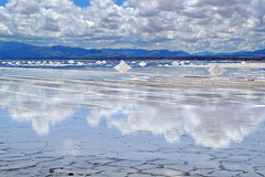
Salinas Grandes is a salt flat/lake with a surface of approximately 220 km2 on the border of the provinces of Jujuy and Salta in northwest Argentina. The ‘salar’ lies at an elevation of more than 3.500 metres above sea level. It has a drainage basin extending over 4.600 km2.
The origin of Salinas Grandes dates from an extended period of time between 5 and 10 million years ago, when the basin was covered with water with a large amount of salts coming from volcanic activity. The gradual evaporation of such continental saline waters gave rise to this salt having a thick crust.
USA - New York, Manhattan - Central Park
| |
|
|
|
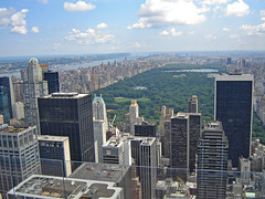
Central Park (and the northern part of Manhattan) seen from the Top of the Rock Observation Deck at Rockefeller Center.
Greece - Crete, Lake Kournas
| |
|
|
|
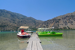
Lake Kournas is the only natural lake in Crete. It is one of the very few areas with plenty of fresh water throughout the year; for this reason, it is protected under the Natura 2000 program. Lake Kournas has been created by accumulation of groundwater coming from the White Mountains. There are also two springs in the lake.
Located just a couple of kilometers from the beach it is surrounded by the mountains and olive groves.
The lake is not that big with a perimeter of 3.5 kilometres, has a maximum depth of 22.5 metres and lies approximately 20 metres above sea level. The volume of the water is summer is 7.5 million cubic metres.
The dark colour of the lake is caused from the seaweeds coming from the depth of the lake. Many species of birds find shelter here, like moorhens, ducks, herons and cormorants. Lake Kournas has always been known for its eels. The surrounding wetlands also host water snakes and terrapins
Germany - Oberstdorf, Breitachklamm
| |
|
|
|
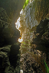
The river Breitach has cut a deep canyon into the rocks of the Bavarian Alps, almost on the border between Austria and Germany, just south of Oberstdorf. The most interesting part of the gorge is a couple of hundred meters long. On some places the steep walls are more than 100 meters high, where only very few spots ever get the sunlight.
There is a secured path along the river, which on the narrowest places has been cut into the steep wall of the canyon. All around is water running down the rocks, gurgles in tiny rivers across the hiking trail into the Breitach. On other place waterfalls are coming down from the cliff walls. At the start of the trail there is still lush green vegetation, but the further you come the scene turns into barren rocks with the noise of the powerful water rushing and tumbling metres below the walkway.
(Visited also in winter, which is of course quite different: www.ipernity.com/doc/294067/36423358/in/album/742620)
Nederland - Harderwijk, Beekhuizerzand
| |
|
|
|
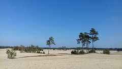
Beekhuizerzand: a Dutch mini desert.
It is one of the few remaining drift sand areas in the Netherlands and even Europe. Beekhuizerzand is an area of about 200 hectares. It had to be restored in 2004 from a wooded area to the drift sand in its current shape. Many pines have been cut for this transformation. The top layer of the soil was removed; causing the wind can do its work again.
Drift sand areas are unique natural landscapes in western Europe, most of them can be found in the Netherlands. They have their own flora and fauna. Characteristic plants and animals are the lichens and the sand lizards. The temperatures in a drift sand area can vary considerably. Sometimes it freezes at night, but during the day the temperature can rise to 40 degrees Celsius.
Switzerland - Muottas Muragl
| |
|
|
|
Muottas Muragl - on an altitude of 2.454 meters - is located high above the wide valley of the River Inn and the valley that leads to the Bernina Pass. It is without any doubt the most beautiful vantage point above the lakes, the villages of Upper Engadine and the surrounding mountains.
Between 1905 and 1907, the first funicular railway in Engadine was built here. Although modernised on many occasions, it has essentially remained the same to this day. The funicular railway takes over the 700-meter climb from Punt Muragl up to the Muottas Muragl in ten minutes. The upper section of the railway has sun collectors that cover the energy requirements of the mountain hotel/restaurant.
The mountain station is starting point of many hikes/walks. Among them is the well known Panorama Trail to Alp Languard, where one can take a chairlift to descend to the valley (PiP 2).
(The PiP was taken some minutes after the main picture.)
Switzerland - Bernina Pass
| |
|
|
|
The main picture is showing the Lago Bianco (see also PiP) and the road across the Bernina Pass before reaching the highest point. I took this picture from the Diavolezza cable car.
The Bernina Pass (2.328 m) is a mountain pass in the Bernina Range of the Alps. It connects the famous resort town of St. Moritz in the Upper Engadin valley with the Italian-speaking Val Poschiavo, which ends in the Italian town. Old paths crossed the Bernina Alps for hundred of years from Grisons to Valtellina in Italy. Back in 1865 a modern road replaced the old paths, which has been widened a number of times and has been open 365 days a year since 1965.
The Bernina Pass is also crossed by rail. The world famous Bernina Express has been travelling over the pass in summer since 1910 and since 1913 this popular tourist train is operating year-round between Chur and Tirano. It is the highest adhesion railway route in Europe. Energy source for the train line is the Lago Bianco, a hydro storage lake.
Apeldoorn - De Freule
| |
|
|
|
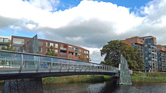
‘De Freule’ is not just one of the more than sixty bridges that cross the ‘Apeldoorns Kanaal’. It is a special bridge for two reasons: firstly it is only a pedestrian/bicycle bridge and secondly it is as a matter of fact also an art work. The 90 meter long bridge - made of iron and bronze - was designed by Tirza Verrips, an artist living in Apledoorn. It was built and opened in the year of 2000.
The bridge connects the city centre of Apeldoorn with a new built neighbourhood called ‘Welgelegen’ on the eastern bank of the canal. More than 200 years ago an estate with the same name was located in that area. It was owned by the famous Dutch admiral ‘J.H. van Kinsbergen’, where he was taken care of for many years by three ‘freules’ (dames/peeress). Many years later the bridge was named after the ‘freules’.
Wales - Beddgelert
| |
|
|
|
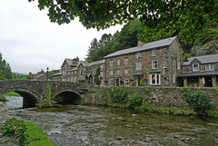
At first glance - certainly on a somewhat rainy gray day - the hard gray stone houses of Beddgelert do not look too inviting. But walking around and seeing all the blooming flowers the village became more and more picturesque.
Beddgelert (meaning “the grave of Gelert”) is probably named after an early christian missionary and leader called Celert (or Cilert), who settled here early in the 8th century. The earliest record of Beddgelert appears on a document dated 1258 (the name recorded is "Bekelert"); eleven years later it is recorded as "Bedkelerd".
Beddgelert lies in a valley at the confluence of the River Glaslyn and River Colwyn. Just above the confluence of the rivers, in the centre of the village, is the old stone bridge with two arches. It is hard to imagine, but the village once was a busy port, when the river was tidal and ships sailed all the way to the centre of Beddgelert.
Switzerland - Abbey Cathedral of St. Gallen
| |
|
|
|
The history of the monastery of St. Gallen (St. Gall) is dating back to the year 612, when an Irish monk named Gallus was on a preaching pilgrimage through Europe. He stumbled on a stone and dropped to a knee at the edge of the Steinach River, where he spotted a hungry bear. He gave the bear some of his bread, perhaps a bribe as not to eat him, but purportedly an offering to help him build a shelter. After Gallus' death, the spot grew in importance as a place of worship and a Benedictine monastery was founded in 747 by St Otmar and named after Gallus.
The Abbey of St Gallen and its monastery grew in stature and wealth, becoming a religious principality, ruled by Prince-Bishops. The Abbey Cathedral at St Gallen survived both the reformation and French Revolution, but under the influence of Napoleon in 1805, when the Canton of St Gallen was established, both the monastery and its political rule were dissolved.
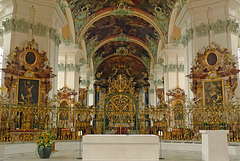
The current cathedral was built between 1755 and 1767 and is one of the last monumental baroque monastic constructions in Europe. A white interior is adorned with malachite green stucco-work, rose marble altars and a gilded altar fence (main picture). The opulently ceiling frescoes (PiP 2) depict biblical characters. The interior is decorated with numerous carvings; among them a wonderful pulpit (PiP 3), several confessionals and eighty four choir seats (PiP 4).
Several of the buildings of the former monastery now house municipal offices. The Abbey Cathedral of St Gallen (PiP 1), the abbey library and the surrounding monastery buildings – (the St. Gallen Abbey District) - was declared a UNESCO World Heritage Site in 1983.
Greece - Crete, Chania
| |
|
|
|
The old harbour of Chania - situated next to the old city - was built in the mid 14th century by the Venetians during their occupation of Crete. It was an important center, serving the Venetian military ships, as well as one of the most important commercial ports of the Eastern Mediterranean Sea.
In the 16th century the harbour was included to the new fortification plans of the city of Chania. During the period of the Turkish rule, the port continued to be a trade center.
Much later, in the19th - early 20th century, the largest ships at that time, had to anchor outside the harbor and reach the pier by boat. The port gradually abandoned and today the Venetian harbour offers moorage for fishing boats and other small boats and yachts.
The promenade along the water is lined with cafes, restaurants, bars and tavernas (PiP). A little bit further away you will find the (former) Turkish Küçük Hasan Pasha Mosque (PiP) and the Venetian shipyards and arsenals (PiP). Another landmark is the lighthouse, built at the harbour entrance by the Venetians and restored between 1830 and 1840 in its present form by the Egyptians.
(Four images stitched together for the main image)
Switzerland - Säntis
| |
|
|
|
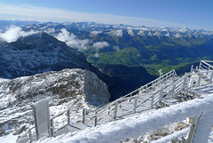
The Sántis is with a height of 2.502 metres the highest peak in the Alpstein massif in northeastern Switzerland. It is a natural landmark in the region between Lake Walen and Lake Constance. The mountain towers above one of the most beautiful landscapes of Europe and can be seen from miles away. .
The name Säntis dates back to the 9th century. It is an abbreviation of the Romansh language for Sambatinus (The one born on Saturday), which was thought to be the name of a nearby area. The name was later used to refer to the summit. In the German language it was originally called Semptis or Sämptis.
We were quite lucky with the weather during our visit. We took the aerial cable car at 9.30 am from Schwägalp, right at the foot of the Säntis At the peak we had a breathtaking clear 360-degree view, although it was freezing cold. It is said that one can see six Alpine countries: Switzerland, Germany, Austria, Liechtenstein, Italy and France. To be honest I can not tell if I saw all these countries. When back - just more than an hour later - the peak was already surrounded by clouds !!
Main picture: Swiss Alps with the Churfirsten in the ‘foreground’.
PiP 1: panorama (three pictures stitched together) looking north (Germany and Lake Constance) and northeast (Austria).
PiP 2 and 3: freezing and ‘hoarfrosting’ cold.
Italy - Brixen Cathedral
| |
|
|
|
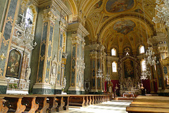
The ‘Dom Mariae Aufnahme in den Himmel und St. Kassian’ (Cathedral of Santa Maria Assunta and San Cassiano) is the largest church in Brixen, once belonging to the powerful Principality of Brixen, nowadays the diocese of Bolzano-Brixen. Although Bolzano is currently the city of residence of the bishop, the most important church in South Tyrol is still the cathedral in Brixen.
The cathedral is dating back to the late 10th century when the main building and its annexes were erected. A fire destroyed the church in 1174. The new romanesque-gothic building was rebuilt in the baroque style during the period of 1745 to 1755.
The cathedral’s two towers (PiP 1) are the landmark of the city of Brixen. The interior of the cathedral is a masterpiece of historical and artistic value. Its wide domed nave is decorated with rich marble and stucco (PiP 2). The main altar has a very striking altarpiece (PiP 3), but the decorative highlight is the fresco on the ceiling.
Wales - Caernarfon Castle
| |
|
|
|
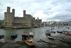
Caernarfon Castle is probably the most impressive and famous of the many Welsh castles. The site of the castle wasn’t chosen by accident. It had previously been the location of a Norman motte and bailey castle and before that a Roman fort stood nearby.
King Edward I started the construction of the castle in 1283, being part of city walls of medieval Caernarfon. It was not only a military stronghold, but also a seat of government and a royal palace. Standing at the mouth of the Seiont river, the fortress with its towers, battlements and colour banded masonry still dominates the walled town, also founded by Edward I.
Edwards son was born in Caernarfon Castle. In 1301 he became the recreated title of Prince of Wales and it was the first time the eldest son of the King of England was invested as Prince of Wales.
In 1969 the castle gained worldwide fame as the setting for the investiture of Prince Charles as Prince of Wales.
In 1986, Caernarfon was added to the UNESCO list of World Heritage Sites as part of the "Castles and Town Walls of King Edward in Gwynedd
Jump to top
- ipernity © 2007-2024
- Help & Contact
|
Club news
|
About ipernity
|
History |
ipernity Club & Prices |
Guide of good conduct
Donate | Group guidelines | Privacy policy | Terms of use | Statutes | In memoria -
Facebook
Twitter

