Jaap van 't Veen's photos
Greece - Prespa, Basilica of Saint Achilles
| |
|
|
|
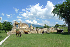
The most important church on Agios Achillios island (see: www.ipernity.com/doc/294067/47395972) was the Basilica of St. Achilles. The church was founded at the end of the 10th century by Tsar Samuel of Bulgaria. Initially it was the cathedral of the empire of Samuel and later - until the middle of the 15th century - a bishop's church.
In the basilica the mummified remains of Saint Achilles - a bishop from Larisa in Thessaly - were kept. These were brought to Agios Achillios after Tsar Samuel conquered Larisa in the 10th century. At the same time he commissioned craftsmen from Larisa to build the three-aisled basilica, which became the seat of the Bulgarian Patriarchate. The impressive church - (20 x 47 meters ) - was a cruciform basilica and among the ruins today one can see the famous sanctuary with three lobed windows, the pillars made of bricks and stones and a tomb on the south side.
After the reoccupation of the area by the Byzantines in 1018, the church became dependent on the archdiocese of Ohrid. In 1072 it was plundered by foreign invaders, but it continued to function until at least the middle of the 15th century. Over the years the church was abandoned, deserted and finally became a ruin.
Greece - Agios Achillios island
| |
|
|
|
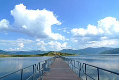
Agios Achillios is a small island in Small (Mikri) Prespa Lake. The name derives from the name of Saint Achilles, bishop of Larisa in the 4th century. The island was both a Roman and a Byzantine settlement and is known for its Byzantine ecclesiastical monuments.
On the island there are about ten houses, a guesthouse and a café/restaurant. It is with an island in Lake Pamvotis, nearby Ioannina, the only inhabited island in a lake in Greece. The main sight on the island is the ruin of the Saint Achilles Basilica (see: www.ipernity.com/doc/294067/47408324) . It is said that the island houses water buffalos, but the only animals we saw were some stray cats and ‘normal’ cows.
The Agios Achillios island and the Prespa Lakes (also known as Prespes) are located in Northwest Greece, at the tri-border point of Greece, Albania and FYR Macedonia/Republic of North Macedonia. Agios Achillios is connected to the mainland by a 650 m long floating pedestrian bridge.
Belgie - Brugge, Jan van Eyckplein
| |
|
|
|
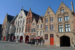
The Jan van Eyckplein is a square - named after the famous painter - located a little bit further away from the other touristic highlights of Bruges. As a result, it is not flooded with hordes of tourists and one can quietly enjoy the beautiful architecture of the typical brick houses with their stepped gables and quaint facades.
The square - constructed in 1787 - is located on the beginning of the Spiegelrei , which once was once was the old harbour of Bruges, where ships loaded and unloaded their goods.
Switzerland - Saint-Ursanne
| |
|
|
|
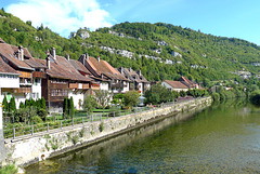
Saint-Ursanne is one of the jewels of the Swiss Jura. The medieval town is situated on the banks of the river Doubs at the foot of a rocky mountain ridge.
According to legend, the little town of St-Ursanne was founded at the end of the 6th century by the Irish monk Ursicinus, who lived as a hermit on this isolated spot. His hermitage within a cave can be reached by climbing 180 steep steps. Between 623 and 635 a first monastery community was founded. Around 1100 it was converted into a canons chapter.
Saint-Ursanne has conserved its medieval character (PiP1). Among the most important buildings in the centre are the collegiate church and its cloister (PiP4) built in the 12th and 13th centuries. Other parts of the old town contain heritage buildings dating from the 17th and 18th centuries. Even today, the town can only be accessed through one of the three historic gates. The ‘Porte Saint-Pierre’ is decorated with ‘La Berbatte’ (PiP3), a clock installed early in the 18th century.
The four-arched stone bridge (PiP2) over the river, built in 1728, awards a particularly splendid view of the picturesque town and its environs. A sandstone statue made in 1729 of St. John of Nepomuk, a protector against floods, stands on the bridge.
Nederland - Texel, Eierland Vuurtoren
| |
|
|
|
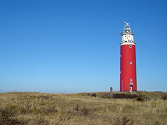
The lighthouse on Texel - officially Eierland Vuurtoren (Lighthouse Eierland) - is named after the island of Eierland, on of the two former islands, which were merged together to present island of Texel. The lighthouse is surrounded by a vast dune area, called Eierlandse Duinen and is located on the most northern point of Texel.
The lighthouse was built in 1864 after some civilians of Texel attended on the dangers of the waters between Texel and the island of Vlieland (72 ships had wrecked between 1848 and 1860). The tower itself is 37,4 metres high.
During the uprising of the Georgians in World War II - they barricaded themselves in the tower - the lighthouse was heavily damaged and had to be ‘rebuilt’. In 1950 it was lighted again.
As said the tower is surrounded by a scenic dune area on the mainland side and a very wide beach (especially at low tide). It is a very pleasant walking clockwise ‘around’ the tower from the car park at the end of the ‘Vuurtorenweg’. After finishing your walk have a drink or snack in ‘Torenrestaurant' with great views of the beach and ‘of course’ the sturdy bright red lighthouse. The lighthouse can be visited; from the top one has spectacular views of the North - and Wadden Sea and the nearby island of Vlieland.
Nederland - Dwarsgracht
| |
|
|
|
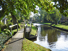
The main ‘street’ (canal) in Dwarsgracht, a hamlet nearby more well known Giethoorn in the Dutch province of Overijssel. The place was founded before 1800 at the time of peat extraction in the area.
Dwarsgracht is a real alternative for the famous, but very touristy, town of Giethoorn. Although just 3 km's away it is a completely different world: the same canal(s), small bridges, boats and thatched roof houses, but without the crowds and hustle and bustle of Giethoorn.
Dwarsgracht has just one café restaurant ( De Otterskooi ) and this is an ideal starting point for either a boat trip with a so called 'whispering boat' or for a bike tour along the canals and lakes. At De Otterskooi you can rent them both. Or just walk along the main canal through the village and enjoy the views over the water, the houses, the flowers, the birds and further away waving reed.
Nederland - Brummen/Bronkhorst
| |
|
|
|
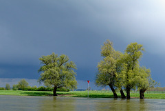
A thunderstorm above the IJssel River, nearby the ferry from Brummen to Bronkhorst (one of the smallest cities in the Netherlands).
(See for a picture and more information about Bronkhorst: www.ipernity.com/doc/294067/31724391/in/album/629489)
Nederland - Bergen op Zoom
| |
|
|
|
Bergen op Zoom was granted city status probably in 1212. In 1287 the city and its surroundings became a lordship as it was separated from the lordship of Breda. The lordship was elevated to a margraviate in 1559. Several noble families ruled Bergen op Zoom in succession until 1795.
The city was built on a place where two types of soil meet: sandy soil and marine clay. The sandy soil pushed against the marine clay, accumulating and forming hills over several centuries. Those ‘hills’ are called Brabantse Wal , literally meaning ‘ramparts of Brabant’; Bergen in Dutch means mountains or hills and Zoom refers to the border of these ramparts.
Bergen op Zoom became a trading city and merchants from all over Europe came to the city to sell their goods. The beautiful historical buildings on the Grote Markt (Market Square) reflect the wealth of the city.
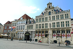
The city hall (right) is a late Gothic building, dating back to the year of 1398; several fires put the building to ashes; the current building with its late-Gothic façade, dates from 1611. In front of the town hall stands a statue of ‘Anton van Duinkerken’, a local writer, poet and professor (PiP2). Hotel De Draak (left) is the oldest hotel in the Netherlands and is at least dating back to 1397, when a fire almost burnt down the entire city, but the inn was one of the few buildings which survived. City archives turned into ashes and smoke during this city fire, but experts say that Hotel de Draak was at least 100 years old when the city fire emerged.
Nederland - Hulshorst, De Maagd
| |
|
|
|
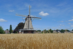
Windmill De Maagd (the Virgin) is a smock mill, which was built in 1894. The flour mill is located on the outskirts of the Dutch village and surrounded by wheat fields. After a first restoration in 1960 it fell back into disrepair. After a second restoration - 1988 - the mill is in working order again.
De Maagd has two flocks of millstones that are used to grind grain on a professional basis. One pair is driven by wind and the other has an alectric engine. The mill is quite unique as it used on a daily base. The flour of the mill is delivered to bakers and (pancake) restaurants, but also to other mill shops, hotels and hospitals.
Nederland - Staverden
| |
|
|
|
Around the year of 1300 Count Reinald van Gelre founded a settlement on the northern Veluwe. The ‘village’ was given city rights in 1298 as a form of encouragement and as a reward for his ambitions. But the development of Staverden never happened and there has never been any urban development since. It never came to anything more than the castle. Staverden Estate however does have 16 farms spread across its lands; a coach house, orangery, watermill, dovecot, workers' houses, a church and a cemetery, and is officially the smallest city in the Netherlands and the Benelux with its ca. 50 inhabitants (situation 2018).
The castle was frequently used as a hunting lodge by the Dukes of Gelre. Since 1400 there were feudal lords living at castle Staverden, who had to preserve and defend the castle. Around 1600 the castle was owned by the Van Haersoltes , who rebuilt it into a more habitable house.
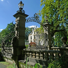
Around 1840 the manor was rebuilt again; Staverden Castle got its current form in 1905, after the estate was purchased by Frederik Bernard s’Jacob , former mayor of Rotterdam. His heirs sold the house to the current owner, the foundation Geldersch Landschap en Kasteelen .
(Picture from another season: www.ipernity.com/doc/294067/21893815)
Nederland - Amsterdam, Hofje van Brienen
| |
|
|
|
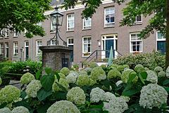
A Dutch hofje is a complex of almshouses around a central courtyard. They were built since the Middle Ages as a charity to house needy or elderly men and women. Amsterdam still has about 30 hofjes ; most of them can be found in or around the Jordaan neighbourhood.
Hofje van Brienen - or officially Het Brienens Gesticht de Star , was founded by Arnoud Jan van Brienen and his wife Sophia Maria Half-Wassenaar . In 1797 they commissioned the city architect of Amsterdam to design this hofje and to build it on the former location of beer brewery De Star . The aim was to provide housing for impoverished Roman Catholic men. Eventually the courtyard was built in 1803 and it was not until 1806 that the first inhabitants moved in.
Hofje van Brienen was completely renovated in 1997 and comprises 26 residential units. Nowadays they are inhabited by both married as unmarried, catholic and non-catholic inhabitants above the age of 45 years with a low income.
The hofje , being a hidden gem full with flowering and evergreen plants, can be visited for free.
Nederland - Broek in Waterland
| |
|
|
|
Broek in Waterland is one of the villages in the Netherlands I do like very much. For me it is almost unbelievable to find such an authentic and picturesque place less than ten kilometres from Amsterdam and without the crowds in other more touristy places around.
Broek in Waterland was originally a fishermen's village and for that reason its church is dedicated to St. Nicolas (PiP 2), the patron saint of seafarers. From the mid 16th century this activity was rapidly replaced by stock farming and the production of dairy. The dairy products were transported to Amsterdam by boat. The harbour - called Havenrak (PiP3) remained important for the village and is still the heart of Broek en Waterland.
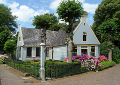
In the 17th and 18th century it was a popular village for the extremely rich (grain) merchants of this area and many impressive houses were built. The tiny village offers almost hundred meticulously renovated and preserved state monuments from the Dutch Golden Age period. Much of these traditional ‘Broeker houses’ have just one floor - due to the weak ground - and are constructed with a timber frame and walls. Much of them are nowadays painted in the famous Broeker grijs (main picture).
Broek in Waterland is surrounded by ditches and meadows and the ‘centre’ of the village is the Havenrak, a widening of the Ee rivulet (PiP4), which flows through Broek. The village has a couple of narrow streets, all lined with the traditional ‘Broeker houses’: having just one floor, due to the weak ground, constructed with a timber frame and walls and most of them are painted in the famous ‘Broeker grey’ (main picture). Some of them do have beautifully decorated entrance doors (PiP 1).
Nederland - Marken
| |
|
|
|
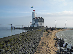
Marken, a former island, has still a lighthouse, which is called Paard van Marken (Horse of Marken). It is situated on the eastern tip of the island and is only accessible on foot or bike.
The current lighthouse was built in 1839; it has a height of 16 meters and a light range of 16.7 km. In 1700 the tower started as a square lighthouse. This was one of three lighthouses near Marken, which was decided to mark the route from the sea to Amsterdam. The three towers were equipped with oil lamps.
In 1839, the square stone tower was replaced by a round iron one on the old foundations. Later on, a brick building with a house and storage place was built, which provided the lighthouse its characteristic shape.
Till 1957 the small fishing village of Marken was an island in the IJsselmeer (the former Zuiderzee ). From that moment on it was connected by the mainland of the Province of Noord-Holland by a dike. The village is situated rather close to Amsterdam and part of the municipality of Waterland. About 2.000 people are living on the peninsula.
Marken (together with Volendam) is one of the most well-known tourist destinations in the Netherlands; it has its own charm with its quaint green coloured wooden houses on poles and the very colourful traditional costumes.
Nederland - Roermond, stadhuis
| |
|
|
|
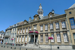
The stadhuis (town hall), of Roermond is situated on the market square. The building has a long history, as already in 1399 there is talk of a ' raithuys ' (medieval for raadhuis = town hall). In 1554 a deliberately lit fire destroyed three quarters of the city, including the town hall.
In the late 17th century the rebuilt town hall was renovated and extended with a couple rooms. From then on it served also as a meeting place for the government of the Overkwartier van Gelre (Upper Guelders).
In 1876, the facade of the town hall was plastered by concrete, which was very popular in that time. The facade was further embellished by reinstatement of the old entrance door. The three dormers with the weapons van Limburg, Roermond and Gelre also dating from that time.
After World War II the city and town hall were severely damaged, but again it was rebuilt. Eight years later the building had to be renovated completely as it was in a seerious state of disrepair. In 1955 the restoration of the old part of the town hall was completed. The main external change was the facade; the concrete layer was removed and the facade with its characteristic pilasters, cornices and fries was lined with tuff.
(PiPs: The town hall has a tower with a carillon. This carillon was donated in 1982 by companies and private inhabitants to mark the 750th anniversary of the city of Roermond. In 1995, the chimes were supplemented by a group of moving images that revolve around the tower of the town hall every afternoon at 12.00 pm.)
Germany - Oberstdorf, Söllereck
| |
|
|
|
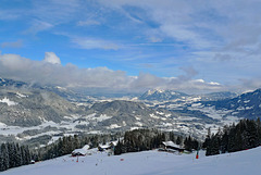
Söllereck is family friendly ski area offering easy and intermediate ski runs with a total of 12 km of slopes. It has one cable car and four ski-lifts. At the base station is a large area for children.
The Söllereck ski area is situated between the elevations of 1.000 and 1.450 m. The area is well known for its winter hiking trails.
The main picture shows the view from the top of the Schrattenwanglift (1.450 m) looking down to Oberstdorf and the valley of the river Iller. The PiP shows the main down hill slope, which has a length of almost 2.800 m.
Nederland - Torenmolen van Gronsveld
| |
|
|
|
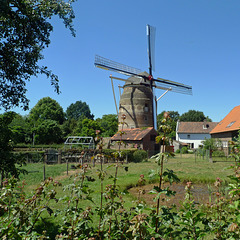
Although the mill is called Torenmolen van Gronsveld it is actually located in suburb of Maastricht. The city was during the construction of the windmill not as big as it is now and all local farmers were only allowed by the local governement to use this windmill.
The Tower Mill of Gronsveld was built between 1618 and 1623 - in the elevationon which the mill is built a stone can be found with the inscription “1622”. The construction took place on behalf of Count Joest Maximilliaan van Gronsveld. De Molen van Gronsveld is the most southerly windmill in the Netherlands and the oldest in the province of Limburg. It is one of the few brick windmills in the Netherlands.
Probably in 1766 the windmill was made a bit taller. This can be seen at the top end of the windmill. These kind of windmills usually go straight up, but its the top turns slightly inwards at the top (PiP).
Between 1924 and 1930 the windmill was taken out of use. In 1941 it was restored. During the fighting on 13 September 1944 with the liberation of Maastricht the windmill and one of the houses next to it were shot at and caught fire. The flour mill has been restored again in 1959. In the beginning of the ‘70’s the windmill has been made in working order and is now regularly in use, grinding grain for farmers and bakers.
Torenmolen van Gronsveld can be visted for free, although the opening hours are limited.
Switzerland - Basel Minster
| |
|
|
|
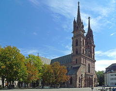
The Basel Minster ( Basler Münster ) is a medieval cathedral, situated on a twenty metres high hill high above the river Rhine. The Romans already had a fortress on this hill. The bishopric of Basel was founded in 343, with a residence in Augusta Raurica. In the early middle ages the bishop moved to Basel and the place served as temporary residence of the German kings, which was (and is) called Pfalz (PiP5), offering wonderful views over the Rhine.
Basel's first cathedral was built by bishop Haito (805-823). A larger church, named Heinrichsmünster after German king Heinrich II, was consecrated in 1019. Towards the end of the 11th century a tower on the west side was added - which is still part of today's Georgsturm . A new church building was erected between 1220 and 1230, but almost completely destroyed, due to an earthquake and fire in 1356.
This building was restored using basically the same ground plan, but with some Gothic style elements and consecrated in 1363. Attached to the church is a former monastery with two cloisters (PiP4). During the 16th century reformation the monastery was closed and the bishop expelled from the city.
The building as it stands today dates back for the most part to the late Romanesque building constructed in the last third of the 12th century and completed around 1225. The Basel Minster with its red sandstone architecture (PiP1), impressive interior (PiP2) and beautiful stained glass windows (PiP3) is one of the main landmarks of Basel and still an important tourist attraction.
Nederland - Vechtdal
| |
|
|
|
Waiting for a swim (??) to cool down a little bit on a hot sunny Sunday along the river Vecht.
(PiPs: The picture was taken next to the ferry for pedestrians and cyclists over the river Vecht near the village of Dalfsen. I have used many ferries, but never a fully automatic one like this.)
Jump to top
- ipernity © 2007-2024
- Help & Contact
|
Club news
|
About ipernity
|
History |
ipernity Club & Prices |
Guide of good conduct
Donate | Group guidelines | Privacy policy | Terms of use | Statutes | In memoria -
Facebook
Twitter

