Scenery 3
Known as dedication :)
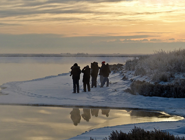
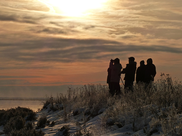
A group of eight of us drove south of Calgary on 18 December 2012, to take part in the annual High River Christmas Bird Count. We covered all the backroads in the SE quadrant of the huge circle around the town. One of the places we stopped at was Frank Lake, a very popular place for birders. This photo was taken, looking towards the sun, giving what I thought was quite a nice effect. Have to admit that while the others were scanning the lake for any sign of wildlife, I was enjoying myself taking scenic shots and ice-crystals : ) I've marked this shot on my map, but placed it in the middle of Frank lake, as I'm not sure just where we were.
We started our search at around 8:30 a.m. and returned to the meeting place around 5:00 p.m., when we handed in our results and stayed for a delicious potluck supper. Thanks so much to the local birders who organized this most enjoyable ending to a long day!
Our small group's sightings for the day:
Mallard 9 in am at Frank Lake; 7 seen flying there in late pm.
Common Goldeneye-4
Bald Eagle-4 ad.
Northern Goshawk-2 ad.
Rough-legged Hawk-1
Merlin-2
Gray Partridge-12
Sharp-tailed Grouse-5
Rock Pigeon-26
Great Horned Owl-5
Snowy Owl-1 (seen 3 times).
Downy Woodpecker-1 m.
Black-billed Magpie-34
Common Raven-8
Northern Shrike-1
American Tree Sparrow-3
Snow Bunting-807
Common Redpoll-925
Hoary Redpoll-1
House Sparrow-245
29 Nov 2012
1 favorite
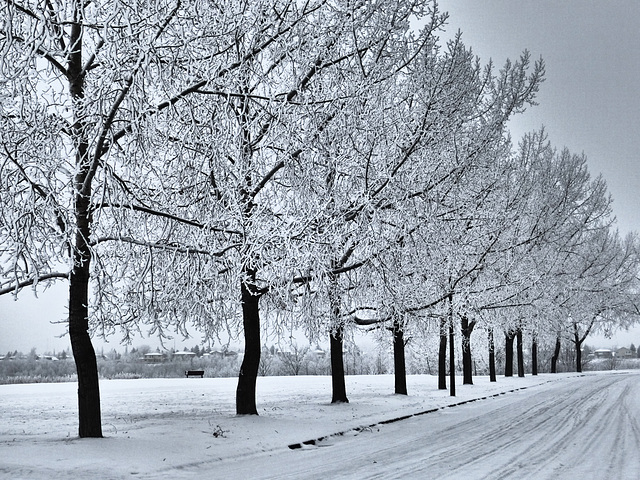
A colour photo of our black and white world
A photo taken on a quick drive through Parkland after I had been on a three-hour walk in the Bow Valley Ranche and Hull's Wood area of Fish Creek Park. Everywhere was a winter wonderland, with everything covered with hoar frost. Taken on 29 November 2012.
12 Sep 2012
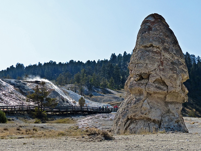
Liberty Cap, Mammoth Hot Springs
This is one of the many features of Mammoth Hot Springs, Yellowstone National Park, Wyoming, US. Taken on the second day of an amazing week's trip from Calgary with friends, Linda and Tony, from England.
"This 37-foot (11-m) hot spring cone marks the northern portion of Mammoth Hot Springs. Liberty Cap was named in 1871 by the Hayden Survey party because of its marked resemblance to the peaked caps worn during the French Revolution. Its unusual formation was created by a hot spring whose plumbing remained open and in one location for a long time. Its internal pressure was sufficient to raise the water to a great height, allowing mineral deposits to build continuously for perhaps hundreds of years."
mms.nps.gov/yell/features/mammothtour/librtcap.htm
11 Sep 2012
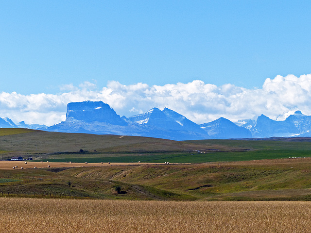
Scenery near the Alberta/Montana border
Can't remember which side of the Canada/US border this quick shot was taken, from a moving car. Gives an idea of the kind of scenery in that area. Taken on 11 September 2012, the first day of a week's holiday in Yellowstone and Grand Teton National Parks.
"The peak is easily seen from Montana and Alberta due to the rapid 5,000 foot (1,524 m) altitude gain over the Great Plains which are immediately east of the mountain. Despite the mountain's being mostly in Montana, the distinctive eastern face quickly becomes hidden as one travels south into Montana, but remains very easy to see on clear days over much of southern Alberta. Hence, many businesses in the area (notably Lethbridge) have "Chief Mountain" in their name.
Chief Mountain is an example of a klippe. It consists of a Precambrian block which rests directly above much younger Cretaceous gray shales. The surrounding portion of the thrust sheet has been removed by erosion leaving behind this isolated block of Proterozoic rock." From Wikipedia.
en.wikipedia.org/wiki/Chief_Mountain
15 Dec 2012
1 favorite
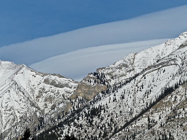
Spectacular clouds over the Rocky Mountains
Posting just before going off on my second annual Christmas Bird Count, which takes place within Calgary today. My tiny group of four people covers part of the NE/SE of the city. Can barely keep my eyes open - I have become so bad at time management and ended up getting just a couple of hours sleep the last two nights. Yesterday's count, the Banff/Canmore Count, was a long day, with eight hours of walking in the town of Canmore, near Banff, mostly covering both sides of the creek there and then along the edge of the Bow River. I added a list of the birds we saw to yesterday's last uploaded photo. I always enjoy this count, as we are surrounded by spectacular scenery - and I always hope to see a wild European Rabbit or two, as well as a small, spindly tree that is near the edge of the Bow River, that someone decorates each Christmas. Later in the day, we saw some unusual and beautiful clouds - possibly Lenticular (lens-shaped)? You can see part of these in the image above.
15 Dec 2012
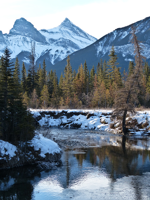
Winter scene in the Rockies
This is the kind of place where several of us walked on 15 December 2012, during the annual, full-day Banff/Canmore Christmas Bird Count. Our group of seven split into two and we covered both sides of this creek until we reached the Bow River, and then continued along the river.
18 Dec 2012
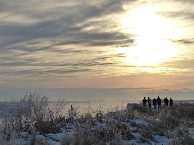
Birders birding
Another cold, wintry shot of six of us at Frank Lake. A group of eight of us had travelled south of Calgary to High River, to take part in the annual High River Christmas Bird Count, on 18 December 2012.
18 Dec 2012
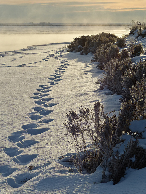
Footsteps
Another cold image from 18 December 2012, when a group of eight of us drove south of the city to High River, to take part in the annual Audubon High River Christmas Bird Count. My group, travelling in two cars, covered the SE quadrant of the huge circle centred on the town of High River, driving along all the backroads and calling in at several farms. This photo was taken when we stopped at Frank Lake and walked along the inlet. As you can imagine, after a long day of birding, the delicious Pot Luck supper that was held at the meeting place was so much enjoyed and appreciated. Actually, it wasn't as bitterly cold as it might look from my photo. Started off at -10C and ended up soaring to -3C. I think it was about five years ago, that our Bird Counts were done in -30C weather! Now that was brutal!!
With the holiday season upon us, here is a reminder from YouTube, that I saw on Dan's Facebook page. Please Don't Drink and Drive! Warning - very graphic - but that is what is needed! And yet people continue to do so ...
youtu.be/45oV6PssNu4
Unstoppable
Another photo from when a few of us were at Frank Lake on 18 December 2012, as part of our group's area to cover for the annual Audubon Christmas Bird Count for High River (south of Calgary). We spent the whole day (8:30 a.m. - 5:00 p.m.) driving all the backroads in the SE quadrant of the huge Count circle that centred on the town of High River. This photo was taken when we walked along the edge of the inlet, looking out over Frank Lake. Had to take my photos looking into the sun, so I did a great job of blowing out part of the sky : ) Not sure if I've marked the location correctly on my map.
Jump to top
RSS feed- Latest items - Subscribe to the latest items added to this album
- ipernity © 2007-2024
- Help & Contact
|
Club news
|
About ipernity
|
History |
ipernity Club & Prices |
Guide of good conduct
Donate | Group guidelines | Privacy policy | Terms of use | Statutes | In memoria -
Facebook
Twitter

