6-09-19
Folder: unsorted2
Sego Canyon Rock Art
More pictographs, to the left of the petroglyph panel. The presence of animal and geometric forms suggests these are Fremont and/or Ute styles.
Sego Canyon Rock Art
A petroglph panel to the left of the Barrier Canyon pictographs. I don't know whether these are mostly Fremont or Ute styles.
Sego Canyon Rock Art
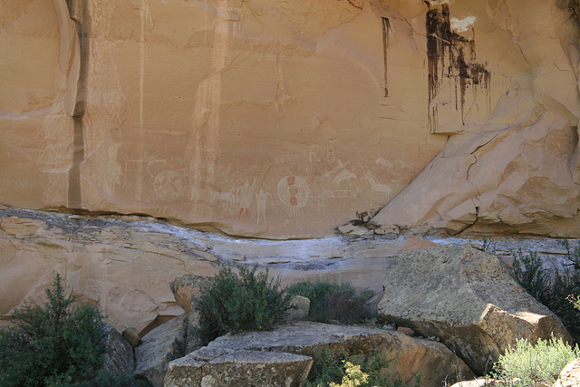
Utah, in the eponymous canyon north of Thompson Springs. This is one of the most spectacular preserved Native American rock-art sites in the southwest. The pictographs (painted) and petroglyphs (chipped/carved) span thousands of years, from perhaps >4000 BCE to contact, and embrace three different styles. This panel shows the oldest, the so-called Barrier Canyon style, with pictographs of humanoid forms with tapering bodies and commonly hollow eyes. The inserts show more recent styles, Fremont (ca. 500-1300 CE) and Ute (>1300 CE; the Ute live in the area to this day.) These also include animal and geometric designs, and are also often petroglyphs. Alas, contemporary vandalism is also present. I'm going ahead and giving the location, however, because it's shown on highway maps and has a large BLM (Bureau of Land Management) interpretive site.
Unnamed
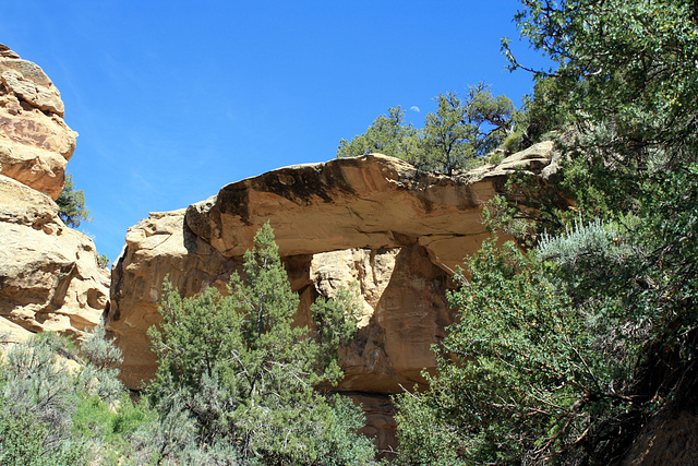
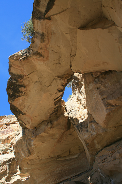
Unnamed rock arch in sandstone directly across the road from the Sego Rock Art site. I'm sure the Native Americans had stories about it--I find it hard to believe the proximity of the rock art is a coincidence!--but there's not so much as an interpretive sign. The arch is in Cretaceous Blackhawk Formation, according to the mapping of Willis (Provisional Geologic Map of the Sego Canyon Quadrangle, Grand County, Utah, Utah Geol. Min. Surv. Map 89, 1986). You can walk up the drainage to directly below the arch (inset).
Unnamed Arch
Just across the canyon from the Sego Canyon rock art site, Sego Canyon, Grand County, Utah. It's in the Cretaceous Blackhawk Formation (Willis, Utah Geol. Min. Surv., Map 89, 198) and is evidently unnamed, without so much as an interpretive sign. I'm sure, tho, the local Native Americans had stories about it--I find it hard to imagine the proximity of the rock art is a coincidence!
Sego, Utah
A ghost town to the north of Interstate 70, about 5 miles east of Crescent Junction where US 191 turns south to Moab. Unusually, Sego was the site of a coal(!) mine, long before Colorado Plateau coal became of interest for firing power plants. The area was active in the early-mid 20th century but never prospered, between the marginal deposits and the lack of water. What finally killed the mine (and the town) was when the nearby railroad (Denver & Rio Grande) dieselized in the mid-1950s. The D&RG parallels what is now I-70 and had become basically the only market for the coal, transportation costs being otherwise prohibitive.
This building is by far the most impressive structure still standing and was evidently the company store. The insets show some views from inside the structure. Many buildings were moved when the mine finally shut down, and flash floods over the years have obliterated most of the rest.
Inside the old company store
Sego, Utah. This is pretty much the only structure still standing. For more about Sego see the enclosing photo.
Inside the old company store
Sego, Utah. This is pretty much the only structure still standing. For more about Sego see the enclosing photo.
Jump to top
RSS feed- Latest items - Subscribe to the latest items added to this album
- ipernity © 2007-2024
- Help & Contact
|
Club news
|
About ipernity
|
History |
ipernity Club & Prices |
Guide of good conduct
Donate | Group guidelines | Privacy policy | Terms of use | Statutes | In memoria -
Facebook
Twitter


